Curated OER
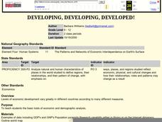
Developing, Developing, Developed!
Students differentiate among and explain various levels of economic development around the world. They see that levels of economic development vary greatly in different countries according to many different measures.
Curated OER
Country Capitals
Students locate country capitals on a world map. In this map skills instructional activity, students review the definition of the word country and discuss what a capital is. Students locate and label capital cities on a world map using a...
Curated OER
Introduction to Symbols
Students study the concept of picture symbols as a way to express ideas without using words. In this picture symbol lesson plan, students place symbols on a U.S. map according to meaning. Students then review various symbols...
Curated OER
Mathematics of Cartography
Students practice their math skills as they explore maps. In this cartography lesson plan, students calculate distance, scale, coordinate systems, and projection as they work independently reading online maps.
Curated OER
Introduction to the Globe
Students investigate how to use a globe. For this map skills lesson, students define what a globe is and locate the various continents on the globe. Students are also asked to locate the four oceans on the globe.
Curated OER
Map Stratego
Middle schoolers determine strategic locations for defense against attack. They use a core map to analyze coast lines and distances to develop a strategic defense plan for the U.S. during World War II.
Curated OER
What Makes a Map?
Students, in groups, brainstorm to find what makes up a map, what kind of information can be "read" from a map, who might use a map, how their world is defined or helped by maps, etc. They make a map of their "world."
Delegation of the European Union to the United States
Cultural Identity
How does cultural diversity impact political identity? That is the question researchers face as they continue their examination of the European Union and the programs it has developed in its attempt to achieve unity in diversity. To gain...
Echoes & Reflections
Nazi Germany
The Holocaust was an evolution of anti-Semitism, scapegoating, and targeted violence against Jews with Nazi policies. A resource unpacks the escalation in violence, along with the erosion of democratic institutions, during the 1930s....
Global Oneness Project
A Collapsing City Skyline
Have your high schoolers learn about the modern history of Myanmar by close-reading an article about the city and people of the city Yangon. As they'll learn, the country is going through some dramatic transitions. After reading the...
Curated OER
Where in the World
Students explore the global grid system. In this globe activity, students identify latitude and longitude lines and how these can tell the coordinates of any place. They use the Internet to find the exact coordinates for their town.
Curated OER
Where in the World? :Understanding Latitude and Longitude
Students play a grid-based game and devise clues to help classmates locate spots on the globe in order to recognize the value of using longitude and latitude for identifying locations.
Curated OER
First World War Maps
Tenth graders examine the First World War. In this Global History activity, 10th graders analyze various maps of this time. Students construct maps of each front of the war by answering various questions.
Curated OER
Materials: Hidden Costs, Mapping the Source and Cost of Raw Materials.
High schoolers map connections among raw materials. In this environmental stewardship lesson, students design strategies to minimize the use of raw materials and discuss how to use more sustainable materials.
Curated OER
She's All Over the Map
Students consider female authors and their literature. Working in partnerships, they research and map the life and work of a Nobel Prize-winning female author of their choice. Students write individual letters expressing their thoughts...
Curated OER
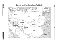
Central and Northern Asia: Political
In this Central and Northern Asia map worksheet, students examine national political boundaries and national capitals in this region of the world. The map is labeled.
Curated OER
Continents and Islands Map Quiz
In this online interactive geography quiz worksheet, students respond to 17 identification questions about the continents and islands of the world.
Curated OER
Biggest Islands Map Quiz
In this online interactive geography quiz worksheet, students respond to 19 identification questions regarding the largest islands in the world.
Curated OER
You Can Find It!
Students, in groups, use longitude and latitude to locate various places on a map.
Curated OER
Where Am I?
Young scholars identify volcano locations by latitude and longitude. They analyze a world map, and complete a "Volcano Event Locations Chart."
Curated OER
Explore Surface Types on a Journey Around Earth
Learners explore satellite data. In this technology cross-curriculum math and world geography lesson, students locate specific map areas using a microset of satellite data. Learners use technology and math skills to determine percentages...
Curated OER
Comparative Religions: Islam
Engage theologians through online text resources during this comparative religions activity. Designed to interact with the online Glencoe text World History, there are many free tools on this site that stand alone. Scholars read the...
Curated OER
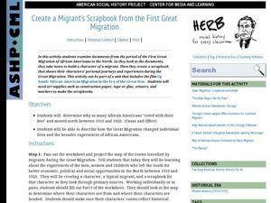
Create a Migrant's Scrapbook from the First Great Migration
Help young historians personally engage in the stories of African Americans during the Great Migration! Assessing a migration route map, learners create a migrant character's experience, adding details while studying primary sources. A...
Curated OER
Regents High School Examination: Global History and Geography, 2009
Get your geographers thinking with this global history and geography standardized practice test. Class members respond to 50 multiple choice questions, 2 essay prompts, and 15 short answer questions that require them to review their...
Other popular searches
- World War Ii Map
- World War I Map
- World War 2 Map
- World War I Outline Map
- World Climate Map
- World Biomes Map
- World Outline Map
- Blank Map of the World
- World Political Map
- Ancient World Greece Map
- World Time Zone Map
- Deciduous Forests Map World


