Howard Hughes Medical Institute
BiomeViewer
Which holds more influence, the environment over humans or humans over the environment? Young scientists explore an online interactive that addresses this discussion. They observe changes in the natural world over time and see which...
University of Pennsylvania
From the Dreyfus Affair to the World Today
Historical events do not occur in a vacuum. Such is the case of the Dreyfus Affair, where the connection between Captain Alfred Dreyfus, Emile Zola, and Hannah Arendt is fused by the events of the early 20th century. The informative...
Geography for Geographers
Five Themes of Iceland
How do the five themes of geography relate to the country of Iceland? Pupils learn about everything from the differences between relative and absolute location to how humans both adapt and change the environment. The presentation...
Orlando Shakes
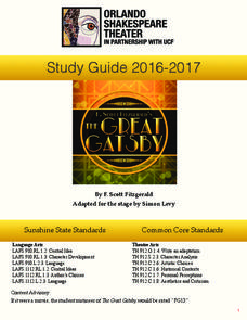
The Great Gatsby: Study Guide
Uncover the exciting world of the Roaring Twenties with The Great Gatsby study guide. Individuals become critics as they write a review of the production. Scholars also read historical information and analyze the differences between the...
Reed Novel Studies
There's a Boy In The Girls' Bathroom: Novel Study
People travel to Washington, DC from all over the world to take a tour of the White House or catch a glimpse of the Washington Monument. Using the novel study for There's a Boy in the Girls' Bathroom by Louis Sachar, scholars research an...
University of Richmond
Foreign-Born Population 1850-2010
If America is a nation of immigrants, where are they from and why did they come? Demographic data and interactive maps help pupils consider answers to these questions by examining the statistics of foreign-born Americans. Features allow...
Radford University
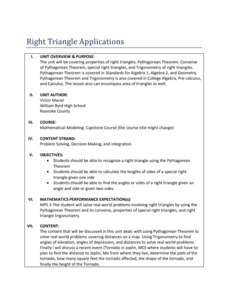
Right Triangle Applications: Lessons 1 and 2
Use right triangles for more than just mathematical problems. The first two lessons of a unit ask pupils determine distances between cities by using the Pythagorean Theorem and a map. To cement understanding, learners use trigonometric...
Flipped Math
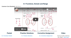
Functions, Domain and Range
Take a deeper dive into the notation of a function. The video presentation uses grocery store prices as an example to explain the concept of a function. Pupils determine whether mappings are functions or not and find the domain and...
Curated OER
Using the Four Main Directions in the Classroom
Students use the four main directions to locate features in the classroom. In this direction lesson, students review the 4 main directions using a world map. Students use a magnetic compass to locate the north wall in their classroom and...
Curated OER
Introduction to the United States Map
Students identify the United States of America and it's states on a map. In this mapping lesson, students examine a globe and find the United States as well as a few land marks (Florida and the Great Lakes). Students then look at a...
Curated OER
Roman Empire: Physical Framework - Location, Borders, Dimensions
Students relate the classical world to the modern world. In this map skills lesson, students turn a blank map into a colorful complete map by following step-by-step directions. This lesson allows students to connect our current geography...
Curated OER
Land Elevation
Students investigate land elevation. For this map skills lesson, students use a physical map to identify various elevations of the land. Students find landform features such hills and coastlines.
Curated OER
The Bread of the Sandwich
Students create relief maps of Canada and Mexico out of everyday objects like dried macaroni, dry rice, sand, etc. They create a clue card for a location game and try to stump their classmates. They host a travel fair to display their...
Curated OER
Name That Continent
Learners practice locating the seven continents, four hemispheres, and four oceans using a large world map and a review song. They also import a world map to the Kid Pix computer program then type in proper labels on the map. There are...
Curated OER
Put Me in My Place: Using Alphanumeric Grids to Locate Places
Students practice locating points on a large wall grid and create and label a neighborhood map. In this geography lesson, students spell and discuss places as the teacher places them on the map. They discuss the concept of an...
Curated OER
The Sands of Arabia
Sixth graders apply geographic information to the study of World History. In this Geography lesson, 6th graders create a political/physical map of the Middle East, develop questions and answers about the culture of the Middle East, and...
Curated OER
Ancient Egypt: Connecting Literature and Geography
Students brainstorm prior knowledge of Ancient Egypt, locate Egypt on map of Africa and on world map, watch King Tut film, discuss term biography, and map geographical information mentioned in stories and documentaries about Ancient Egypt.
Curated OER
Where In the World Are We?
Fifth graders read postcards and find their locations on maps. They use the pictures and text on the postcards to write about imaginary vacations. They compute the mileage and compare it to TripMaker data.
Curated OER
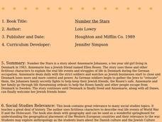
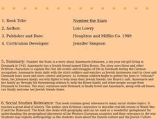
Number The Stars
Students read a book about prejudices that occur in our daily lives. They describe characters in the book. Students discuss real life events of World War II and the Holocaust. Students simulate hiding Jews from the German soldiers. ...
Curated OER
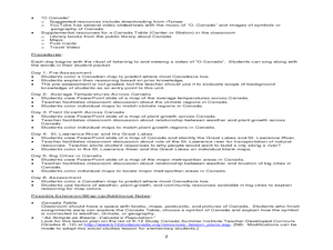
Where Do Canadians Live?
Learners investigate Canadian people by researching the geography of the country. In this world geography lesson, students identify locations within Canada with large populations based on their access to waterways. Learners view and...
Curated OER
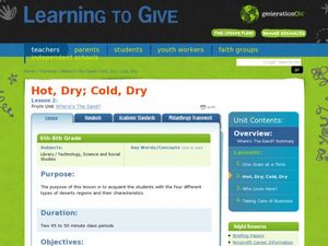
Where's the Sand?
Middle schoolers identify the characteristics of deserts. In this geography lesson plan, students discuss the characteristics of a desert and label a map with the names of deserts.
Curated OER
Geography: Flat Out Wird
In this maps worksheet, students answer short answer questions about comparing a map to a crumpled up piece of paper. Students answer 3 questions.
Curated OER
Number the Stars
Students read Number the Stars. In this social studies lesson, students read the story and use a map of western Europe and identify the countries involved in the war. Students locate the cities of Denmark that are discussed in the story.
Curated OER
Stop Hunger Now
Students explore the problem of world hunger by reading and discussing a United Nations report on world hunger. They brainstorm ideas for programs to end the cycle of poverty and hunger worldwide.
Other popular searches
- World War Ii Map
- World War I Map
- World War 2 Map
- World War I Outline Map
- World Climate Map
- World Biomes Map
- World Outline Map
- Blank Map of the World
- World Political Map
- Ancient World Greece Map
- World Time Zone Map
- Deciduous Forests Map World


