Curated OER
Revisiting the Somme
Students consider how the military folly of the Somme during World War I. In this World War I lesson, students visit selected websites to discover information about the Somme, propaganda, and their effects on the war.
Curated OER
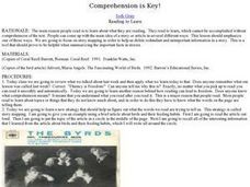
Comprehension is Key!
Students observe and demonstrate how to use a story map to identify the main idea of text. They observe the teacher read an article about birds out loud, and create a story map for the article. Students then independently read another...
Curated OER
The Gold Rush
Students identify the routes involved in the Gold Rush on a map. In this map skills lesson plan, students use a United States map to locate the routes used to travel to California during the Gold Rush. Students demonstrate how to use the...
Curated OER
Cardinal Directions
Students explore cardinal directions. In this social studies lesson, students create maps of home and school using the cardinal directions.
Curated OER
Turning the Tide in the Pacific, 1941-1943
Students analyze the Japanese strategy for the Pacific and compare it to the Allied strategy. They identify on a map the sites that were important the early war in the Pacific, and identify key military engagements.
Curated OER
Where Am I?
Students apply map reading skills by locating places through the use of latitude and longitude.
Curated OER
Facts, Fictions and Perceptions of Regions
Students examine the different characteristics of the regions of the United States. They discuss places they have visited in the U.S., and in small groups conduct research on a selected region of the U.S. Each group labels a map of...
Curated OER
Where Do Hurricanes Happen?
In this hurricanes worksheet, students label the 6 different regions that hurricanes and tropical cyclones occur around the world.
Curated OER
Seven Wonders of the World: The Great Pyramids
Students explore the Great Pyramids. In this lesson on Egyptian culture, students use primary sources to examine Egyptians. Students will design and draft blue prints of their own pyramid.
Curated OER
Absolute And Relative Location
Students create a map that takes someone from school to their home using both relative and absolute locations. They assume the person using the map is unfamiliar with the area.
Curated OER
CHARTING THE COURSE
Students uses atlases, maps, and Web resources to determine the distance, driving time, and amount of money they need to make the trip (estimates should include hotel/motel stays, meals, and souvenirs).
Curated OER
Continents of the Globe
Students identify the continents on the globe. In this map skills instructional activity, students define the term "continent" and identify the seven continents on the globe.
Curated OER
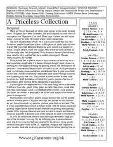
A Priceless Collection
Students read and discuss the background of plants, seeds, and gene banks and grow seeds on their own. In this seeds lesson plan, students also use maps to identify seed banks and research plant farmers.
Curated OER
Prisoner of War Camps in Germany
In this prisoner of war camps worksheet, students study a map of the prisoner of war camps in Germany. Students read information about the conditions in the German POW camps of World War II.
Curated OER
Read a Transportation Story
Eighth graders research the career of Arctic transportation. In this arctic transportation lesson, 8th graders read a book about Arctic truck travel and review the historical aspects of transporting goods in the Arctic. Students review...
Curated OER
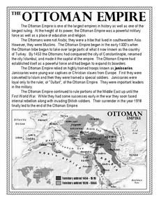
The Ottoman Empire
In this Ottoman Empire worksheet, students read a 1-page selection about the empire and examine a map. Students then respond to 5 short answer questions about the reading selection and the map.
Curated OER
Weather Forecasting Unit
Young scholars study weather concepts, mapping, characteristics in this series of lessons.
Curated OER
Eastern Europe: Passport to Understanding
Seventh graders explore Eastern Europe. They analyze data on select countries. Students prepare a short oral presentation on the country they researched. They locate their country using an interactive map.
Curated OER
Globe Skills Lesson 8 Dust Bowl Travelers
Pupils develop their globe and map skills, In this geography lesson, students examine the Dust Bowl as they complete an activity that requires them to plot latitude and longitude.
Curated OER
European Agriculture
Students make inferences on how physical geography affected the development of early civilizations and come up with solutions to global issues. In this physical geography lesson plan, students compare maps of the past to maps of today to...
Curated OER
Sixth Grade Social Studies Quiz
For this social studies worksheet, 6th graders complete multiple choice questions about economics, climate, maps, and more. Students complete 15 questions.
Curated OER
Causes of WWI-Introductory Lesson
Sixth graders identify the causes of World War I. In this World War I history instructional activity, 6th graders view a Powerpoint to develop background knowledge about World War I. Students make a picture map of the events that led to...
Curated OER
Holocaust Unit
Students read a book about World War II and the Holocaust while in small literature circles. They write journal entries and news articles based on the reading.
Curated OER
Where is Flat Stanley?
Students create a story map of the basic elements and significant events of the book Flat Stanley. Students brainstorm places they would like to visit if they had been flattened and then, write about an imagined experience. Students...
Other popular searches
- World War Ii Map
- World War I Map
- World War 2 Map
- World War I Outline Map
- World Climate Map
- World Biomes Map
- World Outline Map
- Blank Map of the World
- World Political Map
- Ancient World Greece Map
- World Time Zone Map
- Deciduous Forests Map World


