Miama-Dade County Public Schools
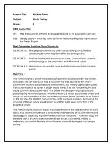
Ancient Rome
This resource outlines several general activities for a study of Ancient Rome, and includes guiding questions, a handout on the story of Romulus and Remus, and ideas for incorporating mapping and timeline activities into your review.
Curated OER
Treaty of Versailles
Students describe the purposes of the Treaty of Versailles. In groups, they analyze the causes and effects of the treaty and discuss why the Americans were so against it. They note ideas for and against its ratification and they make...
Curated OER
The Early Ottoman Empire: 1281 - 1600s
Once one of the most powerful civilizations in the known world, the Ottoman Empire was all-encompassing and highly influencial in the Middle East. Enjoy maps that detail the Ottomans' rule, as well as pictures of relics and architecture...
Curated OER
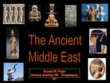
The Ancient Middle East
The foundations of Christianity and Judaism are detailed in these slides, accompanied by bright, vivid pictures and maps. This presentation would successfully supplement a lesson on world religions or to contextualize the history of the...
Curated OER
The "Sick Man of Europe"
An all-encompassing view of the Ottoman Empire, this presentation takes a 300 year journey through the history, culture, and fate of the original "sick man of Europe." Grand photos and detailed maps provide the necessary context to...
Curated OER
Renaissance and Reformation Chapter Test
This is a traditional textbook chapter test on the Renaissance and Reformation, complete with eight multiple choice questions, six fill-in-the-blank, and a 10-question matching section identifying key individuals and terms from the...
Curated OER
The Global Grapefruit - Representing a 3-Dimensional Globe on a 2-Dimensional Map
Students compare and contrast world maps and globes. They convert a 3-dimensional globe to a 2-dimensional map. They are introduced to the Mercator map projection. They observe map distortions of shape, area, distance, directions and angle.
Curated OER
Religions of the World
Second graders explore the part that religion plays in a culture. They explore how many different religions there are in the world and where they're located.
Curated OER
New: Around the World
First graders identify and demonstrate how symbols and models are used to represent features of the environment. They use a map and a globe to label where the students in the book came from, point out the continent, and show which ocean...
Curated OER
Chocolate Place - Factories around the world
Students create a PowerPoint presentation on how chocolate is made. In this chocolate lesson, students locate chocolate factories around the world, and study the process of converting the cacao seed into a chocolate bar. Students share...
Curated OER
Deserts Around the World
Second graders explore the deserts around the world. They use a map and locate America on the map. Students discuss and identify the characteristics of deserts and differentiate the meanings of the word desert and dessert. Students...
Curated OER
Oceans of the World
Second graders demonstrate their ability to find the five oceans on a globe and on a world map and relate their knowledge of mountains and other physical characteristics of land masses to the physical characteristics of the ocean floor.
Curated OER
Mapping your watershed
Pupils investigate the importance of watersheds around the world. By visiting resource links, students can locate watersheds and their sources in the USA and Russia and analyze their effects on the surrounding topography. This...
Curated OER
The World (With an emphasis on the United States)
Fourth graders recognize the different continents. They are introduced to longitude and latitude and how to find locations using these measurements. This series ends with an emphasis on the fifty states of the United States and their...
Curated OER
Mapping Possible Solutions
Fourth graders propose possible sites for the heart of Florida state capital by mapping collected data onto a Florida state map and recording data in a Travel Log.
Curated OER
Three Mapping Activities
Students label three maps of China after being introduced to background information about the country. In this geography lesson, students color two maps and label various points of interest in China. Finally, students draw their own...
Curated OER
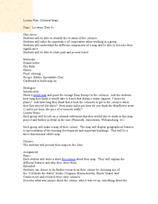
Colonial Maps
Students discover the history of America by identifying the traditional colonies. In this U.S. history lesson, students examine a world map and identify where the voyagers left from Europe to arrive at the United States. Students...
Curated OER
The Power of Maps & Native American Cultures
Sixth graders discover where and how five Native American cultures lived in North America in what is currently the United States. They examine their way of life and the regions they inhabited. Additionally, 6th graders will understand...
Curated OER
The World At Your Fingertips
In this the world at your fingertips activity, students bring in 5 items from home that are not made in the U.S., then complete a chart, indicate on a map and answer 6 questions about imported items.
Curated OER
Cocoa Around the World
In this geography worksheet, students answer 4 multiple choice questions regarding cocoa production around the world using the map and information boxes.
Curated OER
An Adventure to the New World
Fifth graders role play the position of an explorer traveling to the new world. They research the explorers journey and create their own explorer's notebook. They complete different activities and then present their evidence to the class.
Curated OER
Mars Geologic Mapping
Students identify and interpret photographic details of a Martian surface image, design, and create a simple features map. They identify and interpret the geologic history of a part of Mars' surface and then, analyze and discuss the...
Curated OER
Where in the World is Egypt?
In this geography worksheet, learners investigate the location of the continent of Africa and the country of Egypt by studying a map of the region. Students color the map and locate Egypt.
Curated OER
Discover Your World
Fifth graders, in groups, locate a place on a map where the group would like to visit, research the place then write a complete report on the outcome of the findings. They groups must make a cooperative oral presentation to the class.
Other popular searches
- World War Ii Map
- World War I Map
- World War 2 Map
- World War I Outline Map
- World Climate Map
- World Biomes Map
- World Outline Map
- Blank Map of the World
- World Political Map
- Ancient World Greece Map
- World Time Zone Map
- Deciduous Forests Map World


