Curated OER
Making a Travel Brochure of a Louisiana Parish
Although the attachments for this travel brochure project are no longer linked, you can still use the idea here and create your own assignment sheet and rubric. Learners choose a parish in Louisiana (or a city in your state) to research,...
Curated OER
Geography and World History
Students build off of their current knowledge of geography and world history, while being introduced to new concepts and ideas.
Curated OER
Sand Island Story Mapping
After reading Under the Blood-Red Sun, by Graham Salisbury, students use story mapping to create a visual representation of Hawaii. They include Pearl Harbor, Sand Island, and the Japanese relocation camp, where Tomikazu swims to visit...
Curated OER
Global Lesson: Social Studies On-Line Global Lesson: Social Studies On-Line Continents
In this geography PowerPoint a simple world map on which each continent is represented by a solid green landform is the background for each of the nine slides. The continent names appear in a list on the first slide, followed by one...
Curated OER
Let's Make a Map
Second graders draw maps of their playground, noting objects such as trees and play equipment. Working in groups, they make maps of different parts of the school and assemble them into a schoolwide map. They make maps on a field trip to...
Curated OER
Mapping Your Community
Students define the boundaries of their community by comparing the community's official boundaries with other historical, political, physical, and perceived boundaries of the area and create a community map.
Curated OER
Atlantic Ocean Map Quiz
In this online interactive geography quiz worksheet, students respond to 7 identification questions regarding the Atlantic Ocean.
Curated OER
Chromosomes and Genetic Mapping
Students create models of chromosomes using clay, coins, beads, or marbles. They complete a worksheet regarding their crossover frequencies they created with their chromosomes and gene models. They read an essay on sex chromosomes and...
Curated OER
Where in the World is Tacky the Penguin?
First graders complete activities related to they story they are reading in class. Through art and measurement activities, 1st graders relate a story from the "Tacky the Penguin Series" to everyday objects and ideas they encounter.
Curated OER
Europe Map Quiz (Easy)
In this online interactive geography quiz worksheet, students respond to 35 identification questions regarding the countries of Europe.
Curated OER
Focused Learning Lesson: World Geography
Students compare human activities and the physical characteristics of the land and how they have given some regions labels. They also analyze the cultural changes occuring in these regions.
Curated OER
Monarchies of the World Quiz
In this online interactive geography quiz activity, students respond to 27 identification questions about the locations of monarchies. Students have 4 minutes to complete the quiz.
Curated OER
Music to Learn Countries and Capitals Around the World: Learning Countries and Capitals in Asia
Students use musicto explore the countries and capitals of Asia.
Curated OER
Human Impacts on Major Rivers of the World
Middle schoolers explore motivations behind human intervention in the stream flow of selected rivers, infer kinds of interventions and their results, and evaluate level of success of such interventions of stream flow as well as...
Curated OER
Map Lesson Plan
Fourth graders locate and label major sites related to the Revolutionary War in the Hudson River Valley. They examine topographical features of each site and list a few of these features and list two advantages of each military site.
Curated OER
My World - Africa Scavenger Hunt
Students explore the lives of students living in Africa, learn African traditions, and compare and contrast their lives with the lives of African Students.
Curated OER
Scarcity of Water Throughout the World
Young scholars identify the various forms of fresh water on the earth. They observe a demonstration aand read articles that show them the importance of water conservation. They write a journal about their opinion regarding paying for water.
Curated OER
The World's Last Great Wilderness (Antarctica)
It's a shame that there are no photographs in this presentation because the information is fascinating! Each identically fashioned slide contains bullet points of information about Antarctica that will enhance an earth science...
Curated OER
The Fabric of Our World
Students discuss cultural diversity, and examine how the community reflects the cultural background of the inhabitants. They read the book, People, take a community walk, create a rainbow chart, and research other states for relocation...
National Geographic
Exploring Modern Human Migrations
Using maps, images, websites, and handouts, learners work to understand the nature of human migrations. They compare and contrast human migration from the past to the present, identify causes for migration, and trace migration routes on...
Center Science Education
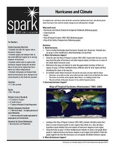
Hurricanes and Climate
Feeling under the weather? This instructional activity on hurricanes can whip things up! With professionally designed maps and handouts, teach your future weathermen (or women) where, when, and how hurricanes occur. They identify...
Discovery Education
Architects in Action
Hands-on and real-world applications are great ways to teach mathematical concepts. Creative thinkers examine how ratios are used to create scale models of buildings and structures. They practice working with ratios by looking at a map...
Curated OER
Comparison of Snow Cover on Different Continents
Students use the Live Access Server (LAS) to form maps and a numerical text file of snow cover for each continent on a particular date and analyze the data for each map, corresponding text file to determine an estimate of snow cover for...
Curated OER
Beyond Demographics
Students study the Dominican Republic through watching and discussing a video about the country and its people. They explain life in the Dominican Republic and describe the emerging picture of the Dominican Republic as viewed through...
Other popular searches
- World War Ii Map
- World War I Map
- World War 2 Map
- World War I Outline Map
- World Climate Map
- World Biomes Map
- World Outline Map
- Blank Map of the World
- World Political Map
- Ancient World Greece Map
- World Time Zone Map
- Deciduous Forests Map World


