Curated OER
Current Earthquake Activity
Fifth graders record any earthquake activity throughout the school year on various maps. In groups, they identify a map locating the points given to them by their teacher. To end the instructional activity, they add the date, strength...
Curated OER
Geography and Culture of China
Take out a map, a paper, a ruler, and those coveted colored pencils for a lesson on Chinese culture and geography. This is a multifaceted approach to basic geography skills that incorporate story telling, class discussion, primary source...
Curated OER
Christopher Columbus: The Man, the Myth, the Legend
Learn more about maps by examining Christopher Columbus's voyage to the New World. Kindergartners will learn about basic map skills and how to identify the compass rose, oceans, and land masses. They will also discover the purpose of...
Curated OER
What They Left Behind: Early Multi-National Influences in the United States
Students research the impact of European voyages of discovery and colonial influence on different aspects of American culture. They access a number of online sources and reference maps to trace the influences of England, France, Holland,...
Curated OER
Gopher It! Exploring German Cyberspace
Students are introduced to the Gopher research tools. In groups, they compare and contrast English and German services on the gopher servers. They create their own dictionary of computer related terms and spend time downloading picture...
Curated OER
Across the United States- Home Learning Activity
In this home-school United States map learning exercise, students work with a family partner as they study a map of the United States. They talk about the states they have visited, play a game by giving each other clues about states, and...
Curated OER
Understanding "The Stans"
Students explore and locate "The Stans" in Central Asia to create, write and illustrate maps, graphs and charts to organize geographic information. They analyze the historical and physical characteristics of Central Asia via graphic...
Edline
How Did the Unification of Germany Change the Course of World History?
Here you'll find a nice guided notes worksheet on Otto von Bismarck, which details Bismarck's plan to unify Germany, as well as asks learners to analyze his motivations and overall impact.
Curated OER
A Visit to Hogwarts
Students collaborate in groups to read excerpts or entire selections from two Harry Potter books, use educational software to create concept maps detailing similarities and differences between first two Harry Potter books, and analyze...
Curated OER
Coming of Age During Japanese Occupation: Richard E. Kim's Lost Names: Scenes from a Korean Boyhood
Explore the implications of the Japanese occupation of Korea during World War II. Learners read Lost Names: Scenes from a Korean Boyhood, participate in classroom discussions about the novel and keep journals in which they respond to...
Curated OER
US City Quality of Life Analysis and Comparison
Students analyze US census data and criteria to compare and measure the quality of life in the country's fifty largest cities. After accessing the 2005 quality of life world report online, students conduct their study to compare three...
Alabama Learning Exchange
Coordinate Geometry
Where do the coordinates lead? As children brainstorm ways to find the location of different buildings, they learn about coordinate points and how to use them to locate areas on a grid or map. They practice using ordered pairs by playing...
National Endowment for the Humanities
How "Grand" and "Allied" Was the Grand Alliance?
Learn more about the Grand Alliance with a scaffolded lesson plan that includes four activities. Class members use primary sources to complete a map exercise, understand the goals and objectives of each individual nation, and participate...
Curated OER
Chamberlain and Hitler, 1938--What Was Chamberlain Trying To Do?
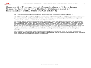
Explore events prior to World War II. Learners view replicas of authentic photographs and hand written documents representing the viewpoints of Adolf Hitler and Neville Chamberlain. They discuss alternate viewpoints, consider historical...
Curated OER
Mapping the New World Lesson Plan
Students compare two maps of the same area from different time periods. For this American History lesson, students look at two maps of the English colonies from 1636 and 1651. They discuss why the maps changed and predict maps from the...
Ms. Catsos
Ancient Rome Map Worksheet
It wasn't just the great leaders of ancient Rome that shaped their civilization—the geography of the region played a major role as well. After first identifying major land masses, bodies of water, and city states on a map of Europe,...
Curated OER
European Crusaders vs. The Muslim World
Detailing the beginning of a battle that continues today, this presentation takes viewers through the various conflicts between European explorers and the Muslim cultures they stumble upon. It details the start of the Western Crusades...
Curated OER
Waldseemuller's Map: World 1507
Students investigate the 1507 word map. In this world geography lesson, students examine the details of each section of the map and then draw conclusions about how the people of 1507 understood the world. Students are evalated on...
Curated OER
Countries of the World
Students identify countries on a world map. In this map skills lesson, students define the word "country" and use post-it notes to locate several countries on a world map.
Curated OER
Draw a Map
Students draw a map. In this map drawing lesson students draw a map to show where a character is from and where they are going in the story. Students are writing an odyssey.
Curated OER
Bluebirds Project: Mapping Species
In this bluebirds project: mapping species instructional activity, students create a map based on data for bluebirds in their area, then answer 5 questions about the mapping of the species. This page has numerous links to...
MENSA Education & Research Foundation
Connecting Africa: A Project-Based Learning Adventure
Mission Possible: Your task is to design a new highway route from Tunis, Tunisia to Cape Town, South Africa. If you accept the challenge, you must create a small map of the route that has already been rejected, a...
Curated OER
Oil: The Problem or Solution to the World's Economic Future
Young scholars map the major oil producing and consuming countries and regions. They identify current and future topographic and political problems that could affect the production and transportation of oil.
Curated OER
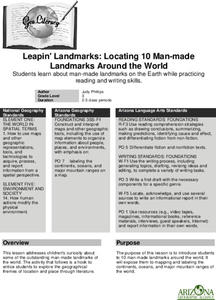
Leapin' Landmarks: Locating 10 man-made landmarks around the world
Third graders engage in a lesson which addresses their curiosity about some of the outstanding people-made landmarks of the world. They explore the geographical themes of location and place through literature.
Other popular searches
- World War Ii Map
- World War I Map
- World War 2 Map
- World War I Outline Map
- World Climate Map
- World Biomes Map
- World Outline Map
- Blank Map of the World
- World Political Map
- Ancient World Greece Map
- World Time Zone Map
- Deciduous Forests Map World


