Curated OER
Using Vegetation, Precipitation, and Surface Temperature to Study Climate Zones
Students begin their examination of the climate zones found around the world. Using a software program, they identify the relationship between the vegetation, climate and temperatures of the different zones. They also plot coordinates...
Curated OER
Trends Forecasting
Students practice trends forecasting to predict the weather. For this forecasting lesson plan, students learn how meteorologists predict the weather by looking at weather trends. They then predict their own forecast, analyze the results,...
Curated OER
Reach for the Stars
Students investigate the Underground Railroad. In this slavery lesson plan, students read books about slavery, the Undeground Railroad, and how slaves escaped the south. Students develop knowledge about coded songs and constellations...
Curated OER
City Life In Europe
Middle schoolers explore Paris. In this geography skills lesson, students watch "City Life in Europe," and conduct further research on the city of Paris and the country of France. Middle schoolers create postcards that feature Parisian...
Curated OER
Leif Erikson Day
Leif Erikson Day lessons breathe life into social studies classroom explorations.
Curated OER
Activities for a Day at the Zoo
A trip to the zoo can result in a multimedia presentation and a variety of interesting research topics.
Curated OER
Spy vs. Spy?
Students consider their beliefs about proper and improper surveillance and then create imaginary neighborhoods featuring surveillance technology in various public and private sites.
Curated OER
Earth Forces
Students use geological techniques such as plate tectonics, mountain building, earthquakes, and volcanoes, in order to explain the earth.
Curated OER
What Do We Do With A Dirty Bomb?
Learners examine composition of dirty bomb and its possible effects on a city, and investigate simulations of such an event; students use computational and problem solving skills to assess damage and prepare report proposing solution to...
Curated OER
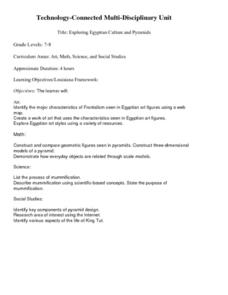
Exploring Egyptian Culture and Pyramids
Students access a variety of Egyptian Culture and pyramid related resources on the Internet. They explore various websites, read articles, create an Egyptian art figure, construct a model of a pyramid, and describe the mummification...
Curated OER
That's My Line
High schoolers work together to brainstorm dialogues intended to persuade another person to engage in a sexual activity. They supply creative and persuasive refusals to these requests.
Curated OER
Tornadoes
Students examine the characteristics of a tornado. They practice using new vocabulary and participate in a question and answer session. They use the internet to gather more specific information.
Curated OER
Voyage of Doom
Students view a video clip about cofferdams. They work together to design and construct their own. They discover the advantages and disadvantages of creating a model.
Curated OER
Castle/Fort Unit
Students compare and contrast castles and forts. They observe buildings in their community and consider how castles and forts are similar. They design their own castle or fort and brainstorm materials to build with, discuss how the...
Curated OER
Operation Genesis
Students, while working in groups under the Operation Genesis project involve fictional elements of role playing to grasp geographic concepts concerning human/environment interaction. They create the physical features of a fictional...
Curated OER
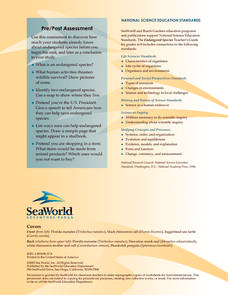
Endangered species
Young scholars define the following words: extinction, endangered species, meteorite collision, glaciation and climate warming. They investigate that there are 307 species on the endangered list, and an average of 10-20 species are added...
Curated OER
Marine Biology Field Trips
Students visit a Marine Biology study area 2-3 times and write a report after the last visit. They participate in the Marine Biology field trips working with lab partners. They complete data sheets to write their primitive environmental...
Curated OER
Virus and Bacteriophage
Students examine the differences between a virus and a bacteriophage. They explore various websites, identify the parts of a virus and a bacteriophage, and construct a model of a virus or bacteriophage.
Curated OER
Temperature in a Cultural Context
Fourth graders investigate the effects of temperature on Native American lifestyle and culture. In small groups they conduct research on cultural practices showing a connection to the climate and create a poster displaying their...
Curated OER
Properties of Materials - Part B
Learners describe the history of materials. They use the kinetic (particle) theory to explain changes of state in matter and trace the flow of heat during changes of state and chemical changes.
Curated OER
Rome: Republic to Empire
Sixth graders discuss the rise of Rome from a republic to a dictatorship. In small groups, they role-play as congress people debating whether or not to give the president more powers. In another activity, 6th graders produce television...
Curated OER
President Who? Forgotten Founders and Their Capitols
Students explore the beginning of the United Colonies that were formed in 1774. In this history lesson plan, students discuss the Articles of Confederation and then answer questions about the events surrounding the development of the...
Curated OER
Westward Movement
Students explore the concept of philanthropy in historical context. In this Westward Movement lesson, students read Our Journey West and explain examples of settlers working together for the common good.
Curated OER
Air Pollution:What's the Solution?-Weather's Role
In this air pollution and weather worksheet, students collect data using an online animation to determine the air quality at given times along with the wind speed and temperature in a particular city. Students make 3 bar graphs using the...
Other popular searches
- Using a Map Scale
- Map Scale Worksheets
- Map Scale Activities
- Geography Map Scale
- Map Scale Math Lessons
- Map Scale Math
- Geography Map Skills Scale
- Math Map Scales
- Map Scale Lesson Plans
- Using Map Scales
- Reading a Map Scale
- Using Map Scale Distance


