Curated OER
Scaling it Down: Caves Have Maps, Too
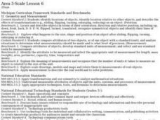
Measurement and map skills are the focus of this lesson, where learners crawl through a "cave" made out of boxes, desks and chairs, observing the dimensions. Your young geographers measure various aspects of the cave and practice math...
Curated OER
Use Google Maps to Teach Math
Capture the engagement of young mathematicians with this upper-elementary math lesson on measuring time and distance. Using Google Maps, young scholars first measure and compare the distance and time it takes to travel between different...
EngageNY
How Do Dilations Map Lines, Rays, and Circles?
Applying a learned technique to a new type of problem is an important skill in mathematics. The lesson asks scholars to apply their understanding to analyze dilations of different figures. They make conjectures and conclusions to...
National Research Center for Career and Technical Education
Information Technology: Photoshop Scale
Scaling is a practical skill as well as a topic to be addressed throughout the Common Core math standards. You are given three different presentations and a detailed teacher's guide to use while teaching proportion, as well as practice...
Curated OER
Drawing to Scale
Students examine the process of drawing a picture to scale. They analyze and discuss real-life blueprints for a house, and create a scale drawing of an original invention using calculators and rulers.
Curated OER
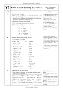
Scale Drawing Lesson Plan
Students calculate actual building measurements from a village map using concepts of ratios and scale in this ten lesson plan mini-unit. They practice measuring angles, multiplying decimals, estimating height and length, and converting...
Curated OER
Map Your Favorite Sports Team's Next Road Trip
Students track a sports team across the country. They use a map scale to calculate the number of miles traveled by their sports team on a trip, conduct Internet research, and calculate how much it would cost them to go along on the trip.
Curated OER
Playground Mapping
Students convert their physical models of a playground from a previous lesson into a map of the playground that includes a scale and key. They examine and discuss examples of maps, view an image to map photo essay, and create a map using...
University of Nottingham
Drawing to Scale: A Garden
See how design and geometry go hand in hand. The activity asks learners to use geometry to design a backyard garden given dimensions of each feature. Scholars work with ratios and scale to develop an accurate scale drawing that includes...
Curated OER
Math and Measurement
Engage the class in exploring linear measurement and map scales. They work in groups to measure various distances in the classroom and convert measurements to other units as directed by the teacher. To access this Word document, click on...
Curated OER
Scale/Ratio
Investigate the use of ratios in scale drawings. Learners scale objects up or down using ratios then find the actual size of something using ratios. They apply their knowledge of ratios as they make their own telescopes in science class....
EngageNY
How Do Dilations Map Angles?
The key to understanding is making connections. Scholars explore angle dilations using properties of parallel lines. At completion, pupils prove that angles of a dilation preserve their original measure.
Prince William Network
Migration Math Madness
A great way to incorporate math into life science, this lesson has learners measure migratory routes on a map and calculate the actual distance that shorebirds on the routes would cover. Learners compute the distance covered in both...
Civil War Trust
Map the Civil War
Mapmaking was a very important element in successfully planning attacks on enemies during the Civil War. Guide pupils through the process of pacing to find the average length of their steps, measure the distance between one object to the...
101 Questions
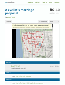
A Cyclist's Marriage Proposal
One cyclist goes to great lengths to make his proposal! Your classes must figure out just what length that is. Using a map with a bike route that spells out Marry Me, learners calculate the total distance of the ride. They base their...
Bowland
Alien Invasion
Win the war of the worlds! Scholars solve a variety of problems related to an alien invasion. They determine where spaceships have landed on a coordinate map, devise a plan to avoid the aliens, observe the aliens, and break a code to...
Radford University
The Wheels on the Bus
Find a cheaper way to keep buses going round and round. Small groups use their knowledge of ratios and proportions to find ways to save money on school transportation. The teams determine the number of miles buses currently travel by...
Curated OER
Introduction to Field Mapping with a Compass and Pace
Students practice using compass and calibrate their own pace, take field measurements of pre-set course with compass and pace, convert measurements into map, using angles and vectors, and make composite class map by adjusting different...
Science Matters
Finding the Epicenter
The epicenter is the point on the ground above the initial point of rupture. The 10th lesson in a series of 20 encourages scholars to learn to triangulate the epicenter of an earthquake based on the arrival times of p waves and s waves....
Curated OER
Real World Investigation- Math and Geography- Elevation Changes
In this math and geography real world investigation, 6th graders plan a driving trip to a city that is located several states away from their home while recording the elevations of three cities that are included in the trip. They use...
Curated OER
Are We There Yet?
Students discover how to use maps and why they are important when using a map. They calculate distance using a map scale and time using travel speed and a map scale.
Curated OER
Map Adventures
Students explore the relationship between a scale drawing and actual distance. For this mapping lesson, students use an amusement park map to determine distances and what they would be like in real life.
Curated OER
Scaled Rubber Band Drawings
Students demonstrate the process of creating a scaled rubber band enlargement of a simple drawing. They observe and discuss a teacher-led demonstration, and create a scaled rubber band enlargement of simple drawings and their invention...
Curated OER
Mapping the Bone Field: An Area and Scale Exercise
Here is an excellent cross-curricular lesson. Learners relate multiplication to area by making a grid on graph paper, and then creating the same grid in real space outside in the school yard.


