Curated OER
Explore: 4th Grade Beaufort Wind Speed
Fourth graders measure wind speed, air pressure, humidity, temperature, and wind direction. They compare their observations with those of actual weather forecasts.
Curated OER
Ecosystems
Students work together to identify the characteristics of their local ecosystem and another one nearby. In groups, they use a Venn Diagram to compare and contrast the two. They use this information to create a collage of both...
Curated OER
Patchwork of the Planet
Students are taught how satellite images can be joined to make a picture mosaic. They use actual satellite images to make satellite mosaics regions of the United States. Students use a camera to photograph portions of a globe in the...
Curated OER
Translating Traditions
Students analyze art reflective of traditions and cultural heritage. For this art analysis lesson, students complete image based discussion.
Curated OER
Species and Spaces - At Risk at Home
Eleventh graders explore and compare Canadian biomes and investigate species at risk. They describe population growth and eco-regions in terms of climate and geography. They research and create presentations about the natural history and...
Curated OER
Two Ways About It
Young scholars take an imaginary hike in two opposite directions along a lake. They view and interpret satellite images and discuss the pros and cons of hydroelectric dams.
Curated OER
New Pen at the Zoo
Students create two drawings for a new animal pen design at the zoo. They must draw the ideas keeping the amount of material available in mind. They compare and contrast their two designs and write how they are similar in perimeter and...
Curated OER
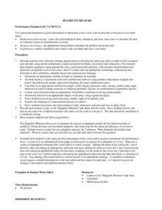
Spaghetti Measure
Learners receive a copy of a "Spaghetti Measure" task sheet along with the scoring rubric. Students preview the task and the rubric prior to starting the task. tudeThey determine the circumference of a circle of spaghetti that will...
Curated OER
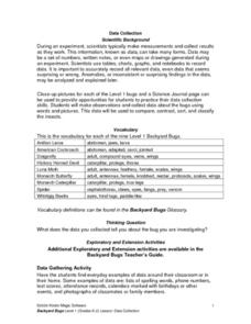
Science: Backyard Bugs Data Collection
Young scholars practice data collection skills by observing common bugs found in their local environment. Once the data is collected they complete data sheets to compare, contrast, sort, and classify the insects. The lesson includes...
Curated OER
Warm up to the Gulf Stream
Students find out the temperature difference between the Gulf Stream and the surrounding water. They locate the Gulf Stream on the infrared image of the eastern seaboard of the US.
Curated OER
An American Spy with Money To Spend
Sixth graders use their imagination, math, reading, computer, geography, and social studies skills in this unique, innovative, and fun instructional activity where students pretend to be international spies!
Curated OER
Wappo Indians of Napa County
Third graders describe the American Indian nation in their local region long ago and in the recent past in terms of national identities, religious beliefs, customs, and various folklore traditions. They synthesize their findings into a...
Curated OER
Gonna Take a Sedimentary Journey
Students collect water samples from a local source, test it, filter it and identify the materials suspended in it. Students disucss the possible sources of sediment in their watershed.
Curated OER
Comparing Amount of Rainfall in Different Geographical Areas
Students construct rain gauges and use them to log rainfall in their school zone, local city, and region and then compare and discuss them by plotting this information.
Curated OER
The Arctic and Taiga Ecozone of Canada
Young scholars discover the differences in the Arctic and Taiga regions of Canada. They identify physical and human characteristics of both region. They also practice using an atlas.
Curated OER
Creating and Analyzing Graphs of Tropospheric Ozone
Students create and analyze graphs using archived atmospheric data to compare the ozone levels of selected regions around the world.
Curated OER
Social Studies: The Connecticut Hill Community
Learners discover the reasons for the settlement of the Connecticut Hill Community. Through an examination of the climate, occupations of the inhabitants, and demographics, they discuss reasons people choose locations for settlement. ...
Curated OER
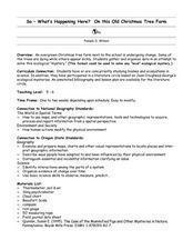
So -- What's Happening Here? On this Old Christmas Tree Farm
Pupils take a field trip to an old Christmas tree farm near their school. In groups, they gather data at the site and analyze the data in an attempt to discover what happened to the area. They identify human activities that led to the...
Curated OER
The Path of Pollution
Students conduct a brainstorming exercise that asks them to list all the ideas about air pollution that can be recalled. The ideas are recorded on a chart that the teacher has prepared. The lesson contains sufficient background...
Curated OER
The Arctic and Taiga Ecozone of Canada
Young scholars examine the various sub-regions of the Arctic and Taiga zones in Canada. Using the online Canadian Atlas, they locate and describe the characteristics of each zone. They organize their information into a chart and share...
Curated OER
Radio Program #11-The Family Farm
Students interpret the lives of persons who grew up on family farms. They compare the changes in farming technology from early days to present time. Students project what the future holds for family farms.
Curated OER
Fastest Glacier
Students compare and contrast continental ice sheets and a glacier. They discuss how glaciers form. Students research the average winter and summer temperatures for their area. They predict what might happen to the Greenland...
Curated OER
Date a Rock!
Students figure the number of half-lives since the sample solidified, and therefore the "age" of the sample rocks.
Curated OER
Alaska's Physical Systems and History
Students read about Alaska's physical systems and determine how Alaska's physical makeup has impacted its history. They create timelines of their particular physical system.
Other popular searches
- Using a Map Scale
- Map Scale Worksheets
- Map Scale Activities
- Geography Map Scale
- Map Scale Math Lessons
- Map Scale Math
- Geography Map Skills Scale
- Math Map Scales
- Map Scale Lesson Plans
- Using Map Scales
- Reading a Map Scale
- Using Map Scale Distance


