Curated OER
Know Your Area
Students investigate transit by analyzing their school surroundings. In this local geography activity, students identify their school in relation to the rest of their state, country and globe. Students discuss their personal travel...
Curated OER
Size Small School
Students explore the concept of scale and ratio. In this scale and ratio lesson, students work in groups to measure a given space such as a hallway, office, or gym. Students measure their area using a meter stick. Students draw a...
Curated OER
GPS Art
Learners design their own logo or picture and use a handheld GPS receiver to map it out. They write out a word or graphic on a field or playground, walk the path, and log GPS data. The results display their "art" on their GPS receiver...
Curated OER
Ridgerunner
Students jog at the beginning of the class while learning about the Appalachian Trail. They integrate math into the lesson by adding up how many miles they have run, and comparing it to distances on a real trail map.
Curated OER
Cartography
Learners follow directions to draw a map of an island. They complete the island map adding their own details using symbols and a legend.
Curated OER
The Fractal Coast
Pupils investigate measuring as it relates to the real world. In this geometry instructional activity, students measure distances as they discuss fractals and how it relates to measuring. They measure both linear and non-linear distances.
Curated OER
Measurement Review
Students measure the distance between two points. In this measurements lesson, students read books about birds that migrate and measure the distances that each bird flies when it migrates. Students discuss the information as a class...
Curated OER
Investigation: The Local Bagel Shop
Sixth graders explore economics by solving business math problems. In this ratio and proportion lesson, 6th graders examine different meals to be purchased at a coffee shop and compare which prices make which meals a better purchase....
Curated OER
You Scratch my Back, I'll Scratch Yours
Students explore the concept of interdependence. In this integrated interdependence lesson, students interpret graphs and charts that require them to analyze the relationship between Mexico and the United States. Students also...
Curated OER
Dream House
Students solve real world problems involving area and perimeter in this unit culminating activity.
Curated OER
Quad Squad
Young scholars pretend they have visited a forest research station on an overnight field trip. They study forest fires, use compass directions, read maps, interpret imagery, and think about the impact of fire on ecosystems.
Curated OER
Environment: Water & Air
The introduction to the lesson mentions a sailor's limited capacity to store drinking water on his ship. Pupils then set up an overnight experiment to remove freshwater from salt water by distillation. There is a math and map activity to...
Curated OER
Gridding a Site
Young scholars make observations of effigy mounds and record them in a notebook. In groups, they must determine the scale of measurement and create their own grid to scale part of the Effigy Mounds National Monument. They also practice...
Curated OER
How Far And How Long Will It Take
Students use a ruler to determine length and then fit the unit to a scale in miles. This unit will also give a geological awareness of altitude and the difference it makes in travel time. The travel time with Mapquest will obviously be...
Curated OER
An American Spy with Money To Spend
Sixth graders use their imagination, math, reading, computer, geography, and social studies skills in this unique, innovative, and fun instructional activity where students pretend to be international spies!
Curated OER
Activities to Enhance STEDII Data
Students develop an understanding of related weather processes such as wind, cloud cover, and temperature using STEDII data and instrumentation. In addition, they integrate mathematical calculations to produce a forecast map.
Curated OER
Language Families
Fourth graders identify and locate the three language families of North Carolina. They calculate the physical area covered by each language family and label them on a map.
Curated OER
Tour De Texas
Students are given a budget and an alternative-fuel vehicle. Using a map of Texas, they are given a starting point and determine how to arrive at their destination within 72 hours. They use the internet to research the alternative fuel...
Curated OER
What Do We Do With A Dirty Bomb?
Learners examine composition of dirty bomb and its possible effects on a city, and investigate simulations of such an event; students use computational and problem solving skills to assess damage and prepare report proposing solution to...
Curated OER
ExplorA-Pond: 6th Grade Area and Random Number Tables
Sixth graders estimate surface area of a pond using a random number table.
Curated OER
ExplorA-Pond: 1st Grade Shapes
Young explorers review the basic shapes (circle, triangle, square, rectangle) and practice putting them together to make new shapes. Given an outline of a pond, they recreate it by combining other shapes.
Curated OER
Eye From the Sky
Students are introduced to the concept of aerial perspective and scale. Students will use satellite technology to view their neighborhoods and sketch the area surrounding their schools. They will take part in a neighborhood walk to view...
Curated OER
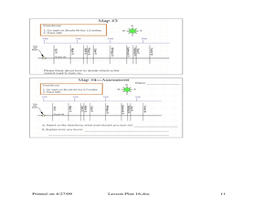
Where Should You Turn?
Fourth graders complete activities to study decimal numbers. In this decimal numbers lesson, 4th graders study decimal numbers to express numbers less than one and intervals. Students complete map and location activities to study the...
Curated OER
How Does Your Garden Grow?
Students create a design for a school garden. For this garden design lesson, students analyze what plants grow best in their school's climate and work in teams to design a garden. Students measure the existing space, determine the...


