Bowland
Alien Invasion
Win the war of the worlds! Scholars solve a variety of problems related to an alien invasion. They determine where spaceships have landed on a coordinate map, devise a plan to avoid the aliens, observe the aliens, and break a code to...
Curated OER
Map Your House
Students are introduced to the concepts of maps as scale models of the whole. After a brief lecture on creating and using an accurate scale when drawing and reading a map. They create a scale drawing of the floorplan of their homes.
Curated OER
Exploration of Scale Models
Students consider the concept of scale models. In this scale activity, students compare the sizes of various every day toys to the sizes of the larger objects they represent.
Curated OER
Amelia the Pigeon: As a Pigeon Flies
Students follow Amelia's adventure on a satellite image. They use measuring and math skills to determine the distance she traveled.
Rainforest Alliance
Knowing the Essential Elements of a Habitat
To gain insight into the many different types of habitats, individuals must first get to know their own. Here, scholars explore their school environment, draw a map, compare and contrast their surroundings to larger ones. They then write...
101 Questions
Neptune
Examine an innovative approach to a large-scale model. Pupils across the state of Maine teamed up to create a model of the solar system that spans 40 miles. Put thinking skills to work within your classes as they make the calculations to...
Curated OER
Problem-Solving Decisions: Reasonable Answers
In this problem solving activity, students answer 6 questions pertaining to a story problem about a tabletop scale model of the Nile River.
Curated OER
The Crash Scene
Fifth graders explore geography by participating in a mapping activity. In this engineering lesson, 5th graders identify the differences between latitude and longitude and practice locating precise points on a globe or map. Students...
Curated OER
What Are Maps For?
Young scholars create a story about a problem someone could have which could be solved by the use of a map. They complete a worksheet that guides them through the features of a map of Chicago. Then they calculate story problems using...
EngageNY
Properties of Dilations
Investigate dilations to learn more about them. The second segment in a series of 16 provides a discussion of properties of dilations by going through examples. The problem set provides opportunities for scholars to construct dilations.
Mathematics Assessment Project
Geometry
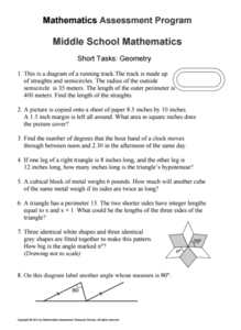
Help learners find joy in facing mathematical challenges. The questions posed on this worksheet encourage young mathematicians to utilize skills learned throughout a geometry unit, and to apply themselves and persevere through problem...
Curated OER
Map Adventures
Students explore the relationship between a scale drawing and actual distance. For this mapping lesson, students use an amusement park map to determine distances and what they would be like in real life.
Curated OER
Introduction to Field Mapping with a Compass and Pace
Students practice using compass and calibrate their own pace, take field measurements of pre-set course with compass and pace, convert measurements into map, using angles and vectors, and make composite class map by adjusting different...
Curated OER
Math with Maps and Globes
Students round out their math skills with these ‘round the world' ideas. In this math and geography lesson, students try out time zone sticks, a polar race, and tic-tac-globe to engage them in learning more about globes and the...
Curated OER
Draw an Inch, Walk a Mile
Students work in small groups to solve the problems presented. The main project, mapping the classroom, use these discussions to collaborate in creating a tangible demonstration of their understanding.
Curated OER
Our Solar System - Comparing Planetary Travel Distances
NASA presents a mini-unit on distances in our solar system. It incorporates scientific concepts of gravity, mass, density, and payload while your aspiring astronauts also employ mathematics skills. They calculate speed, they determine...
Science Matters
Finding the Epicenter
The epicenter is the point on the ground above the initial point of rupture. The 10th lesson in a series of 20 encourages scholars to learn to triangulate the epicenter of an earthquake based on the arrival times of p waves and s waves....
Curated OER
Science: Matter and Energy
Designed to use when teaching adults preparing for their high school equivalency exam, the resource integrates reading practice, writing, and analytical thinking in every lesson. The unit covers 23 topics, but it only includes three...
EngageNY
Getting a Handle on New Transformations 2
Use 2x2 matrices to move along a line. The second day of a two-day lesson plan is the 28th installment in a 32-part unit. Pupils work together to create and solve systems of equations that will map a transformation to a given point. The...
Radford University
Earthquake Problem
Shake up things in the classroom. The unit uses earthquakes to bring a real-life connection to finding arc lengths, logarithms, and equations of circles. Small groups determine whether particular towns would have felt an earthquake after...
Curated OER
Colonial Vacation Planner
Looking for a good lesson on the Colonial Period for your upper-elementary class? Then, this lesson is for you! They use website designs, U.S. travel publications, and maps to plan a family vacation to states which were part of the...
Curated OER
Mapping Skills
In this mapping skills worksheet, students practice scale measurements as they respond to 8 questions that require them to measure to scale.
Curated OER
Essential Elements of Habitat
First graders compare their local area with the Belize landscape. They construct maps of the school area, adding descriptive information. They write haiku poems about their favorite outside places.


