Curated OER
World Geography - Climate Notes
A challenging activity helps young geographers explore the temperatures around the world! They study how the Earth's land temperatures are affected by their proximity to an ocean, as well their latitude and their altitude. A very...
Curriculum Corner
Fairy Tale Unit of Study
What makes a fairy tale a fairy tale? Use a 27-page packet to supplement your next fairy tale unit. With sequencing activities, story map worksheets, character analyses and story elements graphic organizers, and fairy tale highlight...
Radford University
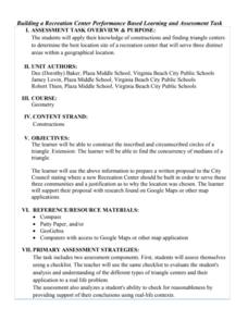
Building a Recreation Center
It's all about location, location, location. Small groups work to find the best spot for a rec center to serve three different communities. Learners construct the inscribed and circumscribed circles of a triangle to find the best place....
Curated OER
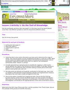
Lesson 3 Activity 1: On the Trail of Knowledge
High schoolers plot the earthquake epicenter data on the base map of the North Atlantic ocean floor using different symbols or colors to characterize different values.
Curated OER
Lesson 2 Activity 2: In the Wake of Lewis and Clark
Learners study the route of Meriwether Lewis and iam Clark's travels and the important events in their journey. They mark the sites on a map and then plan a trip along part of the route.
Curated OER
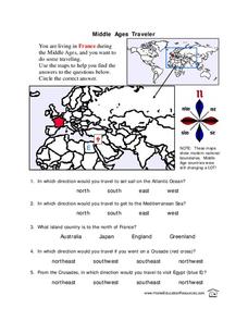
Middle Ages Traveler
In these Middle Ages worksheets, pupils use the maps to help them find the answers to the questions that help them understand the directions of north, south, east and west. Students also color another map of France according the directions.
Curated OER
Working With Electronic Topography Maps
Junior geologists examine topographic maps online and learn how to read them. they answer seven associated follow-up questions. This lesson plan is only a general outline and does not provide the details or the websites that you would...
Curated OER
All About the Animals
Whose footprints are those? After reading Janet Halfmann's book, Little Skink's Tail, young scholars use footprints to determine where on a gridded map certain animals have been spotted. They use the map to answer 3 questions, one...
Curated OER
Memorable Maps
Students draw an assigned map from memory about the United States or any other region they are studying. For this maps lesson plan, students draw a map from their memory at the beginning of the year, and do the same assignment at the end...
Curated OER
Reading a Local and National Weather Map
Students investigate weather maps. In this weather lesson, students discover the meaning of different weather icons and symbols. Working independently, students use the local forecast to correctly label a state map.
Curated OER
Making a Mental Map
Learners discuss maps and explore the concept of the mental maps they use to navigate their everyday routines including the importance of landmarks. They draw a map of how they travel from home to school.
Curated OER
Story Map Situations
Third graders explore a variety of ways to represent text. They represent text in story maps while on the playground. Students depict the elements of a story on a story map. They create a poster for character, setting, problem, and the...
Curated OER
Map Projections: The Grapefruit Activity
Students partcipate in activities in which they examine different map projections. They discover the positives and negatives of each type. They use grapefruits to help them with the different types of map projections.
Curated OER
Maps! Maps! Maps!
Third graders examine and identify different types of maps. They review the types of projections and which maps are better for different information. They answer comprehension questions at the end of the lesson.
Curated OER
Map Study
In this geography worksheet, students study the United States. Students respond to 6 multiple choice questions about the map.
Curated OER
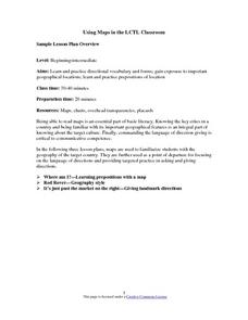
Using Maps in the LCTL Classroom
Students review terms and prepositions of location and view a map to illustrate the meanings of the prepositions students are unfamiliar with. They play "Where am I?" game utilizing correct prepositions then they work with a partner to...
Curated OER
Map Grids
Students study map grids and explore how they can be used to locate positions of objects or features on a map. They read a story and then participate in a grid activity using a large map of the setting of the story.
Curated OER
Reading Maps of the East Pacific Rise
Students make qualitative and quantitative observations and use various maps to investigate the features of the East Pacific Rise The study actual bathymetric maps of the EPR region. They identify key features of the ridge and explore...
Curated OER
A Road Map for the Roman Empire, Ca. 250 CE
Students consider how empires are created and sustained, examine Peutinger Table as a whole and in detail as tool of empire for Rome, c. 250 CE, create ancient time-distance travel chart that synthesizes series of strip maps, and...
Curated OER
Me on the Map Lesson 1
Students use maps, globes, geographic information systems and other
sources of information to analyze the nature of places at a variety of scales. They identify on a map and determine the population
of the city, county, state, country...
Curated OER
The Interconnectedness of Ancient Peoples Map Study
Seventh graders begin this lesson by viewing various maps of the Ancient World. As a class, they take notes on the changes of different areas in Europe and Asia as their teacher lectures to them. They answer questions about the...
Curated OER
Maps and Lines
In these organizing data worksheets, 5th graders complete four worksheets of activities that help them learn maps, graphs, and lines. Students then study images of maps, lines, and graphs.
Curated OER
Mapping Comprehension
Students explore story structure. They discuss questions they can ask themselves while silently reading. Students implement their story knowledge by making story maps. They read The Little Pink Rose and the Cloud and create a story map...
Curated OER
Reading a Local and National Weather Map
Students examine weather maps. They examine icons and map symbols. Students explore vocabulary words related to weather. Students analyze and evaluate information provided on the weather map.


