Jackson Public Schools
Summer Reading Activities
Provide parents with the tools they need to bridge the summer learning gap with this collection of fun activities. Whether it's creating an alphabet poster with illustrations for each letter, playing a game of sight word concentration,...
Indian Land Tenure Foundation
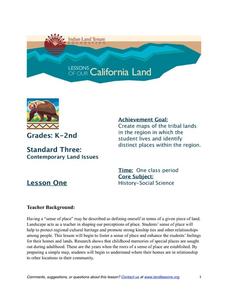
Create a Map
Do your students have a connection to their natural environment? Create neighborhood maps together with your little learners. The lesson starts as the class talks about where they live and what their homes look like. They review their...
Curated OER
John Smith’s Map of the Chesapeake Bay
Young geographers travel back through time with primary source and map analysis and envision Captain John Smith's arrival at the Chesapeake Bay.
Curated OER
Map Skills
Students explore geography by creating a poster presentation in class. For this mapping lesson, students identify the different components featured on a modern day map and how to utilize them in order to navigate. Students read a book...
Curated OER
Basic Mapping Skills
Establish and study the parts of a map with your class and, then they will work in small groups to create their own detailed map, including a legend. There are specific instructions to follow on what needs to be included.
Curated OER
Lewis and Clark
Students investigate Lewis and Clark. In this Lewis and Clark lesson plan, students search the Internet for information about Lewis and Clark and the Corps of Discovery. Students use maps to understand the explorations and decide which...
Curated OER
Great Lakes Homepage for Kids
Here are some outstanding lessons on the geology and history of the Great Lakes. These lessons are divided into Grade 4 -6, and Grade 7 - 8 activities. The activities all use the background information, maps, graphs, data, and Great...
Curated OER
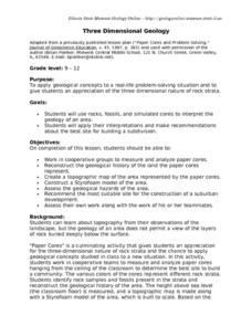
Three Dimensional Geology
Here is a fine lesson plan on geology designed for high schoolers. Learners use rocks, fossils, and other geological clues to determine the geology of an area. Then, they make recommendations to a fictitious city council about the...
Kate Stickley
Reading the World: Latitude and Longitude Lesson latitude and longitude, maps, coordinates on a map, prime meridian, reading maps, equator, globes
Find five activities all about longitude and latitude! Use oranges to show the equator and prime meridian, plot birthdays on a map using coordinates, and plan a dream vacation.
EngageNY
Reading Maps: Locating the Countries We Have Been Reading About
Show your class how to read a map and decipher all of the markings and features. Start out by connecting maps to their homework from the night before and their current reading, in this case That Book Woman, and a related informational...
Curated OER
West Virginia Map
In this map activities worksheet, students use an outline of the map of West Virginia to add the state capital, major cities, and other state attractions. Students complete 3 activities.
Mr. Printables
Map of The USA Jigsaw Puzzle
Encourage young learners to explore the United States with this printable map puzzle. A fun activity that engages children in learning US geography.
Curated OER
Mapping the News
Students explore cartography. In this map skills and map making lesson, Students work in groups to create wall size world maps including legends, compass roses, latitude and longitude, and physical features. Students collect...
Curated OER
United States Map- Map Legend/City Symbols
Students investigate the United States map. In this map skills geography lesson, students explore city symbols on the map legend and identify them. Students use post-it notes to mark various symbols.
Scholastic
Dr. Seuss Extension Activities
Extend the exhilarating learning experience of Dr. Seuss with five activities designed to reinforce literacy skills—site word reading, dialogue writing, story mapping, and more! Featured stories include The Lorax,...
Virginia Repertory Theatre
The Town Mouse and the Country Mouse
Accompany the story, Town Mouse Country Mouse by Jan Brett with an assortment of activities designed to reinforce concepts covering story structure, comprehension, grammar, and social studies. Here, scholars identify the difference...
Just Health Action
Environmental Justice Matters: Mapping Cumulative Impacts (Part 2)
A case study enables class members to confirm whether different geographic parts of Seattle, Washington have disproportionate environmental burdens and benefits. Groups use the EPA's Cumulative Health Impact Analysis formula and...
CJ Hatcher & Associates, Inc.
Skill Building with the Newspaper
Extra, extra, read all about it! Use a newspaper as the primary resource in a special education classroom to teach reading, writing, and math skills. The activities help class members build their reading skills as well as their...
Annenberg Foundation
Reading Maps
Can you read a map? Scholars use an interactive technology tool to analyze maps of various kinds to gather evidence and data to better understand their meanings and usefulness. Using newly obtained knowledge, they form an interpretation...
Curated OER
Exploring the Hudson in 1609
While this lesson focuses on a study of the Hudson River, it could be used as a template for a discussion of map skills, converting measurements, and plotting a route. The lesson includes vocabulary and other resources to make it a...
Curated OER
Tiles, Blocks, Sapphires & Gold: Designing a Treasure Map
Young cartographers in groups hide treasure at school and then create a map to find it using pattern blocks and tiles. They make paintings with clues to create a visual representation of the location of their treasure. Groups present...
NOAA
Mapping the Ocean Floor: Bathymetry
Bathymetry is not a measure of the depths of bathtubs! Through the three lessons, scholars explore two different types of maps and how they are made. The resource focuses on topographic and bathymetric maps and teaching the techniques...
DocsTeach
Analyzing a Map of the Louisiana Purchase
With the stroke of a pen, Thomas Jefferson roughly doubled the size of the United States. The Louisiana Purchase not only grew the new country, but also it gave rise to the legends surrounding westward expansion and accelerated the...
Just Health Action
Environmental Justice Matters: Mapping Environmental Justice Impacts (Part 1)
A case study of Seattle, Washington permits class members to compare and rank how different areas of Seattle are impacted by environment burdens. Groups investigate different zip codes, collect data on five categories, and color-code a...


