Curated OER
Orienteering - The Fundamentals
Students investigate the concept of a compass and it has been used in the past and in modern times. They practice using it in the wilderness in order to test its importance in various exploring activities. Each activity is accompanied by...
Curated OER
Newport Weather Project
Learners study weather and climate patterns using computer and Internet resources. They collect temperature information and share it with other classes via e-mail using graphs
Curated OER
Are You a Super Sign Speler or Speller?
Why is spelling important? Develop your class' spelling skills. They examine examples of homonyms, heteronyms, and creative spelling. They also photograph misspellings in the real world in order to discover the importance of spelling...
Curated OER
Lesson Two: Writing Letters in Code
Combine your friendly letter lesson, grammar lesson, and technology lesson with this fun activity! Young writers compose letters to friends, and then convert the text to Webdings font. Their friends then decode the letter based on a key....
Curated OER
How Much Water is in That River?
Students practice measurement using the Hudson River. They calculate the discharge measurement at a location on the Hudson River using ingenuity and a topographic map.
Curated OER
Informed Drawing Through Observation
Young scholars practice observation techniques to improve their drawing skills. In this drawing technique lesson, students assess drawing as an art media and discuss realism. Young scholars view examples of animal drawings and practice...
Curated OER
An Introduction to Of Mice and Men
By collaborating on producing a product ad and slogan, learning partners demonstrate their understanding of the difference between connotative and denotative language. This week-long activity is designed to be used as an introduction to...
Curated OER
Jack-O-Latern Lesson
Have a Happy Halloween and build strong oral language skills. Special needs Pupils functioning at a moderate level can practice sequencing, writing lists, and using oral language by explaining how they carve a pumpkin.
Curated OER
SpellO': An Orienteering Lesson
Students participate in hands-on activities to practice orienting maps. Given activity cards, students accurately read maps and locate specific stations. Students collect information from the maps to spell a message when the activity...
Curated OER
Finding Your Spot in the World
Learners practice locating places on a Thomas Brothers map. In this map skills instructional activity, students locate places on the map of where their ancestors are from and then practice finding various community places on a map....
Curated OER
Homes Around the World
Students investigate houses and homes from around the world and create a map collage. They compare how the homes are similar and different and why houses match the weather and geography.
Curated OER
Expanding Map Vocabulary
First graders name the vocabulary words in Navajo, Ute and Spanish for the cardinal directions.
Curated OER
George Washington Teaches Map Directions
Learners follow teacher given directions, either oral or written to plot points on a grid to create a profile of George Washington. They apply cardinal and ordinal directions to find the points on the grid.
Curated OER
Individual Horizontal Sundial 2: Cloud/Rain Activity
Young scholars create a sundial to measure local apparent time as it relates to the position of the sun in the sky. In this sundial lesson, students cut and glue gnomon to a sheet of thin cardboard. Young scholars then set the sundial...
Curated OER
Let's Make a Map
Second graders draw maps of their playground, noting objects such as trees and play equipment. Working in groups, they make maps of different parts of the school and assemble them into a schoolwide map. They make maps on a field trip to...
National Geographic
Exploring Modern Human Migrations
Using maps, images, websites, and handouts, learners work to understand the nature of human migrations. They compare and contrast human migration from the past to the present, identify causes for migration, and trace migration routes on...
Mathematics Assessment Project
Identifying Similar Triangles
Math whizzes work with angle sums and exterior angles to figure out the measure of other angles. This particular publication provides comprehensive support in the form of an anticipatory activity, questions designed to prompt discussion,...
Curated OER
Rational and Irrational Numbers 1
You'll need scissors, glue sticks, and mini whiteboards for this activity on rational and irrational numbers. Learners work in groups to classify a variety of expressions as rational or irrational. They are also given a mock discussion...
Mathematics Assessment Project
Mean, Median, Mode, and Range
What a find! Here is a lesson, designed to meet sixth grade math Common Core standards, that focuses on the calculation of different measures of center for the scores from a penalty shoot-out competition. An independent...
Mathematics Assessment Project
Sorting Equations of Circles 2
How much can you tell about a circle from its equation? This detailed lesson plan focuses on connecting equations and graphs of circles. Learners use equations to identify x- and y-intercepts, centers, and radii of circles. They also...
Mathematics Assessment Project
Interpreting Distance–Time Graphs
Pre-algebra protégés critique a graph depicting Tom's trip to the bus stop. They work together to match descriptive cards to distance-time graph cards and data table cards, all of which are provided for you so you can make copies for...
Center Science Education
Tracking Hurricane News
Here is a unique twist for your lesson on hurricanes. After examining extreme weather news headlines, your storm chasers view a PowerPoint about hurricanes and then zoom in on Hurricane Irene. They map a timeline of her trek up the East...
National Geographic
Rescuing, Relocating, and Rehabilitating Wildlife
Bring up the Deepwater Horizon (BP) oil spill that occurred in the Gulf of Mexico in 2010. Display the colorful diagram of the coastal and marine organisms living in the area. Show a video about relocating the eggs of the Gulf's sea...
Curated OER
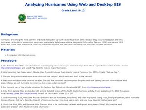
Analyzing Hurricanes Using Web and Desktop GIS
Students analyze hurricanes. In hurricanes lesson, students use the Internet and GIS to analyze hurricanes. Students view the National Atlas of Maps to discuss the direction hurricanes move. Students study the wind and pressure fields to...


