Houghton Mifflin Harcourt
Animal Adventures: Challenge Activities (Theme 6)
Challenge learners who have mastered the basic concepts in the Houghton Mifflin Harcourt thematic units on animal adventures with the activities and exercises suggested in this packet packed with ideas.
DocsTeach
Around the World with Ernest Hemingway
Ernest Hemingway was a traveler and added evidence of these travels to his works. An engaging activity asks readers to analyze 20 photographs of the author, then drag the images to the correct location on an interactive map.
Curated OER
Create A Map!
Students examine two- and three-dimensional shapes, and discuss map skills and attributes. They plan and create their own school campus maps using pre-cut building site shapes.
Curated OER
Map It With Pixie
Fourth graders use the computer program 'Pixie' to create a topographic, detailed map for the state they live in. In this mapping skills lesson, 4th graders use Pixie to make a map of their state that includes topographic features, state...
Curated OER
Archaeology- State Map
Students study state maps. In this map skills lesson, students identify the states' location and how to use a legend. Students complete photocopies of the state map.
Curated OER
Introduction to Maps
Young scholars develop their map skills. In this geography lesson, students participate in an activity that requires them to survey their social studies book in order to find different types of maps and purposes for their uses.
Curated OER
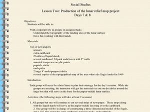
Production of the Lunar Relief Map Project
Students replicate the lunar surface. In this mapping skills lesson, students study the topography of the moon. Students then use craft materials to create topographic maps of the lunar surface where the Eagle landed.
Curated OER
Mapping the Civil War
Students identify the locations of pivotal American Civil War battles. In this map skills lesson, students label Fort Sumter, Antietam, Vicksburg, Gettysburg, and the Battle for Atlanta on an outline map. The map is not included.
Curated OER
An Archaeological Adventure in Athens
Students review map skills and practice finding locations on a map. In groups, they create maps with mystery locations identified by hidden stick-on magnets. Other groups attempt to find the mystery locations and then check their work...
Curated OER
How Do I Get There? Planning a Safe Route to School
One much-needed skill for young learners is direction giving. Have your class plan and draw a safe route for them to travel from home to school. They will also draw places and items that are in between home and school in order to build a...
Curated OER
Customized Topographic Maps and Models
Students explore the information depicted on topographic maps. They construct a 3-D topographic map of a local area. They go on a field trip to the depicted area and compare the 'real world' with their models.
Curated OER
Maps and Modes, Finding a Mean Home on the Range
Fifth graders investigate data from maps to solve problems. In this data lesson, 5th graders study maps and collect data from each map. Students present their data in a variety of ways and calculate the mode, mean, median, and range.
It's About Time
Organizing a Store
When provided with multiple objects, how many ways can the class organize and display them based on predetermined factors? Assist class members with a handy activity—theoretically teaching them concepts to understand periodic...
Curated OER
Character Development Story Map
In this character development story map worksheet, students complete a flow chart about a character in a book. Students fill in the name of the character and write how the character feels and acts before and after a character change in...
Curated OER
Mapping the Past
Middle schoolers study historical maps to view how the world evolved from medieval times through the Renaissance. They work in groups to examine the maps and present a report on one of the listed maps.
Curated OER
Those Who Have Come Before Me
Class members are transformed into explorers as they work in groups to locate hidden items and map their journey along the way. They then leave clues for other groups of young scholars to follow, and ultimately discover how past...
Curated OER
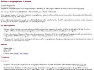
Mapping Mount St. Helens
Students study topographic maps and contour lines and construct a simple three-dimensional model of Mount St. Helens before the May 18, 1980, eruption. They use topographic map skills to interpret the impact of the May 18, 1980, eruption...
PHET
Mapping the Field of Multiple Dipole Magnets
So you built a magnetometer, now what? High school scientists use their magnetometer made in a previous lesson to map the union of magnetic fields of dipole magnets. They experiment with different alignments and draw conclusions about...
Texas State Energy Conservation Office
Investigation: Concept Mapping Fuels
After reading an article, "Fuels for Everything," collaborative groups create a concept map poster of the transportation and non-transportation fuels. This makes a strong introduction to the different types of fuels used for transportion...
Fremont Unified School District
4th Grade California Relief Map Project
Bring life to your next California geography lesson with this great project! Learners design a three-dimensional wall relief map of California, painting and decorating regions using a variety of materials and labeling major geographical...
Annenberg Foundation
Mapping Initial Encounters
Picture someone's excitement of seeing a horse for the first time. How about a cow? The Columbian Exchange changed life for not only Native Americans, but also for Europeans and the entire world. The second lesson of a 22-part series...
Rainforest Alliance
Knowing the Essential Elements of a Habitat
To gain insight into the many different types of habitats, individuals must first get to know their own. Here, scholars explore their school environment, draw a map, compare and contrast their surroundings to larger ones. They then...
NASA
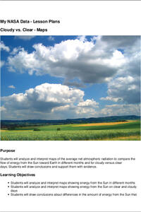
Cloudy vs. Clear - Maps
Find out the science of how clouds keep Earth cooler on hot days. Using guided discussions, investigators analyze and interpret maps of how much solar energy Earth receives at different times of the year. Participants draw conclusions...
Curated OER
Maps and Globes: Where in the World are We?
Students explore maps and globes. In this introduction to map and globe concepts lesson, students identify features of physical maps, political maps, and globes. Students locate land and water, and recite a poem about the names of the...


