Curated OER
Globe Lesson 4 - Intermediate Directions
Students explore the concept of intermediate directions. In this geography skills lesson, students use map skills in order to identify intermediate directions as they complete a map activity.
Curated OER
Globe Skills Lesson 8 Dust Bowl Travelers
Students develop their globe and map skills, In this geography lesson, students examine the Dust Bowl as they complete an activity that requires them to plot latitude and longitude.
Curated OER
Celebrating the Solstice and Equinox
Fourth graders graph the number of daylight hors throughout the year and examine why day length varies. They discover that seasonal changes and latitude on Earth affect the number of hours of daylight in each day. Students listen to...
Curated OER
MAP UNIT
First graders investigate how maps are used to identify different locations. They will also appreciate how there are different types of maps for their purposes. Finally students study how maps contain symbols that represent real places.
Curated OER
South America Layered
Seventh graders create an overlay map of South America. They show the relationships between population, landforms and economies with their maps.
Curated OER
Design an Island
Students make a map of an imaginary island using the topographic symbols provided from a worksheet. Students place lakes, dwellins, reefs, etc. in areas where they would logically be located from understanding how the topography of an...
Curated OER
Getting to the Core of World and State Geography
Students create topography relief maps. In this geography skills lesson, students review geography core knowledge skills, design and make a state relief map, and compile a student atlas.
Curated OER
The Bread of the Sandwich
Students create relief maps of Canada and Mexico out of everyday objects like dried macaroni, dry rice, sand, etc. They create a clue card for a location game and try to stump their classmates. They host a travel fair to display their...
Curated OER
Lesson Design Archaeology- World Map
Students practice locating positions on the world map. In this map skills lesson, students explore the world map and items such as the compass rose, Equator, mountains, cities, etc. The students practice locating positions on the world...
Curated OER
The Gold Rush
Students identify the routes involved in the Gold Rush on a map. In this map skills lesson, students use a United States map to locate the routes used to travel to California during the Gold Rush. Students demonstrate how to use the map...
Curated OER
Geography Skills
Young scholars practice their geography skills. In this geography skills lesson, students locate, plot, and label places on maps and globes.
Curated OER
Cattle Trails
Students identify and locate cattle trails on a globe. In this map skill lesson, students use a marker to locate Texas and Montana and use the map scale to calculate the distance of the cattle trail.
Curated OER
Creating Station Models
Students review weather conditions at various cities and create station models on a weather map.
Curated OER
Where In the World Am I?
Learners identify their location in the world after studying latitude, longitude, relative location, and absolute location. They use assigned web site to find information to make a flipbook that answers questions about their location in...
Curated OER
Our 50 States
Students identify the location of the 50 states using an interactive map. They practice geography skills by playing a fun game. Pupils become familiar with the state abbreviations for the US states. Students become familiar with the...
Curated OER
GPS Treasure Hunt for Knowledge
Students examine themselves as being part of a global community. In this global community lesson, students investigate GPS systems. Students gain knowledge on how the device works. Students discover that satellites provide information...
Curated OER
Lesson 3 Activity 1: On the Trail of Knowledge
Students plot the earthquake epicenter data on the base map of the North Atlantic ocean floor using different symbols or colors to characterize different values.
Curated OER
Eagle Creek Park (A Hike)
Students plot a hiking course using aerial photos and a topographic overlay and find the latitude and longitude of absolute locations. They measure the total distance of a hiked area and figure the area of the ground walked using Heron's...
Curated OER
Sunrise and Sunset
Students utilize a Mesonet daily solar radiation to determine the times of sunrise and sunset and the length of the day. They describe how sunrise and sunset change with latitude and longitude and how the length of the day changes with...
Curated OER
Stranded along the Coast
Students plot stranding sites onto a map using latitude and longitude as well as compass directions with respect to coastal features. They identify several species of marine animals that might become stranded; distinguish their...
Curated OER
Social Studies: African Folklore and Geography
Students discover the connection between geography and folklore in several African nations. In groups, they record information from maps of their assigned countries. Students observe the pictures in books and match the geographic...
Curated OER
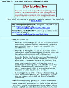
Navigation
Students study the basic methods for finding one's position on Earth. Latitude can be deduced from the height above the horizon of the pole star or of the noontime Sun, while longitude requires an accurate clock giving universal time.
Curated OER
Tell Time With Your Feet
Students discover what the latitude and longitude of their location is. They start walking and measure their shadow. They fill in a chart to discover the approximate time.
Curated OER
Mapping Africa
Students identify the location of parallel and meridian coordinates. They illustrate their understanding of the physical shape of the continent of Africa through a mapping activity, then explain the processes that have influenced the...
Other popular searches
- Latitude and Longitude Maps
- Maps, Longitude and Latitude
- Longitude & Latitude Maps
- Longitude Latitude Maps
- Maps, Longitude Latitude


