Curated OER
Coordinate Graphs
Students use coordinate graphs in order to identify objects and their locations. They are shown how to plot the x and y coordinates and then are given values to be plotted during guided and independent practice. Students are assessed on...
Curated OER
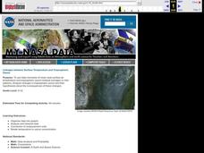
Linkages Between Surface Temperature And Tropospheric Ozone
Students collect and interpret data to make predictions about the levels of ozone in the atmosphere. Using the internet to collect data students use their collected data to create a line graph for analysis. Students make mathematical...
Curated OER
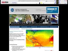
Surface Air Temperature Trends of the Caribbean
Students investigate the seasonal changes to sea surface and near-surface air temperatures near the equator. They use actual satellite data to track and graph the differences in air and sea temperatures during different seasons in the...
Curated OER
Geology Word List
In this science worksheet, students review the vocabulary words for the separate categories related to the concept of geology.
Curated OER
Globe Lesson- Early Spanish Settlements
Young scholars use a globe. In this geography and early settlements lesson, students learn about the settlement of missions and haciendas in New Mexico. Young scholars locate Mexico City and San Francisco on the globe and determine the...
Curated OER
Create Your Own Country!
Students create their own countries. In this geography skills lesson, students establish governments, cultural backgrounds, atlas/geography components, national anthems, and national symbols for a country they create.
Curated OER
The Five Themes of Geography
In this geography skills instructional activity, students respond to 18 fill in the blank and short answer questions about the 5 geography themes.
Curated OER
CLIL: A Lesson Plan
Students explore Vancouver. In this Vancouver geography and English language building lesson plan, students brainstorm what they know about Vancouver and predict what their text will cover. Students listen to the informational content of...
Curated OER
A Geopoem About Alaska
Sixth graders conduct Internet research on the physical and human characteristics of Alaska. They compose and write geopoems about the state of Alaska, using a template.
Curated OER
Hurricanes
Eighth graders gather information on hurricanes that are affecting the world at the time of the lesson. They work together in groups to collect the data and record their information in a table. They are asked questions to finish the lesson.
Curated OER
On the Road Again": Moving People, Products, and Ideas
In this lesson students learn how to identify modes of transportation and communication for moving people, products, and ideas from place to place. Students also study the advantages and disadvantages of different modes of...
Curated OER
Vocabulary Review: Completing Sentences
In this vocabulary worksheet, students check the word that will correctly complete a sentence, 7 sentences. Students choose from 4 words.
Curated OER
Natural Hazards
Students evaluate the hazards of naturally occurring events. After watching a video concerning safety hazards, students work in groups to discuss the safety issues involved in taking a trip to a mountainous region. Recommendations are...
Curated OER
Interpreting Satellite Images
Students identify differences between photography and satellite imagery space.
Curated OER
Subsidence/ Erosion
Students utilize prior knowledge about the Pontchartrain Basin. In this subsidence/erosion lesson, students study the chart on land subsidence and must them identify and find solution for problems caused by erosion.
Curated OER
Circle the Earth - Explore Surface Types on a Journey around Earth
Students use CERES percent coverage surface data with a world map in locating landmasses and bodies of water at Earth's Equator.
Curated OER
Linkages Between Surface Temperature And Tropospheric Ozone
Pupils organize and analyze data regarding changes in tropospheric ozone and then hypothesize about the consequences of these changes.
Curated OER
Chuuk Introduction (Middle School)
Learners pretend they are visiting a relative in the Chuuk nation of Micronesia. Using their knowledge of the 4th of July, they compare and contrast the holiday to the Chuuk's independence day. They create travelogues that outline...
Curated OER
Our Fifty States
Seventh graders identify and locate all fifty states in the United States and their capitals. Individually, they research one state identifying when it became a state, its motto, song, flower and nicknames. To end the instructional...
wikiHow
Wiki How: How to Get Longitude and Latitude From Google Maps
This article will teach you how to get longitude and latitude for any given location using Google Maps.
Other
Boat Safe Kids: Longitude and Latitude
This website starts at the very beginning and explains how round globes are transferred to flat maps. Then they explain the use of longitude and latitude.
PBS
Pbs Nova: Find Your Longitude
Lost at sea with only your sextant? Use your knowledge of longitude to find your place. The non-shockwave interactive activity makes the concept of longitude concrete.
ABCya
Ab Cya: Latitude and Longitude Treasure Hunt
Use the longitude and latitude clues to find the treasures on the map. The more treasures you find the more challenging it will be to find them.
National Geographic
National Geographic: A Latitude/longitude Puzzle
Through examining maps students will be able to identify locations and characteristics of them based on latitude and longitude and infer what events might occur in the places.
Other popular searches
- Latitude and Longitude Maps
- Longitude & Latitude Maps
- Longitude Latitude Maps
- Maps, Latitude/longitude


