Curated OER
Australia/Oceania Outline Map
For this Australia and Oceania outline map worksheet, students explore the region of the world as they label the 14 countries. The countries are numbered and lines for the answers are provided on the sheet.
Curated OER
Character Map
In this character analysis worksheet, students explore two characters. Students fill in the graphic organizer, similar to a story map, for two characters and compare and contrast them.
Friends of Fort McHenry
British Attacks in the Chesapeake during the War of 1812
This is a fun mapping activity that will have your class knowing the ins and outs of the battles in the War of 1812. Your young cartographers will not only plot decisive attacks, but will analyze their purpose, goals, and impact on...
Radford University
Streets of Stephens City
Who has the best street smarts? An educational lesson has future mathematicians analyze street maps and measure angles on the map to determine if streets are parallel. They also consider safety issues at different types of intersections.
PBS
The New West: Interactive Map | A Biography of America
Using this interactive map activity, from A Biography of America, explore how the "New West" evolved during the late 20th century, transforming from the wild, untamed Old Rocky Mountain West into a smaller, more accessible "New West."...
Curated OER
Some Things You Need to Know to Read a Map
Pupils study things the you need to know to read a map and explain location.
Curated OER
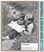
Mapping a Study Site
Students explore outdoors. In this mapping techniques instructional activity, students map out an outdoor area that they have examined. They work in small groups to come up with the symbols and draw the map. This instructional activity...
Curated OER
South America Map
In this map of South America worksheet, students identify and label the countries in South America. Students improve their understanding of South America.
C-SPAN
2016 Electoral College Map
The electoral college can be confusing for citizens of any age. Clear up misconceptions with a handy printable map that details how many electoral votes are allotted to each state, as well as a history of modern elections, complete with...
Curated OER
Geography and Culture of China
Take out a map, a paper, a ruler, and those coveted colored pencils for a lesson on Chinese culture and geography. This is a multifaceted approach to basic geography skills that incorporate story telling, class discussion, primary source...
Education World
The African American Population in US History
How has the African American population changed over the years? Learners use charts, statistical data, and maps to see how populations in African American communities have changed since the 1860s. Activity modifications are included to...
Curated OER
A world of oil
Students practice in analyzing spatial data in maps and graphic presentations while studying the distribution of fossil fuel resources. They study, analyze, and map the distribution of fossil fuels on blank maps. Students discuss gas...
Curated OER
Current Earthquake Activity
Fifth graders record any earthquake activity throughout the school year on various maps. In groups, they identify a map locating the points given to them by their teacher. To end the lesson, they add the date, strength and damage to each...
Curated OER
Across the United States- Home Learning Activity
In this home-school United States map activity, learners work with a family partner as they study a map of the United States. They talk about the states they have visited, play a game by giving each other clues about states, and write...
Curated OER
Listening Comprehension: Retell Main Events of a Story
Story retell is a very important skill. Little learners use a story map and a previously heard story to walk through the retell and story sequencing process. They complete this activity as a whole class and then on their own.
Curated OER
Geography of South America
Young explorers study South American geography. They study maps and create a physical map of the Andes themselves! They also research the geography, environment, and the culture of the Andes and present a report to the class.
Curated OER
Countries Involved in World War II
Students create their own floor map of Europe, Northern Africa, and the Pacific. They locate, identify, and speak for one of the countries involved. In addition, they classify the country they represent as an Axis Power or as an Allied...
Curated OER
Ecology Explorers
Students create accurate, detailed map showing physical features, plants and trees, and other details of three school sites.
Owl Teacher
Introduction to World Geography
Give your learners a thorough overview of what they will learn when studying geography, from the five themes of geography (location, place, environment, movement, and regions) to the tools of a geographer and parts of a map.
Curated OER
Plotting Earthquakes
Students plot earthquakes on a map. In this lesson on earthquakes, students will explore recent earthquake activity in California and Nevada. Students will plot fault lines and earthquake occurrences on a map.
Curated OER
Comprehension: Identify Story Grammar
This fully scripted lesson could be a big help for someone new to teaching Kindergarten. It outlines what you should do and say as you teach grammar and literary elements such as, main character, setting, and events through reading. The...
Novelinks
The Giver: Reading Road Map
Sometimes it's helpful to read certain passages in a novel slowly and carefully, and to read other parts more quickly to move the plot along. Learners tread carefully through Chapter 20 of Lois Lowry's The Giver, noting which...
Curated OER
Exploring our National Parks
Students utilize maps/Atlases to find key spatial information, locate U.S. National Parks, characterize the geography of a specific region, and create a National Park brochure.
Other popular searches
- United States Maps
- Weather Maps
- Topographic Maps
- Story Maps
- Maps and Charts
- Types of Maps
- Maps and Globes
- Middle East Maps
- Maps and Flags
- Historical Maps
- Maps of Europe
- Create Character Maps


