Curated OER
Story Map
In this Language Arts worksheet, students complete a story map. Students include a description of the beginning, middle, and end of a story.
Curated OER
Concept Map
In this Louisiana musical landscape worksheet, students utilize a blank concept map in order to organize information they have learned about groups, communities, musicians, and music.
Curated OER
Freshman Project-Part One-Science Concept Map & 4-Questions Strategy
In this project worksheet, students are given a rubric to asses their concept map and their four question strategy completed for their science project.
Curated OER
Character Map
In this character map graphic organizer worksheet, students add details about a character in a story as they record details in the spaces provided.
Curated OER
Washington, D.C. Map
Here is an outline map of Washington, DC. Some of the points of interest in the city are labeled, as are Maryland, Virginia and Arlington. There are plenty of important monuments and locations not identified, making for a good...
Curated OER
Exploring the Map of Morocco
In this exploring the map of Morocco worksheet, students find and label cities, islands, bodies of water, mountains, deserts and other countries around Morocco.
Curated OER
Map of India
In this map of India worksheet, students label the capital city, the bodies of water and the compass points, then color the surrounding colors according to directions.
Curated OER
Story Map
For this story map worksheet, students read a story and find the different story elements. They fill in the setting, characters, conflict, and climax.
Curated OER
Map of Town
Third graders draw a map of the town given different sites to locate on the map by the teacher. They explain that latitude and longitude are used to locate places on maps and globes, identify the distinctive physical and cultural...
Curated OER
Topographic Mapping
High schoolers create a three dimensional model of a two dimensional topographic map. They explore how the two dimensional significance of a topographical map is helpful to create a three dimensional model. Students use other...
Curated OER
Wind Mapping With Bubbles
Students identify wind direction by using bubbles. In this weather lesson plan, students use a small container of bubbles and a map of their house to create a wind map. Students blow bubbles and note the general direction the bubbles are...
Curated OER
Story Elements Map
In this excellent story elements map worksheet, students view and discuss the advantages and disadvantages of using a graphic organizer to help structure stories and compositions. To my eye, this graphic organizer will help students...
Curated OER
Vocabulary Word Map
In this vocabulary word map worksheet, learners choose a word from a social studies text and write it in the center of the page. Students define it, write an antonym, use it in a sentence, and draw a picture.
Curated OER
Writing/Setting/The Adventures of Tom Sawyer--Map Your Childhood Project
Students write using a strong sense of place. In this Adventures of Tom Sawyer lesson, students discuss the importance of setting to the novel. Students brainstorm five specific locations that contribute to their personal history....
Curated OER
Geography of South America
Student's identify geographic features of a South American map. They use the scale of the map to calculate distances between points. They identify examples of the five geographic themes on the map of South America.
Curated OER
Around the Town
In the world of GPS, make sure your kids can still read maps and determine distances between locations. You will need neighborhood street maps, ideally of your class' home turf. Ask kids questions about different locations in relation to...
Curated OER
Countries of the World
Students define the meaning of the word country. In this countries of the world map instructional activity, students identify boundaries, countries, and symbols within countries on the map. Students distinguish the words country and...
Curated OER
Finding Captain Hook's Treasure
Students use their map-reading skills to find Captain Hook's treasure. They see how the directions on a map correspond with "real-life" directions, and that symbols on a map represent real things.
Curated OER
Tools of the Trade: The Use of Geographic Tools
Students examine the tools of demographic analysis and apply them to real-world situations. They analyze maps, define terminology, and write an information paper for the appropriate government agency to recommend an action or policy change.
Curated OER
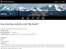
My World
Students study maps. In this social studies lesson, students draw a map of either their room at home or the route they take to school. Students label items on their maps.
Curated OER
National Expansion
Students investigate the Manifest Denstiny. They explore how the idea was evident in 19th century American maps. Students brainstorm the relationships between maps and national expansion. They review a map from 1816 that called for...
Curated OER
Plotting a Hurricane Using Latitude and Longitude
Learners define and use "absolute location," latitude, and longitude. They locate on a map or globe the Earth's poles, circles, tropics, and beginning points of measurements for latitude and longitude.
Curated OER
Boundaries and People
Students map watersheds to find their boundaries. In this watershed activity students map and then give their "watershed address." Students show the trail from stream, larger stream to oceans. Students describe the...
Curated OER
Rivers Run Through It
Using a relief map of New York State, learners answer questions about the distance between different cities, identify bodies of water, and more. First, they discuss vocabulary related to the Hudson River area. Then, they complete a...
Other popular searches
- United States Maps
- Weather Maps
- Topographic Maps
- Story Maps
- Maps and Charts
- Types of Maps
- Maps and Globes
- Middle East Maps
- Maps and Flags
- Historical Maps
- Maps of Europe
- Create Character Maps


