Curated OER
Singing for the Animals
Students examine the correct attitudes and poster for a concert. For this "Singing for Animals" lesson, students created charts to diagram information about the homeless animals they were singing for. Students used correct diction and...
Curated OER
Literature Study Guide: Gulliver's Travels
Although the title suggests this resource is devoted to Gulliver’s Travels, the materials and templates can be used with any work of literature. Readers fill out a reading schedule chart, write a summary, keep a vocabulary word list, and...
Michigan Sea Grant
What's in This Water?
Pupils investigate the biological and chemical characteristics of water to determine where purple loosestrife occurs. They create data sheets to record water quality tests in several locations and work in groups to conduct the water...
Curated OER
Landscape Diversity in the Yukon Territory
Students review and analyze a satellite image of the Yukon territory.
Curated OER
What Do Plants Need to Grow?
Fourth graders control variables to determine the effect on plant growth. They collect information by observing and measuring and construct simple graphs, tables, maps and charts to organize, examine and evaluate information.
Curated OER
Latin America: Places and Regions
Seventh graders create a Latin American portfolio in the form of a country presentation using PowerPoint software. They use their knowledge of geographic concepts to interpret maps, globes, charts, diagrams, and timelines.
Curated OER
Immigration to the United States
Students examine the reasons why people immigrated to the United States. Using maps and charts, they analyze population movements and religious affiliations. They discover how the United States became a lesser Protestant country.
Curated OER
Blowing in the Wind
Students identify and interpret maps, graphs, charts, tables and political cartoons. Students identify what a compass rose is and review its meaning in relation to standard directions. Students design their own weathervanes. Students...
Curated OER
Sense of Place
Students identify the major folk regions of Louisiana and the relationship between folklife, geography, and ecology. They give deeper thought to what makes their own community unique, what their sense of place actually is. Students...
Curated OER
By Land, Sea or Air
Students learn navigational techniques change when people travel to different places. They understand differences between navigation on land, water, air and in space. They explain the concept of dead reckoning as it applies to...
Curated OER
Volcanic Activity in the U.S.
Students locate and map ten volcanoes in United States, create chart comparing volcanoes by last eruption, type of volcano, location, and interesting fact, and create Powerpoint slide show describing basic
information about volcanoes and...
Curated OER
My Family Tree
Students create a family tree. In this ancestry lesson, students research a country that one of their ancestors is from. Students interview a grandparent and map out a family tree.
Curated OER
What's the Matter? (Grade 3)
Third graders organize information about the three types of matter and to reinforce concepts learned in the matter unit of the science curriculum. They use Inspiration software to create a concept map of the three types of matter.
Curated OER
Aquifer Model
Students, after researching and brainstorming about aquifers and locating aquifer maps of Texas, participate in the building of a model of an aquifer complete with a pumping station. They also answer a variety of questions at the...
Curated OER
From Restriction Maps to Cladograms
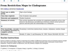
Students develop a matrix to determine the number of differences between each set of primate species. They determine closely related organisms then complete the cladogram and answer a set of questions.
Curated OER
Mapping River Statistics
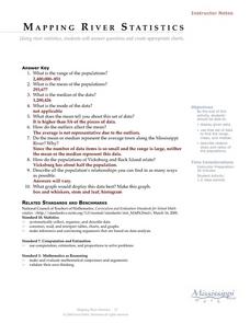
Students research different statistics to do with the Mississippi River. They answer questions about finding data and collect it by conducting research. The research is used to construct a data table. Then students use the table to...
Mark Twain Media
Understanding Informational Text Features
Everything you need to know about informational text features can be found in this resource. Recognizing these types of text features and how they are used in text allows readers to better understand information. Teachers...
Curated OER
Lesson 1 Activity 1: Tools of the Ancients
Students examine how Christopher Columbus determined his latitude.
Curated OER
National Marine Sanctuaries Shipwrecks
Junior oceanographers access the Channel Islands National Marine Sanctuary Shipwreck Database and plot the locations of several shipwrecks. Shipwrecks are always an enthralling subject and this activity allows your learners to act as...
Curated OER
Treasure Hunters
Students design an on campus treasure hunt to find various architectural vocabulary words which they then create definitions for on the blog page on the Environmental Design website.
Curated OER
Molecular Biology and Primate Phylogenics
By counting differences in amino acids, biology stars examine the relationships between different primates. With information gleaned, they map out a phylogenic tree and discover common ancestry. You will need to create printable versions...
Curated OER
The Road to Revolution: (1770-1776)
Posing a guiding question about the inevitability of the American Revolution, the presentation guides students through the circumstances leading up to "The shot heard 'round the world" up to the Declaration of Independence. Teachers can...
Curated OER
Crises in the Late Medieval Church
Corruption and power misuse about, the medieval church is on its last legs by the time this presentation is finished. Using inventive flow charts and maps to illustrate the growing crises between the church and medieval society, students...
Safe Drinking Water Foundation
Water Pollution
An introductory instructional activity to a unit on water pollution, young environmentalists are asked to brainstorm examples of pollutants in water. This instructional activity will help develop a sense of what water pollution is and...
Other popular searches
- Analyze Maps and Charts
- Reading Maps and Charts
- Charts and Maps
- Ireland Maps and Charts
- Tables, Maps and Charts
- Maps, Charts, Globes
- Graphs Charts and Maps
- Interpreting Charts and Maps
- Tables Maps and Charts
- Graphs, Charts and Maps
- Graphs\, Charts and Maps
- Charts, Graphs, Maps


