Curated OER
Reading Comprehension 5: Level 8
Why is an atlas called an atlas? Because it is named for the Greek Titan, Atlas, of course. Young readers learn all about Atlas and atlases in a short passage used as the basis of a reading comprehension exercise. After responding to...
Curated OER
Where Am I: How to Read a Map
Third graders develop an understanding of maps. They explore what a map is, who uses maps, and how to use maps. Students investigate the compas rose. They create a compose rose which illustrates the cardinal directions. Students practice...
Texas State Energy Conservation Office
Investigation: Concept Mapping Fuels
After reading an article, "Fuels for Everything," collaborative groups create a concept map poster of the transportation and non-transportation fuels. This makes a strong introduction to the different types of fuels used for transportion...
Curated OER
What do Maps Show: How to Read a Topographic Map
Students identify the characteristics of topographical maps. Using examples, they practice reading them and describing the information they gather from them. They also discover how to use the website from the U.S. Geological Survey.
Curated OER
Magical Maps
Second graders discuss the importance of using maps and how they are used. After they listen to a folktale, they develop their own story line maps and write their own folktale to accompany a map. They also identify and locate the seven...
Curated OER
Mapping Perceptions of China
Students discuss what types of things are included on a map. They compare and contrast maps of China with a map they create and practice using different types of maps. They write analysis of their classmates maps.
PBS
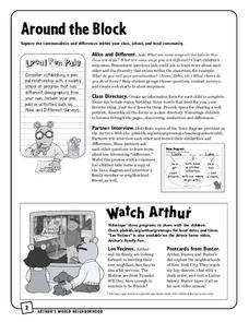
Around the Block
Arthur and his friends help children explore the concepts of family, community, and diversity in a fun series of activities. From performing peer interviews to mapping out the different places students have lived or visited, this...
Ontario
Reading Graphic Text
Do students really need to be taught how to read cartoons, comic books, and comic strips? Yes. Just as they need to learn how to read other forms of graphic text such as diagrams, photos, timetables, maps, charts, and tables. Young...
Tennessee State Museum
An Emancipation Proclamation Map Lesson
Did the Emancipation Proclamation free all slaves during the Civil War? Why was it written, and what were its immediate and long-term effects? After reading primary source materials, constructing political maps representing information...
National Geographic
Australia, Antarctica, and Oceana
Go on a traveling adventure throughout Australia, Oceana, and Antarctica! This textbook excerpt offers a full unit of study that can easily be supplemented by extra projects or research materials. Learners study maps, read about native...
Curated OER
Transportation and Mapping
Students view murals that depict various modes of transportation. They discuss the importance of maps to navigation and create a map. They compare and contrast transportation of the past with modes of transportation used today.
Curated OER
Map It!
Fourth graders demonstrate map making skills by using the computer to create maps of the geographic features, regions, and economy for their state.
Education World
The African American Population in US History
How has the African American population changed over the years? Learners use charts, statistical data, and maps to see how populations in African American communities have changed since the 1860s. Activity modifications are included to...
Curriculum Corner
Camping Literacy Pack
Increase camping vocabulary just in time for summer with a camping themed literacy pack. Use word cards and sentence cards to enhance fluency, build vocabulary, and strengthen writing skills. The activities are perfect for centers,...
Curated OER
Charts, Maps, and Graphs Lesson on the Holocaust
Students practice interpreting data. In this Holocaust lesson, students research selected Internet sources and examine charts, maps, and graphs regarding the Jewish populations in and out of Europe. Students respond to questions about...
Curated OER
Lively Read of the Tale of Despereaux
Students create a character map of the main characters in The Tale of Despereaux. After reading the text, students create a character chart based on information they gleaned from the story. They use this information to write a letter...
Curated OER
Map It With Pixie
Fourth graders use the computer program 'Pixie' to create a topographic, detailed map for the state they live in. In this mapping skills lesson, 4th graders use Pixie to make a map of their state that includes topographic features, state...
Tech Know Teaching
6th Grade Constructed Response Question
Graphs, charts, maps, diagrams. Reading and comprehending informational text is far more than just decoding the words on a page. Here's a packet that provides young readers with practice answering constructed response questions using...
Curated OER
CHARTING THE COURSE
Young scholars uses atlases, maps, and Web resources to determine the distance, driving time, and amount of money they need to make the trip (estimates should include hotel/motel stays, meals, and souvenirs).
Curated OER
Understanding "The Stans"
Students explore and locate "The Stans" in Central Asia to create, write and illustrate maps, graphs and charts to organize geographic information. They analyze the historical and physical characteristics of Central Asia via graphic...
Curated OER
A world of oil
Students practice in analyzing spatial data in maps and graphic presentations while studying the distribution of fossil fuel resources. They study, analyze, and map the distribution of fossil fuels on blank maps. Students discuss gas...
Curated OER
Gopher It! Exploring German Cyberspace
Students are introduced to the Gopher research tools. In groups, they compare and contrast English and German services on the gopher servers. They create their own dictionary of computer related terms and spend time downloading picture...
Curated OER
Hopeful Eyes on Southern Skies
The Times covered a drought in 2011, which affected producers, consumers, and sellers. The class gets informed about climate and the economics of agriculture as the read this article and answer each of the 11 comprehension questions. A...
Curated OER
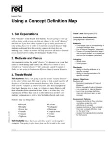
Using a Concept Definition Map
Students define "natural disaster" by offering examples and charting them to discover what a concept definition map is. Then students create their own maps using the word "city".


