Curated OER
Where Is Hoku?
Young scholars are introduced to map making and reading. Using maps, they identify the cardinal directions and discuss the importance of a legend. They analyze the human characteristics of the classroom and create overhead view maps of...
Curated OER
Mobile of Information
Young scholars create a mobile of various geometric designs to be usend to display information from a variety of texts. They add graphics as well as graphs and charts, color, design and artwork to express the ideas learned through the...
Curated OER
Lake Billy Chinook
Students explore aerial photographs and maps of Round Butte Dam. They examine the land modifications necessary to create a dam. After reading a book about building a dam, students compare the environmental impact of Lake Billy Chinook to...
Curated OER
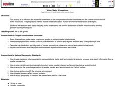
Water, Water Everywhere
Students are introduced to the complex issues of water resources around the globe. In groups, they take on the role of a country and map out the location of water sources. They barter, sell or take over other groups to have access to...
Curated OER
Treasure Hunt Region
Students are introduced to new geography related vocabulary words. In groups, they focus on a different region of the school and develop a new name for it. They create a treasure map for another group to use in the region of the school...
Curated OER
Site vs. Situation: Location! Location! Location!
Students examine places with a similar latitude to Alabama, and discuss the importance of a location's site versus its situation. They analyze maps, create a chart, and write a paragraph on the difference between site and situation.
Curated OER
Oregon Trail Landforms
Fourth graders explore landforms located along the Oregon Trail. They discuss the significance of the Oregon Trail, identify visual landforms, and explain the definition of each one. Students complete worksheets, color, and label maps.
Curated OER
Boilermaker Geography
Fifth graders investigate the geography of central Indiana with an emphasis upon finding the location of Purdue. They make a connection to literature with the reading of a newspaper article to create the context for the lesson plan while...
Curated OER
Gathering Weather Information
Students watch a video of a recent weather disaster. Using the internet, they work together to examine the weather forecast for tomorrow and next week and discuss why it is important to know the weather. In groups, they use weather...
Curated OER
Like Waves on the Shore: Settling Canada
Learners examine and discuss past and current migration patterns in Canada. Using populatioon maps they complete a worksheet on migration waves.
Curated OER
Mass Transit
Students explore the world of mass transit and how it affects their community as well as how it attempts to reduce our pollution mass. Included as well are the environmental and social factors relating to mass transit. They read and...
Curated OER
VAcations in Northern California
Students explore the natural resources and National Parks of Northern California that are commonly visited by people traveling in the United States. They use maps to locate various sites, plan a highway travel route and use the internet...
Curated OER
Where Did It Come From?
Students research island formation, plot locations on a map and make an analysis of why some islands are formed where they are.
Curated OER
Block Magic and Block Magic, Too!
Students are shown how to make fast, fun pictorial blocks using only easy rotary-cut square and rectangles. They do not use any paper piecing or applique' required. Students review "How to Read the Charts". Then the teacher...
Curated OER
Surface Water Supplies And The Texas Settlements
Pupils engage in a lesson that is concerned with the allocation and finding of water resources. The location of different settlement areas is considered as one looks how the water is distributed. They map some of the early Spanish and...
Curated OER
The Great Turkey Walk
Students formulate questions that can be addressed with data and collect, organize, and display relevant data to answer them. They wcreate bar graphs and pie graphs
Curated OER
Habitats: Rainforest
Pupils use the internet to find reasons the rainforest is endangered and ways that affects the rest of the world. They read for information, perform experiments, locate rainforests on maps, and write about this ecosystem.
Curated OER
Planetary Poster
Students engage in a study about the planets and create a poster as one of the projects during the study. They create individual charts for mapping the solar system so the locations can be found in mock space missions to other planets.
Curated OER
How's the Weather?
Students explore earth science by researching the Internet. In this weather pattern lesson plan, students utilize the website weather.com to analyze the weather in different geographic locations. Students view charts and graphs based on...
Curated OER
'European Exploration, Conquest, and Trade
Fifth graders examine the motives, progress and results of the European exploration and conquest of Asia, Africa and the West Indies from the 15th to the 17th centuries. They use maps to trace spice routes and research the role of spices...
Curated OER
Cultural Exchange (Salem)
Students view the photo of the The Tea Trade Painting and discuss what they see. They will then discuss what went into the beginning of a major sea voyage. Next they explore routes traveled by the New England traders. They study sailing...
Curated OER
Social Studies: Analyzing Massachusetts Immigration
Students investigate immigration in Massachusetts during the 1990's. They research a series of questions pertaining to immigration, including their experiences, obstacles, and countries of origin. They graph the five most prevalent...
Curated OER
Earth's Surfaces
Students identify and define geology and earth surface vocaulary and their meanings to classify rocks and explore caves and their properties. Students find rocks and test them according to Moh's scale. They create a color coded earth...
Curated OER
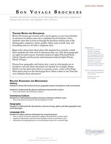
Language Arts: Mississippi River Brochure
Students create brochures about recreational activities along the Mississippi River. Focusing on points of interest, they research attractions and create maps of the surrounding area. Once students write descriptions of their...
Other popular searches
- Analyze Maps and Charts
- Reading Maps and Charts
- Charts and Maps
- Ireland Maps and Charts
- Tables, Maps and Charts
- Maps, Charts, Globes
- Graphs Charts and Maps
- Interpreting Charts and Maps
- Tables Maps and Charts
- Graphs, Charts and Maps
- Graphs\, Charts and Maps
- Charts, Graphs, Maps


