Curated OER
How Has Math Evolved?
Eighth graders pick a topic or person to research related to the history of mathematics. They brainstorm and create a concept map, using the multimedia software inspiration, about what they are researching and want to examine. They then...
Curated OER
Texas History Math
Seventh graders practice math skills while they become familiar with Texas' Boom & Bust economy and the natural history of the east Texas Piney Woods.
Curated OER
8th Grade Math Parallel and Transversal Lines
Eighth graders label and define geometrical lines and angles. They identify angles on the board as acute, obtuse, straight, or right. In groups, 8th graders build with masking tape on the wall a pair of parallel lines, and a transverse...
Curated OER
Science Inquiry Lesson: Mapping Project
Students explore the methods of creating maps. They create a map of Animas River Park using a compass and measuring tape, develop a single map from the team map sections, and devise another map of the Animas River Park using a GPS unit.
Curated OER
Hawaii: A Stolen Star
Explore the islands of Hawaii. Investigate Hawaiian culture and compare their personal traditions to Hawaiian traditions. They locate Hawaii on a map and research the history of Hawaii.
Curated OER
Colonial Vacation Planner
Looking for a good lesson on the Colonial Period for your upper-elementary class? Then, this lesson is for you! They use website designs, U.S. travel publications, and maps to plan a family vacation to states which were part of the...
Curated OER
Call to Arms: A Service Project
Sick of selling candy and washing cars? How about hosting a Digital Day or a Learning Lunch? The suggestions here make fund raising fun and rewarding. Raise money to preserve important maps and other primary source documents.
Mathematics Assessment Project
Discovering the Pythagorean Theorem
Young mathematicians join the ancient order of the Pythagoreans by completing an assessment task that asks them to find the area of tilted squares on dot paper. They then look at patterns in the squares to develop the Pythagorean Theorem.
Curated OER
Arkansas History Lesson Plan: Identifying Arkansas on a Map
Students investigate their hometown of Arkansas. In this U.S. Geography lesson, students identify Arkansas on a map and distinguish it form the other states. Students investigate the history, state line, and personal experiences that...
National Gallery of Art
Islamic Art and Culture
Provided by the National Gallery of Art in Washington, this resource for teachers examines Islamic art, including calligraphy, arabesques, and geometric designs. A recounting of the spread of the faith and the tumultuous political...
Curated OER
The Good, The Bad, The Ugly
Sixth graders examine the causes of the stock market crash of 1929. In this integrated math/history unit on the stock market, 6th graders study, research, and read stocks, visit a local bank, and create a PowerPoint to show the finished...
Curated OER
The Ancient Middle East
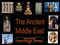
Math and history collide in this presentation, which displays ancient Babylonian numbers and math amidst a discussion about the earliest empires of the known world. Images of maps, ancient relics, and migration patterns establish the...
Curated OER
Global Warming
A series of independent learning activities teaches learners about global warming as it relates to economics and industrialization. The culminating project requires them to create a multimedia presentation identifying the problems,...
Agriculture in the Classroom
A Holiday Tradition: Which Christmas Tree Will You Choose?
Different varieties of Christmas trees provide an interesting way to combine social studies, science, math, and technology. Class members not only research the history of the Christmas tree holiday tradition, they compare and contrast...
Curated OER
The Four-Color Problem: Concept and Solution
Take a walk through time, 1852 to 1994, following the mathematical history and development of the Four-Color Theorem. Learners take on the role of cartographers to study an imaginary world of countries that need to be mapped. One rule:...
Curated OER
Colonial Maps
Young scholars discover the history of America by identifying the traditional colonies. In this U.S. history instructional activity, students examine a world map and identify where the voyagers left from Europe to arrive at the United...
Curated OER
Utah History & Geography
Fourth graders calculate and determine the distances between counties in Utah. Using a map of Utah, they determine the distance between three county seats, the total distance round trip, and label a map with the distances.
Curated OER
Math Hunt: Extreme Weather
Students investigate integrals. In this math instructional activity, students relate real world situation to investing. They may visit a local business to do this assignment.
Curated OER
Math and Native Americans
Students explore how math is relevant to Native Americans. Students investigate Indian culture through geometry. They describe and create geometric polygons and patterns. Students problem solve with tangram patterns to make Indian...
Curated OER
Navigation
Students explain that globes are the best way to show positions of places, but flat maps are portable and can show great detail. They make a mercator projection of the route Lewis and Clark took on their journey.
Curated OER
We're Gonna Have A Party
First graders explore map skills. They discuss the map vocabulary and use directions to find a location on a map. Students discuss and use the components of a map to answer a variety of questions. They use the map and directions to find...
Curated OER
Project Whistlestop:Missouri Vacation Learning Unit
Fourth graders reserach the state of Missouri. In this Missouri History lesson, 4th graders plan a vacation to a region of Missouri. Students work in collaborative groups to determine all aspects of the trip. Students use math skills for...
Curated OER
Time Zones
Students solve time zone problems and chart travel around the world. In this time zone lesson plan, students learn about the history of time zones and view a time zone map. Students use the time zone map to solve time zone problems. ...
PBS
Home, Sweet, Home!
Young scholars investigate the local history and architecture of their community. They draw maps, conduct Internet research, discuss varied architectural designs, take a walking tour of their town and work in teams to record their...


