Nebraska Department of Education
Goal Maps
High school freshmen are asked to think about their future goals and reflect on what they have learned about the barriers they may face and the resources they have to overcome these barriers. Individuals then respond to questions on a...
Newspaper Association of America
Community Connections with Geography and the Newspaper
Understanding geography and government begins at the local level. Using maps and the parts of a newspaper, a unit plan introduces the concept of community. It starts with the creation of classroom and school maps, and then moves through...
Curated OER
Map It!
Fourth graders demonstrate map making skills by using the computer to create maps of the geographic features, regions, and economy for their state.
Curated OER
Mapping the News
Students explore cartography. In this map skills and map making lesson, Students work in groups to create wall size world maps including legends, compass roses, latitude and longitude, and physical features. Students collect...
Curated OER
Identifying Watersheds with Topographic Maps
Learners model a watershed and delineate one using topographic maps. In this hydrology lesson plan, students use aluminum foil to model a landscape and observe how water moves on it. They also observe the features of a topographic map...
Curated OER
Tools of the Trade: The Use of Geographic Tools
Students examine the tools of demographic analysis and apply them to real-world situations. They analyze maps, define terminology, and write an information paper for the appropriate government agency to recommend an action or policy change.
Curated OER
Map It With Pixie
Fourth graders use the computer program 'Pixie' to create a topographic, detailed map for the state they live in. In this mapping skills lesson, 4th graders use Pixie to make a map of their state that includes topographic features, state...
Curated OER
Tasty Mapping
Students create an edible map. In this civics and geography lesson, students research their town's features and local government. Students work in groups to design and create a physical map of their town based on research.
Curated OER
Weather Maps
Students interpret information on a weather map in order to construct a graph, and discuss how the weather impacts their lives.
Curated OER
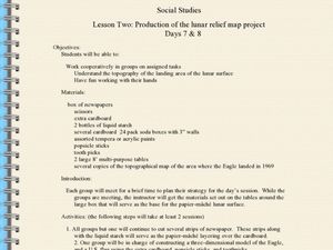
Production of the Lunar Relief Map Project
Students replicate the lunar surface. In this mapping skills lesson, students study the topography of the moon. Students then use craft materials to create topographic maps of the lunar surface where the Eagle landed.
Curated OER
What's Your Temperature?
Learners take a look at the local newspaper and focus on the weather section. They get into small groups, and each one looks at the same map, but of a different part of the country. They must prepare a presentation that shows how...
Curated OER
The Hatfield and McCoy Feud
Fourth graders investigate the Hatfield and McCoy feud. For this Hatfield and McCoy feud lesson, 4th graders examine factors that caused the feud. Students also locate on a map where the feud took place, make a timeline of the main...
Curated OER
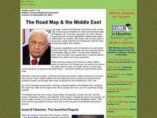
The Road Map & the Middle East
Will walls help? Read to learn how Prime Minister Ariel Sharon proposes to build walls around Isreal in hopes of isolation from Palestine. Complete an online Webquest, analyze maps, listen to audio clips, answer discussion questions, and...
Curated OER
Will There Be a White Christmas This Year?
Students examine historical weather data, and create map and color key that illustrates the likelihood of a white Christmas in different locations across the United States.
Curated OER
Map Creation
Second graders identify a map, symbol, key, and compass rose. Students create and print a map for teacher evaluation using the computer. Students identify the symbols on their map and orally present them to the class.
Curated OER
Introduction of the Lunar Relief Map Project
Students investigate the geographic features of the surface of the moon. In this lunar relief map lesson, students watch and discuss the Apollo II Moon landing and make preliminary plans for their lunar maps.
Curated OER
Why We Count
Students visualize census data on a map and use a map key to read a population map. In this census lesson, students use a map of the Virgin Islands and corresponding worksheets to gain an understanding of population density.
Curated OER
Celebrate Hanukkah in Israel
Explore Hanukkah and its origins with a social studies instructional activity. Learners discover the history of Hanukkah and its traditions. They locate Israel on a map, hear the story of the menorah and create...
Curated OER
Maps with a "Spin"
Students, in groups, research and map the effects of a proposed airport three miles outside of town. They prepare a presentation based on a set of maps they make and explains its different points of view from the viewpoints of the town...
Concord Consortium
The Six Faces of Amzora
Here's a task that is out of this world! Given a description of a fictional cube-shaped planet, scholars answer a set of questions about the planet. They create a two-dimensional map and consider the distances between locations on the map.
Curated OER
Latin American Relief Map
Students, in groups, research, design and construct a relief map of a section of Latin America using papier-mache. They show major landforms, elevations and notable bodies of water. They present their maps to the class.
Curated OER
Presenting our Newspapers
Students present their group newspapers. In this presenting instructional activity, students share their newspaper creations with peers and receive feedback. This instructional activity is part of a unit: "In the News".
Curated OER
Map It!
Fourth graders collect and explore different maps and their uses before using the program Pixie to create maps of geographic features, political features, and economic information for the state in which they live.
Curated OER
Creating a Colonial Newspaper
Students identify people, events and issues of importance during the French and Indian War and compare them with issues that only affected New Hampshire. They discover how newspapers gave people a sense of identity.


