Curated OER
Design an Island
Students explore islands. They create a two- or three-dimensional map of an island. They explain how the topography of an area influences the location of water sources, ecosystems, and human settlements. Lesson includes adaptations for...
Curated OER
The Sounds of Samba
Young scholars research the origins of Samba in Brazil using the internet. After defining new vocabulary, they locate the cities in Brazil using latitude and longitude which practice the Samba. In groups, they compare and contrast the...
Curated OER
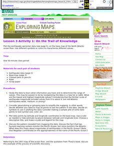
Lesson 3 Activity 1: On the Trail of Knowledge
Students plot the earthquake epicenter data on the base map of the North Atlantic ocean floor using different symbols or colors to characterize different values.
Curated OER
Social Studies: African Folklore and Geography
Students discover the connection between geography and folklore in several African nations. In groups, they record information from maps of their assigned countries. Students observe the pictures in books and match the geographic...
Curated OER
Making a Map of the Classroom
Students create a map of the classroom using the computer programs AppleWorks and iChat in this math-based technology lesson. Lesson extension ideas include a scavenger hunt and maps of other school buildings.
Curated OER
Comparison of Snow Cover on Different Continents
Students use the Live Access Server (LAS) to form maps and a numerical text file of snow cover for each continent on a particular date and analyze the data for each map, corresponding text file to determine an estimate of snow cover for...
National Wildlife Federation
I Speak for the Polar Bears!
Climate change and weather extremes impact every species, but this lesson focuses on how these changes effect polar bears. After learning about the animal, scholars create maps of snow-ice coverage and examine the yearly variability and...
Midnight Martian
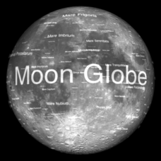
Moon Globe
Not just a simple globe of the moon, this interactive version allows you to choose lighting according to the location of the sun, views from different positions on Earth, and more! Satellite images and topographic data have been combined...
Curated OER
Your Expedition of Discovery
Learners study GPS and see how it is used to determine points on the Earths surface. In this expedition lesson students use GPS to find given coordinates.
Curated OER
"Where in the World is my School?"
Students learn new vocabulary and discuss what GPS is and does. They locate their school using the equipment.
Curated OER
MAP UNIT
First graders investigate how maps are used to identify different locations. They will also appreciate how there are different types of maps for their purposes. Finally students study how maps contain symbols that represent real places.
Curated OER
Navigation
Students study the basic methods for finding one's position on Earth. Latitude can be deduced from the height above the horizon of the pole star or of the noontime Sun, while longitude requires an accurate clock giving universal time.
Curated OER
Globe Lesson 4 - The Compass
Students study compass' and their use in navigation. In this compass instructional activity, students use a compass and a globe to answer the questions about navigation.
Radford University
Earthquake Problem
Shake up things in the classroom. The unit uses earthquakes to bring a real-life connection to finding arc lengths, logarithms, and equations of circles. Small groups determine whether particular towns would have felt an earthquake after...
Curated OER
Mush! Tracking Travelers on the Trail
Students get to know Alaska and the Iditarod route that is run by dogs as they track the mushers' progress on a map that they create specifically for the race. They learn about latitude, longitude, plotting on a map, checkpoints, and...
Curated OER
Our 50 States
Students identify the location of the 50 states using an interactive map. They practice geography skills by playing a fun game. Pupils become familiar with the state abbreviations for the US states. Students become familiar with the...
Curated OER
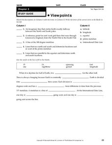
Viewpoints
In this map worksheet, students review latitude, longitude, equator, and prime meridian. This worksheet has 5 matching and 8 fill in the blank questions.
Curated OER
How far have we traveled?
Students practice longitude and latitude to determine given position on Earth's surface, convert and calculate angular measurements, and use Pythagorean Theorem to determine change in position or distance traveled between any two locations.
Curated OER
Orientation of the Earth in Space
Students hypothesize the location of the sun in the sky at diferent times of day and at different latitudes. They perform several experiments to provide evidence for their hypothesis. Experiments including observing the sun's position at...
Curated OER
Plotting Earthquakes
In this earthquakes worksheet, students access a website to gather information about the magnitude and location of earthquakes for 5 days. Then students complete 7 short answer questions.
Curated OER
Individual Horizontal Sundial 2: Cloud/Rain Activity
Learners create a sundial to measure local apparent time as it relates to the position of the sun in the sky. In this sundial lesson, students cut and glue gnomon to a sheet of thin cardboard. Learners then set the sundial in an...
Curated OER
Carbon Monoxide and Population Density
Tenth graders investigate the carbon monoxide level at a fixed latitude. They determine if there is a relationship to population density. They download data sets and generate a graph. They determine a link between human activity and...
Statistics Education Web
What Percent of the Continental US is Within One Mile of a Road?
There are places in the US where a road cannot be found for miles! The lesson plan asks learners to use random longitude and latitude coordinates within the US to collect data. They then determine the sample proportion and confidence...
Other popular searches
- Latitude and Longitude Maps
- Maps, Longitude and Latitude
- Longitude & Latitude Maps
- Longitude Latitude Maps
- Maps, Longitude Latitude


