Curated OER
Celebrating 100 Years of Negro Leagues Baseball
Ninth graders locate original locations of Negro Leagues Baseball teams using latitude and longitude, calculate distances between locations using maps and/or Internet resources, and use critical thinking skills to compare and contrast...
Curated OER
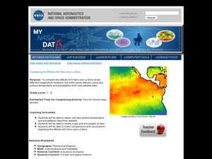
Comparing the Effects of El Nino and La Nina
Students examine the differences between an El Nino and La Nina year. In this investigative lesson students create maps and graphs of the data they obtained.
Curated OER
Earthquake Depth
Students research and locate earthquake epicenters on a map using latitude and longitude. They determine if the depth of an earthquake has any relationship to the distance from a plate boundary.
Curated OER
The Distribution of Earthquakes
Students determine the rate of seismicity by determining the frequency of aftershocks following a major earthquake. They incorporate the use of the Internet, Excel 2000, a map of their area with latitude and longitude markers, and paper...
Curated OER
GPS Scavenger Hunt
Learners go on a GPS scavenger hunt. They use GPS receivers to find designated waypoints and report back on what they found. They compute distances between waypoints based on the latitude and longitude, and compare with the distance the...
Curated OER
Asia Crossword
In this geography instructional activity, students complete a crossword puzzle on the continent of Asia. They answer 21 questions related to the type of government systems found, capital cities, deepest lake, and lowest population density.
Curated OER
Two Reasons for the Four Seasons
Students explore the reasons for the seasons. In this season lesson plan,students use flashlights to demonstrate the movement of the Earth and how it influences the seasons. Students label pictures and discuss what would happen if the...
US Mint
Absolutely and Relatively: The Puerto Rico Quarter Reverse
How much does your class know about Puerto RIco? How much can they learn from the back of a 2009 quarter? Use the coin, part of a series of quarters that depict US territories, to teach learners about the geography, culture, and history...
Curated OER
Charles Lindberghs's Flight to Paris
Students practice map skills. In this map skills lesson, students locate the cities of New York and Paris on a map. Students read about the flight made by Charles Lindbergh in May 1927 from New York to Paris. Students answer 8 questions...
Curated OER
Walking that Line
Young scholars attempt to describe and use longitude and latitude. They will identify different countries, their neighbors, and borders around the world. Included in the instructional activity the students identify natural features that...
Curated OER
Locating Patterns of Volcano Distribution
Students examine patterns of volcanic distribution worldwide, use tables to plot and label location of each volcano on map, lightly shade areas where volcanoes are found, and complete open-ended worksheet based on their findings.
Curated OER
Geographics in Arkansas
Third graders discuss where Arkansas is located on the United States map. They use geographic tools to participate in activities.
Curated OER
Old World and New World - Why Contact Took So Long
Students use a globe to determine why contact between the old world and the new world took a long time. In this map skills lesson, students analyze routes between regions to determine why it took so long for the old world and the new...
Curated OER
Planet Earth
Learners explore and analyze data from different maps in order to explain geographic diversity among the continents. Student groups research continents' physical features and examine how they contribute to quality of life for inhabitants.
Curated OER
Applications of the Pythagorean Theorem - Magnetism
Middle and high schoolers use the Pythagorean Theorem to complete a table showing with the magnetic field strengths in given cities. They find the average value of the Earth's magnetic field and plot one of the three-dimensional values...
Mr. Head's 6th Grade Classroom
Absolute Location
How do we know where we are in the world? A presentation for middle schoolers explains absolute location and other geography terms such as relative location. It also gives scholars the opportunity to practice finding absolute location on...
Curated OER
Make Your Own "Weather" Map
Students create their own "weather" map using data from x-ray sources. They analyze and discuss why it is important to organize data in a fashion in which is easy to read. They compare and contrast different x-ray sources using a stellar...
Curated OER
Snow Cover By Latitude
Students examine computerized data maps in order to create graphs of the amount of snowfall found at certain latitudes by date. Then they compare the graphs and the data they represent. Students present an analysis of the graphs.
Curated OER
A Bird's Eye View of our 50 States
Third graders focus on state birds as they learned absolute location (latitude/longitude) of each state, as well as their relative location (bordering states).
Curated OER
Geotagging in school
Students create a digital photo map of the world. In this digital photo map lesson plan, students pick topics such as the Olympics, natural disasters, or trip planning and create a photo map on the computer.
Curated OER
World Climate Growing Zones
Young scholars create a map showing where crops would be grown around the world. In this crops lesson plan, students show how the world climate would produce different parts of the world at different times. Young scholars fill out...
Curated OER
Exploring Marine Ecosystems in the Caribbean and Maine
Students compare the marine habitats of Maine and the Caribbean using temperature, tides, ocean currents, latitude and longitude. In this marine ecosystems lesson plan, students analyze maps to complete graphic organizers that evaluate...
Curated OER
Water Monitoring Vocabulary
As the title implies, this is a list of vocabulary terms relating to water monitoring. If your ecology class is learning about how to test water quality, this will be an appropriate reference sheet for them. As a bonus, if you live in...
Curated OER
March of the Polar Bears: Global Change, Sea Ice, and Wildlife Migration
Students study global change and how these changes impact wildlife. In this polar bears lesson students analyze maps and data to understand climate change.
Other popular searches
- Latitude and Longitude Maps
- Maps, Longitude and Latitude
- Longitude & Latitude Maps
- Longitude Latitude Maps
- Maps, Longitude Latitude


