Curated OER
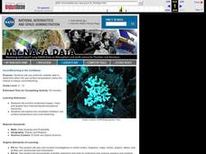
Coral Bleaching in the Caribbean
Students use authentic satellite data on the NASA website to determine when the sea surface temperature meets the criteria to induce coral bleaching.
Curated OER
What A Tombstone Can Tell Us
In this coordinates worksheet, students determine the coordinates to visit a cemetery. Students determine 18 coordinates on this worksheet.
Curated OER
Science: Hurricanes As Heat Engines
Pupils conduct Internet research to track the path of Hurricane Rita. They record the sea surface temperature of the Gulf of Mexico during and after the hurricane and draw conclusions about how hurricanes extract heat energy from the...
National Wildlife Federation
I’ve Got the POWER Wind Energy Potential at Your School
The 20th lesson in a 21-part series connects the wind data and expectations of a turbine to whether such devices should be built in your area. Scholars begin with estimating the wind potential at school by using long-term climate...
Curated OER
Westward Expansion
Students locate California and New York on a map and explore available means of travel in the 19th century. Students explore the role of trade in pioneer America and simulate various barter transactions.
Curated OER
Dalai Lama
Sixth graders use skills and knowledge that they gained from their Tibet unit to formulate a final product of their Tibet journey. This study covers topics such as Tibet's geographical location, religious beliefs, customs, dress, and way...
Curated OER
Welina's World
Students living in Hawaii draw a picture of themselves in their neighborhood. They draw their neighborhood in relation to their district and then in relation to the island they are from. They compare their pictures to their classmates'...
Curated OER
Make Your Own "Weather" Map
Students develop and apply a variety of strategies to solve problems, with an emphasis on multi-step and non-routine problems. They acquire confidence in using mathematics meaningfully.
Curated OER
Mapping a Refuge
Pupils record observations gathered while at a national wildlife refuge. In this lesson on wildlife refuges, students choose an observation spot and record seasonal changes throughout the year.
Curated OER
Muppet Treasure Island
Students watch the movie "Muppet Treasure Island" and then taking on roles of characters in the movie answer navigational questions to try discover the location of a treasure hidden by the teacher.
Curated OER
Students Become Mapmakers
Young scholars practice making a map of a continent and correctly plotting five cities on that map. They place latitude and longitude lines on a map, determine the need for various map projections and explain why map scales are necessary.
Curated OER
Plotting Plates
Young scholars investigate plate tectonics and their correlation with natural phenomena like earthquakes and volcanoes. They use the internet to see real-time data about earthquakes and volcanoes. Students plot latitude and longitude...
Curated OER
Cargo Shipping
Students work effectively in groups to achieve a common goal: Create the most efficient cargo shipping route. They successfully identify and locate port cities using latitude and longitude. To use the formula r=d/t (rate equals distance...
Curated OER
What Causes Irregular Temperature Patterns?
Students examine common trends in climate across the U.S. They identify the anomalies in hot-cold temperature differences in the U.S and locate them on the map using latitude and longitude coordinates.
Curated OER
Our State Road Trip
Students take a virtual tour of the country of China instead of a state. Using the Internet, they examine the differences between a political and physical map and use latitude and longitude to locate specific places. They also research...
Curated OER
Beach Sands of the World
Students examine a variety of sand samples from throughout the world. On an index card, they write the characteristics of the sand and draw what the grains look like to use during the activity. Using a map, they practice plotting...
Curated OER
Research Cruise Scavenger Hunt
Students track the research cruise of the Ronald H. Brown from San Diego to the Galapagos Islands. They match research groups with the key words, using the ship's daily logs to find the answers.
Curated OER
How to be a Great Navigator!
Students, through teacher lecture and class discussion, explore historical methods of navigation: dead reckoning and celestial navigation.
Curated OER
Where in the World...?
Students use longitude and latitude to locate various cities, regions, landforms, and bodies of water around the globe. They use The New York Times Learning Network's crossword puzzle 'Longitude and Latitude' to sharpen their atlas skills.
Curated OER
THE TRAVELS OF BABAR: An Adventure in Scales
Students locate and identify the seven continents. They use longitude and latitude in establishing a location. Students enhance the knowledge of geographical location with cultures. Individuals or small groups research multiple aspects...
Curated OER
Osprey Journey
Students investigate the migration route of one bird, Osprey B4, using information gathered from satellites to track birds over a two-year period. They coimpare their graphs with maps of B4's migrations that have been plotted by...
Curated OER
Around the World in 5 Days
Learners explore continents, draw map, discuss cultures, use research to learn geography, and investigate cultures.
Curated OER
Plotting Earthquakes
Learners explore earthquakes. Using the National Earthquake Information Center website, students plot daily earthquakes on a map. They observe the magnitude of each earthquake. Learners identify the pattern of earthquake locations and...
Curated OER
Where In the World Am I?
Learners identify their location in the world after studying latitude, longitude, relative location, and absolute location. They use assigned web site to find information to make a flipbook that answers questions about their location in...
Other popular searches
- Latitude and Longitude Maps
- Maps, Longitude and Latitude
- Longitude & Latitude Maps
- Longitude Latitude Maps
- Maps, Longitude Latitude


