Curated OER
The Crusades: Routes of Two Crusaders
Use these worksheets to kick off a great lesson on The Crusades. Eighth graders will analyze a map and four short passages to answer six reading comprehension questions.
Curated OER
Immigration and Ellis Island
Fourth graders explore family histories. For this social studies lesson, 4th graders identify the countries from which their ancestors came and locate them on a map. Students discuss the role that Ellis Island played in immigration in...
Curated OER
World Hunger - A Cultural Crisis
Students explore the problem of world hunger and starvation. After a class discussion, students use a map to identify specific areas where populations are starving. In groups, students research reasons for the lack of food. They prepare...
Curated OER
The Fall of Rome and the Beginning of the Middle Ages
A major turning point in world history is the focus of this presentation. Rome has fallen, and with its descent comes the Dark Ages. With pictures, maps, and important information about the Middle Ages, this slideshow would be a great...
Curated OER
How Did British Imperialism and Colonization Impact India?
How did British imperialism and colonization impact India? Uncover how India was considered to be Britain's most valuable colony, how Europe's Industrial Revolution affected India, and the beginnings of the East India Company. A short,...
Curated OER
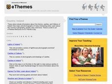
Country: Ireland
Students use the Internet to examine the history, castles, and folklore of Ireland. Photographs of sites are also included.
Curated OER
Getting from Place to Place
Students examine modes of transportation. In this transportation instructional activity, students listen to their instructor present a lecture on modes of transportation over the past 300 years. Students respond to questions about the...
Curated OER
Renaissance Trade and Exchange
Sixth graders map out trade routes. In this Renaissance time period lesson, 6th graders complete a Christopher Columbus Map Activity, discuss and identify the parts of a map, and locate Asia, Europe and the Middle East. Students...
Curated OER
The Ottoman Empire
Students recognize that the Ottoman Empire was at its grandest during the reign of Suleyman the Magnificent. They use a map to draw in the extent of and the details of the Ottoman Empire during hie reign. In addition, they prove the...
Curated OER
Europe Capitals Map Quiz
In this online interactive geography quiz activity, students respond to 40 identification questions regarding capital cities of European countries.
Curated OER
The Seven Continents Scavenger Hunt
Who doesn't enjoy an engaging scavenger hunt? Here, scholars listen to, and discuss, the informative text, Where is my Continent? by Robin Nelson. They then explore the seven continents and four major oceans using Google Earth.
Curated OER
The End of the War: WWII
Enhance your student's reading with this presentation on the end of WWII. This series of slides contains information, focus questions to guide student reading, and a video entitled, The Impact of World War II. Note: To view the video...
Curated OER
What Can Third Graders Learn About Cooperation From the European Union?
Fourth graders explore the reasons the European Union began and identify the lessons they can apply to group work in the classroom. In this European Union lesson, 4th graders read the booklet from the website and complete several steps...
Curated OER
Estimating Distances
Fifth graders explore the concept of estimating distances between two places on a map. In this estimating distances lesson plan, 5th graders interpret maps according to measuring distance. Students choose a place on a map and find the...
Curated OER
Small European Countries
Young scholars examine the advantages and disadvantages of being a very small European country in today's world. They locate each country on a map using the coordinates, discuss the governments of each country, and develop a list of...
Curated OER
Social Studies:
Students identify various types of breads fromother countries and locate them on maps. In small groups, they make story maps of books that mention bread and make books resembling sandwiches. Students have a bread tasting party and...
Curated OER
China - the Geography of European Imperialism - Spheres of Influence in China
Ninth graders create a map of China. They identify the various spheres of influence carved out by the Imperialist powers of Europe as well as locating geographical features of china and major cities. They explain the global impact of...
Curated OER
Look! You're Wearing Geography
Sixth graders explore economic systems. In this economics lesson, 6th graders discover global markets. Students work in small groups to identify where their clothing and materials originated. Students locate countries on a map and...
Curated OER
Gallery Scavenger Hunt for U.S. History
In this U. S. historical facts worksheet, students participate in identifying the various leaders being described, identify places described in detail and fill out a map by following the directions given.
Curated OER
Tourism in Northern Ireland
In this tourism instructional activity, students label pictures of tourist destinations with the name of the country they are located in, write sentences about pictures showing damage caused by tourists, identify locations on a map, and...
Curated OER
Park Brochures
Sixth graders investigate natural environments by researching national parks. In this brochure making lesson plan, 6th graders explore a specific national park and research it's information by utilizing the web. Students create travel...
Curated OER
Social Studies: The Birth of Olympism
Students complete maps of Ancient Greece identifying key sites of the ancient Olympic games. After watching a video, they complete worksheets about the games and the athletes. Students discuss how the spirit of Ekecheiria, the "Sacred...
Curated OER
The Holocaust: Concentration Camps
Tenth graders, after reading a variety of passages and watching a video on "Children Remember the Holocaust," explore the concept of brutality of deportation and analyze conditions in concentration and death camps. They review maps and...
Curated OER
Ellis Island: Gateway To America
Fifth graders study the immigration station on Ellis Island. Through several activities, they see that immigrants who arrived at Ellis Island came to America from different countries, mostly those in Europe, for a variety of reasons.
Other popular searches
- Blank Maps of Europe
- Outline Maps of Europe
- Geography Maps of Europe
- Maps of Europe 1914
- Maps of Europe Political
- Maps of Europe Ppt
- Maps of Europe Pot
- Maps of Europe 1919
- Europe Maps
- Europe Outline Maps
- Europe Geography Maps
- Western Europe Maps


