Curated OER
University of Texas: Latvia: Political Map
A political map of Latvia showing its major cities, highways, and rivers. You can also find the neighbors of Latvia on this map from the Perry-Castaneda Collection.
Curated OER
University of Texas: Albania: Political Map
A political map of Albania showing its major cities and highways, district boundaries, and neighboring countries. Clicking on the map will enlarge it. From the Perry Castaneda Collection.
Curated OER
University of Texas: Albania: Relief Map
A relief map of Albania clearly showing its mountainous terrain and its rivers. Clicking on the map will enlarge it. From the Perry Castaneda Collection.
Curated OER
University of Texas: Bosnia Herzegovina: Political Map
A political map of Bosnia-Herzegovina showing the major cities and highways, the Inter-Entity Boundary Line, and its neighboring countries. Clicking on the map will enlarge it. From the Perry Castaneda Collection.
Curated OER
University of Texas: Bosnia Herzegovina: Relief Map
A relief map of Bosnia-Herzegovina showing its rivers and mountainous terrain. Clicking on the map will enlarge it. From the Perry Castaneda Collection.
Curated OER
University of Texas: Bulgaria: Political Map
A political map of Bulgaria showing its major cities and highways, province boundaries, and its neighboring countries. Clicking on the map will enlarge it. From the Perry Castaneda Collection.
Curated OER
University of Texas: Bulgaria: Relief Map
A relief map of Bulgaria which shows its mountainous terrain. Clicking on the map will enlarge it. From the Perry Castaneda Collection.
Curated OER
University of Texas: Croatia: Relief Map
A relief map of Croatia showing its long coastline and mountainous terrain. Clicking on the map will enlarge it. From the Perry Castaneda Collection.
PBS
Pbs: Mapping the Holocaust
When Allied forces reached the concentration camps in WWII, they were not prepared for the devastation that they saw. The soldiers filmed what they witnessed and Frontline used the footage in the documentary Memory of the Camps [57:35]...
Curated OER
University of Texas: Maps: Turkey
This political map of Turkey from the Perry-Castaneda collection shows Turkey reaching from Asia across the Bosporus to Europe.
Curated OER
University of Texas: Lithuania: Political Map
A political map of Lithuania showing the major cities and highways, county boundaries, and neighboring countries. From the Perry Castaneda Collection.
Lonely Planet
Map of Scotland
This is a map of Scotland. It is in full color and has all major cities located on it. You can click on the map for information on Scotland.
Lizard Point Quizzes
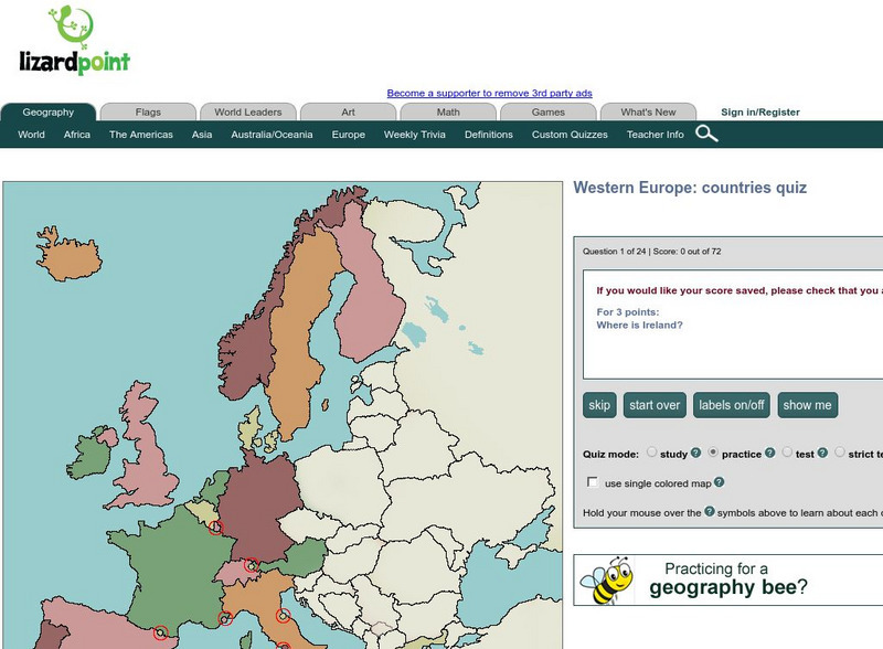
Lizard Point: Western Europe: Countries Quiz
Test your geography knowledge by taking this interactive quiz over the countries of Western Europe.
Made From Media
Made From History: Europe in 1914 First World War Alliances Explained
See actual illustrated maps form the time of World War I. On one side, see the dual alliance between Germany and Austria-Hungary, and on the other, the Triple Entente between France, Russia, and Great Britain.
Science Struck
Science Struck: How Many Countries Are There in Europe?
Presents a map and a list of all the European countries, along with their capitals, land area, population, language, and currency.
Other
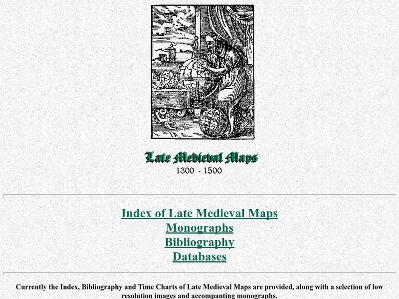
Cartographic Images: Late Medieval Maps 1300 1500
Find some incredible maps of early cartographers. What did they know of the world then? Did they know it was round? Take a look at this site.
Other
Military Analysis Network: Map of Nato Member Nations
Great map of Europe with color coated countries denoting when they joined NATO.
Ancestry
Europe 1820
Although there is no key, the map shows provinces, country boundaries, and the German Confederation boundary of 1820.
Curated OER
Educational Technology Clearinghouse: Maps Etc: Physical Map of Europe, 1916
A physical map of Europe from 1916 showing color-coded elevations and water depths for the area extending from Iceland to the natural boundary between Europe and Asia (Ural Mountains to the Caspian Sea), and the Arctic Circle to the...
Curated OER
Educational Technology Clearinghouse: Maps Etc: Europe, 1898
A map showing Europe in 1898. "Europe is composed of twenty or more independent states or countries, in nearly every one of which the people differ from those of others in language, customs, and standards of living...In Europe [there...
Curated OER
Etc: Maps Etc: Europe During the Glacial Period, Glacial Period
A Map of Europe showing the extent of the ice sheets during the last glacial period, the flow direction of the ice, and the remnant glaciers found in Europe in 1916.
Curated OER
Etc: Maps Etc: Europe After the Treaties of Utrecht and Nystad, 1721
A map of Europe in 1721 after the Treaty of Utrecht ending the War of the Spanish Succession, and the Treaty of Nystad ending the Great Northern War between Sweden and the Russians and Danes. The map shows the northern territories of...
Curated OER
Etc: Maps Etc: Europe After the Congress of Vienna, 1815
A color map of Europe after the Congress of Vienna in 1815, which redrew the continent's political boundaries after the French Revolution, Napoleonic Wars, and the dissolution of the Holy Roman Empire. This map is color-coded to show...
Curated OER
Etc: Maps Etc: Europe at the Beginning of the Modern Era, 1792
A map of Europe in 1792 during the French Revolution and the beginning of the Modern Era. This map is color-coded to distinguish between various countries throughout the continent, including Great Britain, France, United Netherlands,...
Other popular searches
- Blank Maps of Europe
- Outline Maps of Europe
- Geography Maps of Europe
- Maps of Europe 1914
- Maps of Europe Political
- Maps of Europe Ppt
- Maps of Europe Pot
- Maps of Europe 1919
- Europe Maps
- Europe Outline Maps
- Europe Geography Maps
- Western Europe Maps


