Other
The Castles of Wales
This resource includes an index and maps of castles in Wales, plus essays, glossary of castle words, FAQ's, plus other information related to castles.
Other
Stones of Wales
This is an interactive map of Wales, if you click on the major cities, links are provided to give more information.
Other
Stones of Wales
This is an interactive map of Wales, if you click on the major cities, links are provided to give more information.
Other
The Ancient Theatre Archive
Pictoral tour of ancient Greek and Roman theaters. Click on particular countries on the map of Europe to zoom into them. Then click on particular cities for pictures and brief descriptions of theaters within them.
Curated OER
University of Texas: Relief Map of Sweden
This page provides a map of Sweden, identifying major cities, railroads, highways & boundaries. From the Perry Castaneda Collection.
Library of Congress
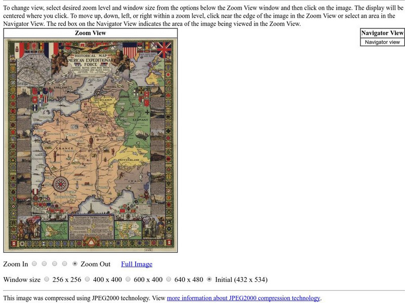
Loc: American Memory: Historical Map American Expeditionary Force
Explore this interesting historical map drawn by Ezra C. Stiles that showed the American Expeditionary Force in Europe during World War I.
Nations Online Project
Nations Online: Austria
Features a country profile of Austria, background details, and numerous links to comprehensive information on the country's culture, history, geography, economy, environment, population, news, government, maps, and much more tourism...
Curated OER
Educational Technology Clearinghouse: Maps Etc: Vegetation in Europe, 1898
A map showing Vegetation in Europe as of 1898. "The great agricultural regions are (1) the northern lowland from the Atlantic eastward through southern Russia, and (2) the broad fertile valleys of the Danube, the Po, the Rhone, and the...
Curated OER
Etc: Maps Etc: Physical Features of Europe, 1901
A map from 1901 of Europe, showing the physical features of the region. This map is color-coded to show general elevations from sea level to over 6,500 feet, mountain systems, drainage divides, lakes, rivers, coastal features, and the...
Curated OER
Educational Technology Clearinghouse: Maps Etc: Fisheries of Europe, 1915
A map from 1915 showing the principal fishing grounds of Europe. The map shows the chief types of fish produced in the areas. The map shows principal cities and ports, railroads, rivers, and coastal features.
Curated OER
Educational Technology Clearinghouse: Maps Etc: Central and Western Europe, 1920
Map of Central and Western Europe after the Treaty of Versailles at the end of WWI. The map includes railroads, canals, major cities and capitals, and the country boundaries established by the Treaties of Versailles, proposed boundaries...
Curated OER
Etc: Maps Etc: Political Boundaries in Europe, 1920
Map of Central and Western Europe after the Treaty of Versailles at the end of WWI. The map includes railroads, canals, shipping routes, major cities and capitals, and the country boundaries established by the Treaties of Versailles,...
Curated OER
Educational Technology Clearinghouse: Maps Etc: Drainage Basins of Europe, 1916
A map showing the Atlantic, Mediterranean, Arctic, and Caspian drainage basins or watersheds of Europe. The map includes major river systems and the bodies of water they flow into.
Curated OER
Educational Technology Clearinghouse: Maps Etc: Coalfields of Europe, 1910
An outline map from 1910 of the principal coal fields of Europe.
Curated OER
Educational Technology Clearinghouse: Maps Etc: Ethnic Groups of Europe, 1916
A 1916 map showing the historic lands held by the various groups of Europe, including the Latin nations (Italy, France, Spain, and Portugal), Teutonic nations of Germany, Netherlands, Scandinavia, and which include the Celts of the...
Curated OER
Educational Technology Clearinghouse: Maps Etc: Cities and Towns of Europe, 1901
A sketch map from 1901 of Europe, showing the distribution of cities and towns in the region at the time. The size of the dots indicate the comparative populations.
Curated OER
Etc: Maps Etc: Density of Population in Europe, 1901
Map showing density of population in Europe.
Curated OER
Etc: Maps Etc: Production of Sugar Beets in Europe, 1916
A map showing the production of sugar beets in Europe in 1916.
Curated OER
Etc: Division of Europe as to War With England, 1778 1782
A map showing the division of Europe as to War with England, 1778 to 1782, including neutral countries, countries hostile to England's Maritime Code, and open enemies of England.
Curated OER
Etc: Europe During the Time of Napoleon I, 1804 1814
Europe, during the Time of Napoleon 1.
Curated OER
Etc: Maps Etc: Western Europe During the Third Inter Glacial Stage, 25,000 Bce
Map of Western Europe, at a time when sea levels were much lower and the British Isles were connected with the mainland. Major river routes are shown extending to the theoretical coastline of the period. According to the authors in 1916,...
Curated OER
Principal Railway and Steamship Routes, Central Europe and Mediterranean, 1910
Map shows principal railways and steamship routes throughout Central Europe and the Mediterranean Sea in 1910. This map also shows major cities and rivers, and uses the Mercator's Projection.
Curated OER
Educational Technology Clearinghouse: Maps Etc: Barred and Safety Zones, 1917
A map of the "barred zones" and "safety lanes" outlined in Germany's 1917 note to the United States regarding neutral shipping to and from Europe.
Curated OER
Educational Technology Clearinghouse: Maps Etc: Grape and Wine Production, 1916
A 1916 map of grape and wine production in Europe.
Other popular searches
- Blank Maps of Europe
- Outline Maps of Europe
- Geography Maps of Europe
- Maps of Europe 1914
- Maps of Europe Political
- Maps of Europe Ppt
- Maps of Europe Pot
- Maps of Europe 1919
- Europe Maps
- Europe Outline Maps
- Europe Geography Maps
- Western Europe Maps


