Curated OER
Signs and Symbols
Sixth graders carefully analyze a triptych of the nativity, paying close attention to the lines, shapes and symbols included in the artwork. They explore the role of the Catholic church in society at the time the piece was created and...
Curated OER
Fate vs. Mind: A Macedonian Folk Tale
Young scholars read examples of folk tales and describe the characteristics of fables and folk tales. They also examine the concept of fate and if it plays a part in people's lives.
Curriculum Corner
Earth Day Book
This Earth Day, celebrate our beautiful planet with an activity book that challenges scholars to show off their map skills, complete a crossword puzzle, write acrostic poems, alphabetize, and reflect on their personal Earth-friendly habits.
Curated OER
Africa Capitals Map Quiz
In this online interactive geography quiz learning exercise, students examine the map that includes 53 African countries. Students match the names of the countries to the appropriate locations.
Curated OER
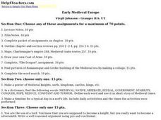
Early Medieval Europe
Students engage in a host of activities during an examination of early Medieval Europe. They draw coats of arms, make collages of architectural designs, and create posters of knights, serfs, and castles. Students role-play as sons of...
Curated OER
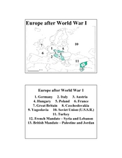
Europe after World War I
In this Europe after World War I map worksheet, students note the 11 regions of the Europe labeled on the map.
Curated OER
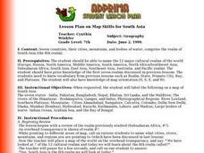
Lesson Plan on Map Skills for South Asia
Seventh graders observe and discuss an overhead transparency map of South Asia. In small groups, they label a blank map of South Asia, and listen to a lecture on the realm.
Delegation of the European Union to the United States
The Founding and Development of the European Union
How did Europe transition from a period of conflict to a period of sustained peace? As class members continue their study of the history and development of the European Union, groups examine the events in six time periods, from the...
Advocates for Human Rights
A Global Perspective on Immigration
To gain a global perspective on immigration, groups investigate and create a map of the migration patterns in Africa, Asia, Europe, Latin America, and the Middle East. Class members then examine the background, immigration history, and...
Curated OER
Introduction to Age of Absolutism
Who were the absolute monarchs of Europe and what effect did they have on their countries? Young historians begin by naming qualities they believe are important for a monarch to possess. They then take notes on four key factors...
Alpha Omega
History and Geography—Two World Wars
Here's a combination textbook/workbook that examines the conditions in Europe that lead to World War I. Ideal for homeschoolers as well as classroom use.
Curated OER
The Ancient Civilization of Mali
Students explore the ancient civilization of Mali and examine various historical and cultural aspects of the civilization. In this ancient civilization of Mali instructional activity, students examine trade with respect to geographic...
University of California
Decolonization
The ripple effect from one small event can impact many others. Young historians research the ripple effect World War II had on decolonization in the second installment of an eight-part series. Through primary and secondary documents as...
Curated OER
Romania
For this blank outline map worksheet, students explore the political boundaries Romania located in Europe. This map may be used in a variety of classroom activities.
Curated OER
Silk Roads Big Map: A Silk Roads Encounters Project
Students are introduced to the Silk Road and its purpose. Using a map outline, they create an oversized replica of the Silk Road from Europe to Asia. They add political and physical features to the map along with the routes of travelers.
Curated OER
Getting To Know Germany
In this getting to know Germany activity, students use map skills (map not included) to answer 14 questions, then draw a map of Germany labeling the capital and major cities.
Curated OER
Transatlantic Travel
Learners design an interactive map with modes of transportation that actually move across the ocean. They construct transatlantic maps of the northern hemisphere and imagine what it would be like to operate various modes of...
Curated OER
EU and Turkey
Should Turkey be admitted to the European Union? Before debating this question, class members research the background and stated purpose of the EU, read articles of Turkey's bid to become a member of the EU, and the concerns other...
EngageNY
Grade 9 ELA Module 4, Unit 1, Lesson 5
What did the Crusades and plantations do with the global sugar spread? As class members continue their study of Sugar Changed the World, they examine how Crusaders brought sugar to Western Europe and how cultivating sugar led to the...
Curated OER
Number the Stars
Students read Number the Stars. In this social studies lesson, students read the story and use a map of western Europe and identify the countries involved in the war. Students locate the cities of Denmark that are discussed in the story.
Curated OER
Mapping the War
Students work in pairs to draw their own maps as specified of World War II areas. When all projects have been completed let one group at a time share their assignments with the rest of the class. Compile all the maps into a classroom...
Curated OER
Claiming Land
Students examine several European maps with conflicting representations of the same geographic region. They uncover why different European nations produced different maps. In addition, they determine the role maps played in helping...
Curated OER
Continents and Oceans
In this geography worksheet, students read a paragraph and learn about the seven continents and five oceans of the world. Students study a map of the world and answer 12 short answer questions. This is an online interactive worksheet.
Curated OER
European Agriculture
Learners make inferences on how physical geography affected the development of early civilizations and come up with solutions to global issues. In this physical geography lesson plan, students compare maps of the past to maps of today to...
Other popular searches
- Blank Maps of Europe
- Outline Maps of Europe
- Geography Maps of Europe
- Maps of Europe 1914
- Maps of Europe Political
- Maps of Europe Ppt
- Maps of Europe Pot
- Maps of Europe 1919
- Europe Maps
- Europe Outline Maps
- Europe Geography Maps
- Western Europe Maps


