Curated OER
The Path of the Black Death
Students analyze maps, firsthand accounts, and archival documents to trace the path and aftermath of the Black Death. Connections between the plague and changes adopted by the ruling class are explored in this lesson.
Curated OER
What They Left Behind: Early Multi-National Influences in the United States
Students examine how the European voyages of discovery influence American culture even today. They map eighteenth century Europe's impact on the United States.
Curated OER
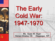
The Early Cold War: 1947-1970
With a combination of images, maps, and valuable information, this presentation is a strong resource for a history class that is coming out of a WWII unit and into a Cold War unit. Some points are outlined for students, while others are...
Curated OER
How Does Your Garden Grow? Discovering How Weather Patterns Affect Natural Cycles
For the warm-up in this cool climate lesson, you will need to click on "Mapping" and then "US Mapping" once you arrive at NOAA's "US Climate at a Glance" page. Earth science explorers realize that 2012 was a warm winter for us. They read...
Curated OER
World War II
Offering a comprehensive overview of the beginning of World War II, this resource could be a useful addition to a unit on this topic. It could be used as a way to lead a discussion on the war, or as a review tool before a test. Either...
Curated OER
What They Left Behind: Early Multi-National Influences in the United States
Learners research the impact of European voyages of discovery and colonial influence on different aspects of American culture. They access a number of online sources and reference maps to trace the influences of England, France, Holland,...
Curated OER
Western Civilizations, Chapter 23: Modern Industry and Mass Politics, 1870-1914
Looking for an interactive way to supplement your western civilization course? Check out this comprehensive website, designed to accompany the Western Civilizations text (although it is valuable independently). Scholars investigate...
National Endowment for the Humanities
Lesson 1: On the Road with Marco Polo: A Boy in 13th Century Venice
Learners investigate Marco Polo's life as a young boy in 13th century Venice. They analyze maps, explore various websites, complete a chart and answer discussion questions, and create a travel brochure about visiting 13th century Venice.
Curated OER
The Age of Early European Explorations & Conquests
Your students' world will literally take shape in this presentation, which chronicles the growing edges of the (flat) earth during European Exploration of New Worlds. Dias, da Gama, Magellean, and Columbus are key players in this game of...
Rice University
U.S. History
How did the discovery of the Americas change the world? A US history textbook covers topics such as the Americas, changes in European society, and the trans-Atlantic slave trade. Young academics also complete the assessment included in...
Curated OER
The Geography of the United States
Full of bright maps and interesting information, this presentation details U.S. Geography. Slides include basic facts about size, regions, topography, and demographics, as well as fascinating trivia about the United States, including...
Student Handouts
Christopher Columbus Workbook
Youngsters gain ample reading comprehension practice while studying the history of Christopher Columbus with this great workbook! It includes word puzzles and comprehension checks of multiple assessment styles, including multiple choice,...
Echoes & Reflections
Antisemitism
Propaganda and anti-semitism were linked to evil ends during the Holocaust. Using video testimony of Holocaust survivors, examples of Nazi propaganda, and discussion questions, learners explore the roots of anti-semitism in Europe and...
Curated OER
The Silk Roads Big Map
Students generate oversized rendition of the Silk Roads from Europe to East Asia, apply elements such as political and topographic features, the Silk Roads, products of the regions, and the routes of key travelers.
Curated OER
Global Lesson: Social Studies On-Line Global Lesson: Social Studies On-Line Continents
In this geography PowerPoint a simple world map on which each continent is represented by a solid green landform is the background for each of the nine slides. The continent names appear in a list on the first slide, followed by one...
Curated OER
Food Detectives
Students investigate the regions in which particular grains are grown. Using the packaging from a variety of foods, grains are identified and the general locations where they are grown are plotted on a map.
Curated OER
Old World and New World - Why Contact Took So Long
Students use a globe to determine why contact between the old world and the new world took a long time. In this map skills lesson, students analyze routes between regions to determine why it took so long for the old world and the new...
Curated OER
The Renaissance, Background
Students are introduced to the Renaissance by viewing a PowerPoint presentation. In this Renaissance lesson plan, students locate the important countries and cities of the Renaissance. Students compare how it was in England from the rest...
Curated OER
European Lakes, Rivers, Bays, and Seas Map Quiz
In this online interactive geography quiz activity, students respond to 12 identification questions regarding European lakes, rivers, bays, and seas.
Curated OER
World Map and Globe - Lesson 15 (K-3)
Students discover mountain ranges and their locations in the world. In this physical map lesson, students locate and identify major mountain ranges of the world on a large physical map.
Curated OER
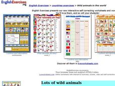
Wild Animals in the World
In this wild animals worksheet, students answer multiple choice map questions, choose the correct animal names for the pictures, and more. Students complete 4 activities.
Curated OER
Religions of the World
In this world religions map worksheet, students note the 12 regions of the world and the religious beliefs practiced by the majority of people in those regions.
Curated OER
Getting to Know My World
Students participate in hands-on activities using maps and globes to identify geographical features. Students use map legends to identify direction. Students locate oceans, continents, countries, states and cities. Handouts and...
Curated OER
Partition of Africa Questions
In this colonial Africa worksheet, students study a map of Africa from 1885-1914. Students then respond to 9 short answer questions based on the information presented in the map.
Other popular searches
- Blank Maps of Europe
- Outline Maps of Europe
- Geography Maps of Europe
- Maps of Europe 1914
- Maps of Europe Political
- Maps of Europe Ppt
- Maps of Europe Pot
- Maps of Europe 1919
- Europe Maps
- Europe Outline Maps
- Europe Geography Maps
- Western Europe Maps


