Curated OER
Continents
Students investigate World Geography by researching the different continents. In this Asian Geography lesson, students discuss the continent of Pangaea and color a worksheet of the continents. Students locate China on the map worksheet...
Curated OER
Babar's Travels
Students read the story The Story of Babar and have a class discussion about his travels, discuss their families, design a map, pick music, and more. In this cross curricular musical lesson plan, students create a music map for each of...
Curated OER
Africa - Not Just One Big Safari
Students draw a picture of an African city that is similar to a U.S. city and discover how other parts of the world have the same types of buildings. In this global similarities instructional activity, students create a map of an ...
Curated OER
Beauty of Maps: Constantinople
For this geography worksheet, students learn the capital cities of European countries. Students match 9 countries to their correct capital city.
Curated OER
Immigration: Creating Change
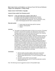
Students explore how immigration has changed the culture of America. After identifying the foods and diets of Europeans and Native cultures, students create a map indicating where foods came from. Students design a restaurant menu,...
Curated OER
European Integration: Who and Why?
This French IV-V lesson addresses European integration into the European Union. French language learners research, discuss, and present in the target language. Online research, discussion, and presentations will take approximately 5-7...
Curated OER
The Brief American Pageant: The Resurgence of Conservatism
Take a short trip back in time with this presentation, which details the political and electoral contexts of 1980's and 1990's America. Covering the Gulf War as well as domestic economics, these slides feature easy-to-read charts and...
Core Knowledge Foundation
Columbus Sailed the Ocean Blue
Young adventurers embark on a journey, setting sail along the blue ocean with Christopher Columbus. Teachers will find that this unit makes their lesson planning smooth sailing!
Curated OER
Exploration Resume Project
Seventh graders take on the role of a European explorer and create a resume, or personal data sheet, listing his achievements in reverse chronological order. They draw and label a map and list what the explorer did to add to Europe's...
Curated OER
Breaking News English: Map Shows Chinese Discovered America
In this English worksheet, students read "Map Shows Chinese Discovered America," and then respond to 47 fill in the blank, 7 short answer, 20 matching, and 8 true or false questions about the selection.
Curated OER
Breaking News English: Map Shows the Chinese Discovered America
In this English worksheet, learners read "Map Shows the Chinese Discovered America," and then respond to 47 fill in the blank, 7 short answer, 20 matching, and 8 true or false questions about the selection.
Curated OER
Charlemagne
Students examine the life and accomplishments of Charlemagne. In this medieval times lesson, students create timelines that feature events of Charlemagne's life. Students record the events as well as Charlemagne's opinion of the events...
Curated OER
Roman Empire: Physical Framework - Location, Borders, Dimensions
Students relate the classical world to the modern world. For this map skills lesson, students turn a blank map into a colorful complete map by following step-by-step directions. This lesson allows students to connect our current...
Curated OER
Civil War Naval Strategy
Learners apply critical thinking skills to war strategy. In this Civil War map instructional activity, students use their knowledge of latitude and longitude as well as scale to respond to questions regarding Civil War battle strategies.
Curated OER
The New Monarchies: 15c - 16c
Use this presentation about the monarchies and powerful figures in 16th century Europe to set the stage for some of history's most influencial events. With maps and photographs to show the spread of power throughout Europe, the slides...
Curated OER
The Wars of Religion (1560s-1648)
Providing the details of different religious wars in 16th - 17th century Europe, this presentation includes pictures and maps to help contextualize these important events. The last slide prompts viewers to answer a question about the...
Curated OER
Western Civilizations, Chapter 9: The High Middle Ages: Religious and Intellectual Developments
If you are looking for a comprehensive guide to western civilizations, explore this online resource! Although designed for use with the Western Civilizations text, this site can be implemented in any course. A chapter quiz challenges...
American Battle Monuments Commission
The Battle of the Atlantic
World War II is known for its land and air battles in Europe, but the waters of the Atlantic saw its share of skirmishes from 1939 to 1945. Learn more about the roles of the Allied powers in establishing ocean territory during World War...
Curated OER
The Brief American Pageant: American in World War II
From the home front to the middle of Europe, America's presence in World War II was forever transitioning with the strain of war. The variety of maps and charts offered in this presentation helps to contextualize the 1940's. The amount...
Curated OER
The Silk Road, An Ancient Internet
Pupils examine how goods and ideas moved along an ancient trade route between China and Europe. They make charts of items, ideas, etc. that were transported along the Silk Route.
Curated OER
Renaissance and Reformation Chapter Test
This is a traditional textbook chapter test on the Renaissance and Reformation, complete with eight multiple choice questions, six fill-in-the-blank, and a 10-question matching section identifying key individuals and terms from the...
Curated OER
A Tale of Two Frogs
Second graders locate Russia on a map or globe and work in pairs to complete the Map worksheet. They read the book, A Tale of Two Frogs stopping after page 15. They write an ending to the story and then read more of the book stopping...
Curated OER
The Congress of Vienna
Established to "undo what Napoleon had done," the Congress of Vienna instituted many changes throughout Europe in the early 19th century - the details of which are included in this presentation. Maps and key decisions are outlined in...
Curated OER
Challenges to the Concert System
A panoramic view of the European revolutions of the 19th century ties these slides together, which feature paintings and maps to illustrate the effects of each revolution. Details and information about the Greek, Belgian, French, and...
Other popular searches
- Blank Maps of Europe
- Outline Maps of Europe
- Geography Maps of Europe
- Maps of Europe 1914
- Maps of Europe Political
- Maps of Europe Ppt
- Maps of Europe Pot
- Maps of Europe 1919
- Europe Maps
- Europe Outline Maps
- Europe Geography Maps
- Western Europe Maps


