Curated OER
Mapmaker, Make Me a Map!
Here is a well-designed, very thorough lesson plan on mapping for very young children. Within the six-page plan, you will find everything you need to implement the activity. They will identify various landforms found in Colorado on a...
Curated OER
Where in the World Is Mexico?
Students practice map-reading skills as they locate Mexico and its cities on a world map. By creating a puzzle out of a map of Mexico, students engage in a meaningful hands-on activity to help them explore that country's geography.
California Academy of Science
Exploring the Impacts of Feeding the World
Approximately 50 percent of people in the world who are chronically hungry work in agriculture. While it seems counter-intuitive, the farther you live from a farm, the more food options are available. Scholars explore concepts related to...
Curated OER
The Desert Alphabet Book
Learners explore world geography by researching a science book with their classmates. In this desert identification lesson, students utilize a U.S. map to locate the geographical locations of deserts. Learners create an oral report based...
Curated OER
Force of Habitat
Plants and animals of the desert are the subject of this instructional activity. While the activities involve an exploration involving Nevada, this resource could be altered for use with any area. This detailed instructional activity...
Curated OER
Places in My World
Second graders explore where they are located on the globe. In this maps and globes lesson, 2nd graders use a map to show where they live and show the cardinal directions. Students identify characteristics of mountains, flat land,...
Curated OER
Deserts Around the World
Second graders explore the deserts around the world. They use a map and locate America on the map. Students discuss and identify the characteristics of deserts and differentiate the meanings of the word desert and dessert. Students...
Curated OER
The Desert Alphabet Book
Students use a book to discover an interesting fact from the desert using each letter of the alphabet. Using a United States map, they identify the meanings of symbols and locate deserts within the U.S. In groups, they participate in...
Curated OER
Opening Doors to Social Studies with Children's Literature: The Desert Alphabet Book
Pupils explore the geography of the United States. In this social studies lesson, students identify the major deserts on a map of the United States.
Curated OER
Kid Maps: Reading and Creating Maps with Human Characteristics
Learners look at maps. In this map instructional activity, students listen to the book My Map Book by Sara Fanelli and they see the difference between human characteristics (buildings, etc.) and natural characteristics (rivers, etc.)....
Curated OER
Leapin' Landmarks: Locating 10 Man-made Landmarks Around the World
Third graders label continents, oceans, and major mountain ranges on maps and use the maps to write an informational report about landmarks. In this landmarks lesson plan, 3rd graders write about 1 major landmark.
Curated OER
Mapmaker, Make Me a Map!
Young scholars are introduced to the state quarter program and examine the Colorado state quarter. They locate Colorado on a map and create a map with a key. They discuss the state motto and examine pictures of the state's geographical...
Curated OER
Where Are the Bugs?
Students trap, collect and identify arthropods in a newly created desert tortoise preserve area over a period of one school year. They determine the rate at which various arthropods take up residence in the newly landscaped area. Data is...
Curated OER
Exploring Hawaiian Mountain Zones
Fourth graders watch a video that describes the climate and vegetation zones of Hawaii. They describe the different physical conditions that create vegetation zones from the sea to the mountains. In groups, they create an illustrated...
Curated OER
Exploring the World's Geography
Students discuss the seven continents of Earth and the diverse geography. After discussion, they create their own paper-mache globes which properly display all seven continents, the equator, and the prime meridian. They conduct research...
Curated OER
Welcome to the Sahara Desert
Students explore their artistic skills. In this Sahara Desert instructional activity, students use the Internet to research the Sahara and paint a watercolor picture depicting the desert.
Curated OER
Exploring the Variety of World Markets
Students examine the various types of world markets and analyze the differences between developed and developing countries. They watch a PowerPoint presentation and take notes, participate in a role-play that demonstrates supply and...
Curated OER
Three Mapping Activities
Students label three maps of China after being introduced to background information about the country. In this geography lesson, students color two maps and label various points of interest in China. Finally, students draw their own...
Curated OER
California Geography
Fourth graders explore geography of four distinct regions of California: mountains, coast, central valley, and desert. They locate California on map, identify state's boundaries and borders, and explore agriculture, a major economic...
Curated OER
Stars and Stripes Forever: Researching Veteran's Day and Historical Events
Sixth graders research Veteran's Day and wars that affected the United States. In this research lesson plan, 6th graders work in small groups to create an oral presentation based on Internet and conventional research. They complete...
Curated OER
Map Your State: Regions of Arizona
Fourth graders define vocabulary and locate physical features on maps. In this mapping lesson plan, 4th graders explore regions of Arizona through landforms found on topographic maps. Students research the history and culture of the...
Curated OER
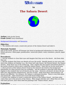
The Sahara Desert
The children will create a watercolor picture of the Sahara Desert and label it.
Curated OER
The Ancient Civilization of Mali
Students explore the ancient civilization of Mali and examine various historical and cultural aspects of the civilization. In this ancient civilization of Mali lesson, students examine trade with respect to geographic locations, discover...
Curated OER
Life in Sahara
Students explore the geography of the Sahara region of Africa and identify characteristics of a desert habitat. They explore the culture of the people living there and how it has adapted to desert life.


