Curated OER
Add and Subtract with Hudson River shipping
Rivers aren't just a place for animals to live, they also provide industrial transportation. The class will examine the Hudson River on a map, discuss all the commercial vessels that use the River to transport materials, then complete a...
Curated OER
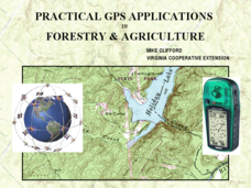
Practical GPS Applications in Forestry & Agriculture
An explanation of the Global Positioning System (GPS) and the Geographic Information System (GIS) is given in this presentation. Uses and applications are considered. How it works and sources of error are also touched upon. A large...
Curated OER
Measurement
First graders participate in various activities dealing with measurement, length, volume, and temperature. They identify the need for standard units of measure, sort and classify objects, measure distances, and use a thermometer.
Curated OER
World Projections
Students identify map projections and examine polar maps. In this map skills lesson, students use a flat world map to identify various projections and calculate the distances between locations by using a map scale.
Curated OER
Measuring Distance and Area in Satellite Images (College Level)
Students are able to download, install, and use Image J image analysis software to quantify change over time in satellite images. They access and download satellite images for specific locations and times. Students set a scale (spatial...
Curated OER
Playground Mapping
Students review their physical models of the objects on their playground at school. Using the model, they convert it into a map with a scale and key. To end the lesson, they use the map to locate different objects and measure the...
Illustrative Mathematics
Placing a Fire Hydrant
Triangle centers and the segments that create them easily become an exercise in memorization, without the help of engaging applications like this lesson. Here the class investigates the measure of center that is equidistant to the three...
Mr. E. Science
Introduction to Earth Science
From the layers of Earth's spheres to latitude and longitude to looking at topographic maps, learners discover the elements of Earth's systems.
PHET
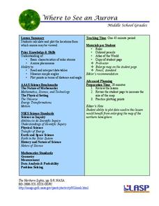
Where to See an Aurora
Where can you see an aurora in North America? After completing an astronomy activity, scholars can locate the exact coordinates. Pupils plot points of the inner and outer ring of the auroral oval and answer questions based on...
Kenan Fellows
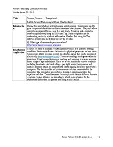
Sensors, Sensors…..Everywhere! Middle School Meteorologist Create Weather Bots!
My forecast is that you'll want to use the resource. Pupils design and create a weather bot as part of a project-based unit. These bots should be able to measure temperature, humidity, barometric pressure, wind speed and direction, and...
Mathematics Assessment Project
College and Career Readiness Mathematics Test C1
Challenge high schoolers with a thorough math resource. The 20-page test incorporates questions from upper-level high school math in applied and higher order questions.
Chicago Botanic Garden
Seed Dispersal and Plant Migration
There are five methods of seed dispersal. They include gravity, mechanical, animal, water, and air. Scholars study seed dispersal in lesson five of the series of six. Through discussions, hands-on analysis of different seed types, and...
Curated OER
Using Kilometers
In this measuring in kilometers activity, students choose 6 distances and measure each one in kilometers and choose 6 objects to measure in millimeters.
Curated OER
Follow That Ship!
Students in this exercise are introduced to the distinct ways of measuring distance (nautical miles) and speed (knots) at sea, as well as the concepts of latitude and longitude for establishing location.
Curated OER
Getting to the Core of World and State Geography
Students create topography relief maps. In this geography skills lesson, students review geography core knowledge skills, design and make a state relief map, and compile a student atlas.
Curated OER
Ridgerunner
Learners jog at the beginning of the class while learning about the Appalachian Trail. They integrate math into the lesson by adding up how many miles they have run, and comparing it to distances on a real trail map.
Curated OER
Where Is Japan? How Far Is That?
First graders use literature and hands-on activities with maps and globes to explain distance and tools used to measure distance. They select tools to measure various objects in the classroom, then apply those concepts to their map...
Curated OER
Plan a Cruise Lesson Plan
Students measure distances and report them in fractions, convert fractions to decimals, and multiply decimals.
Curated OER
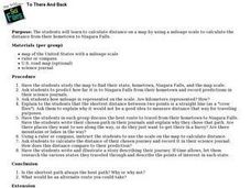
To There And Back
Students calculate distance on a map by using a mileage scale to calculate the distance from their hometown to Niagara Falls. They, in groups, determine the best route, then compose stories about their journey to Niagra Falls.
Curated OER
MAPPING THE SCHOOL FOREST
Students measure distances and directions using paces and a compass. They determine their own pace, explore how to read a compass bearing, and how to take bearings on given sites.
Curated OER
Tour De Texas
Students are given a budget and an alternative-fuel vehicle. Using a map of Texas, they are given a starting point and determine how to arrive at their destination within 72 hours. They use the internet to research the alternative fuel...
Curated OER
Cattle Trails
Students identify and locate cattle trails on a globe. In this map skill lesson, students use a marker to locate Texas and Montana and use the map scale to calculate the distance of the cattle trail.
Curated OER
Globe Skills Lesson 7 The Transcontinental Railroad
Learners explore the Transcontinental Railroad. In this geography skills lesson, students use map skills in order to locate legs of the Transcontinental Railroad on globes.
Curated OER
Measure Up!
Students examine parallax and angular measurements. In this investigative lesson students calculate distances of objects and map their results.


