Curated OER
Diversity Geography
Students research another country and its people. In this diversity instructional activity, students work in groups to research an assigned country and develop a short oral report. Students use diversity beans to represent the people...
Curated OER
Temperature and Daily Life: Mexico City and Indianapolis
Students compare the effect of temperature on daily life of a citizen in Mexico City, Mexico with that of a citizen of Indianapolis, Indiana.
Curated OER
Why is there Pollution in Mexico City?
Learners explore the causes of air pollution in Mexico City from a holistic approach.
Curated OER
Geography: How do Louisiana Rice Farmers Help the Environment after they Harvest Rice?
Third graders study maps of the United States locating Louisiana, the East Coastal Plain, the Mississippi Alluvial Plain, the West Gulf Coastal Plain, and five of the main rivers. In this geography instructional activity, 3rd graders...
Curated OER
Where is Mesoamerica?
Young scholars create a map of Mesoamerica using construction paper, clay or by drawing it. In this World Geography lesson, students determine the location of Mesoamerica, make a map, then present their map to their class.
Curated OER
Instruments From Around the World
How much does the environment affect how and what man creates? Children explore the effect of the environment on primitive man as they research raw materials from a specific location. They use their findings to write a short essay about...
Curated OER
If…Then…Ideas for History
Have your class examine a very old piece of art as they consider history, chronology, geography, culture, and tradition. They discuss the concept of ritual as it is associated with religious practices and research the spread of...
Curated OER
Carnavals and Colonialization
Ninth graders compare and contrast different Carnavals throughout Latin America. For this Latin American lesson, 9th graders study the geography and colonial history of Latin America.
Curated OER
Max Knows Mexicao, United States and Canada
Learners utilize their map skills to explore the regions of North America. They explore the physical characteristics and climates of the regions. Students label their map and prepare a presentation of their findings.
Curated OER
Hypoxia and the Dead Zone in the Gulf of Mexico
Young scholars investigate the causes of hypoxia, the characteristics of a watershed, and how the actions and management practices of people can both negatively and positively affect aquatic ecosystems.
Curated OER
History/Geography
Students review North America, Africa, Europe and Asia. They identify Australia as the smallest continent. They identify Australia as an island continent nicknamed "the land down under." They color a map of Australia.
National Museum of the American Indian
The A:Shiwi (Zuni) People: A Study in Environment, Adaptation, and Agricultural Practices
Discover the connection of native peoples to their natural world, including cultural and agricultural practices, by studying the Zuni people of the American Southwest. This instructional activity includes examining a poster's...
Teacher.org
Christmas Around the World Part 1
A creative lesson shines a spotlight on Christmas celebrations throughout six different countries. Scholars read an informative text and share their new-found knowledge with their peers. After hearing about each country, pupils choose...
National Endowment for the Humanities
La Familia
Young scholars identify at least one country where the Spanish language is spoken, describe similarities and differences between Spanish, Mexican, and Puerto Rican families, and practice speaking the Spanish words for several family...
Scholastic
Perfect Postcards: California
It's time to hear about some adventures in travel! The Transcontinental Railroad changed life and travel in the United States during the 1800s. Practicing online research skills, pupils discover the features they would like to visit on...
Curated OER
LESSON PLANS
Second graders encounter how the native and Spanish cultures influenced art on Colonial New Mexico. They experience some of the games, art and tools of colonial New Mexico. Students strive to increase new vocabulary. They also access how...
Curated OER
A Tough Nut to Crack
Children, based on a set of criteria, evaluate the quality of pecans. They research recorded history of pecan trees as well as how their seeds moved across western Missouri into southeastern Kansas, Oklahoma, Texas and Mexico. In...
Curated OER
Understanding Mayan Culture
Students study an ancient culture in Mexico whose people were called the Mayans. They compare certain aspects of Mayan culture with Ancient Egypt. They discuss why some other ancient cultures (Egypt and China) were able to survive for...
Curated OER
What Happens When Sea Level Rises or Falls
Students examine the impact of sea level on land formations. In this geography and map lesson, students construct a contour map model illustrating how much of the clay "coastline" is covered as water is added. Metric measurement is...
Curated OER
How to Clean Up An Oil Spill
Students practice cleaning up an oil spill. In this good citizenship lesson, students experiment with different cleaning agents to see which ones clean oil off a soft toy. They compare this experiment with the volunteers helping with the...
Curated OER
Pop Around the World
Students study the origin of popcorn. They locate countries where it is grown on a world map. They color the world map and glue kernels of popcorn onto the countries from which popcorn originated. They write the names of common items...
Curated OER
Tornado Alley-- Night of the Twisters
In this science and geography worksheet, learners read 2 pages of background information about Tornado Alley which may help them understand Night of the Twisters by Ivy Ruckman.
Curated OER
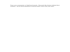
Murals: Historic Walls
Young scholars examine Mexican history in murals. In this visual arts lesson, students research the artistic style of Mexican murals and the artists that create them. Young scholars then present their research findings to their...
Curated OER
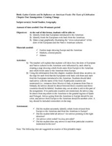
Immigration: Creating Change
Students explore how immigration has changed the culture of America. After identifying the foods and diets of Europeans and Native cultures, students create a map indicating where foods came from. Students design a restaurant menu,...
Other popular searches
- New Mexico Geography
- Geography of Mexico
- Mexico Geography Map
- Geography Mexico
- Cultural Geography of Mexico
- The Geography of Mexico
- Physical Geography of Mexico
- Teaching Geography of Mexico
- Making Physical Maps Mexico


