Curated OER
Topographic Maps Worksheet
In this geography skills worksheet, students respond to 37 multi-part questions that require them to read and interpret topographic maps.
Curated OER
Florida: U.S. Geography for Kids
In this Florida geography worksheet, students locate and label the important features of Florida and create icons for the economy and culture of Florida.
Curated OER
Oaxaca Geography and the Climate
Students examine the diverse geography of the country of Mexico and the state of Oaxaca. They analyze how the geography of the state of Oaxaca affects its climate and create maps showing the different climate areas.
Curated OER
Mexico
Third graders become culturally aware of the differences all over the world. They explore a different culture, and recognize and appreciate the similarities and differences with their own.
Curated OER
Call to Arms: A Service Project
Sick of selling candy and washing cars? How about hosting a Digital Day or a Learning Lunch? The suggestions here make fund raising fun and rewarding. Raise money to preserve important maps and other primary source documents.
Curated OER
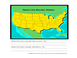
Capitals, Oceans, And Border States
Students investigate geography by completing games with classmates. In this United States of America lesson, students examine a map of North America and identify the borders of Mexico and Canada as well as the Pacific and Atlantic....
Curated OER
Where in the Latitude Are You? A Longitude Here.
Students distinguish between latitude and longitude on the map. In this mapping lesson, students participate in mapping skills to recognize spatial relationships, and where to find natural resources on the map. Students create their own...
Curated OER
Border to Border
Students use the Internet to gather information on the country of Mexico. They also discover the culture of their people and compare them with the United States population. They take a virtual tour of some of Mexico's most historical ruins.
Curated OER
Celebrate Hanukkah in Israel
Explore Hanukkah and its origins with a social studies lesson. Learners discover the history of Hanukkah and its traditions. They locate Israel on a map, hear the story of the menorah and create their own dreidel. Afterwards, they sing...
Curated OER
Name the States Worksheet 1
For this name the states worksheet, students examine 6 state map outlines and identify each of them by writing the state names and postal abbreviations.
Curated OER
Dark Days on the Prairie
Young scholars explore U.S. geography by researching agriculture. In this dust bowl lesson, students complete a cause and effect worksheet based upon the dust bowls that covered a large portion of Oklahoma and Texas in the early 1900's....
Curated OER
A Visit to Mexico City: An Introduction to World Communities
Third graders complete a variety of activities as they take an imaginary trip to Mexico City, complete with passports, maps, and Spanish dictionaries. They write postcards to send home and create items to sell at the market. The unit...
University of New Mexico
New Mexico Land of Enchantment
Third graders research Native American Cultures surrounding New Mexico. They analyze the history and geography of the state. They play a guessing game that incorporates the indigenous plants and animals of New Mexico. In groups, learners...
Curated OER
Mapping the Border
Learners create maps of the borderland region. They decorate their maps with colors, pictures, icons, scenes, words that reflect their understanding of the character and history of the borderland.
Curated OER
Mexico: A Look At Its Culture and Geography
Students canvass the Mexican geography, culture, dress, language, crafts, and traditions in this unit of eight lessons. The Mexican Independance Day is compared to our own and the contributions of the Mayan, Azetec, and Spanish are...
Curated OER
Temperature and Daily Life: Mexico City and Indianapolis
Students compare the effect of temperature on daily life of a citizen in Mexico City, Mexico with that of a citizen of Indianapolis, Indiana.
Curated OER
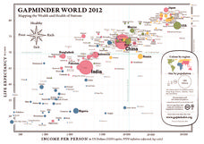
Gapminder World 2012
Here is a very interesting infographic that compares the average life expectancies, per capita incomes, and population sizes of every country in the world in 2012.
Curated OER
Foods and Languages of the World
Students review Mexico's location and language and learn to pronouns 10 new Spanish food words. Students listen as the book, Corn is Maize is read, touching and passing around an ear of Indian corn. Students discuss the contribution of...
Curated OER
Geography of the United States
Students examine the population growth of the United States. In this Geography lesson, students construct a map of the fifty states. Students create a graph of the population of the USA.
Curated OER
Immigration: Creating Change
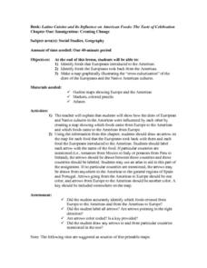
Students explore how immigration has changed the culture of America. After identifying the foods and diets of Europeans and Native cultures, students create a map indicating where foods came from. Students design a restaurant menu,...
Curated OER
Identifying Border States of the U.S.
In this identifying border states of the U.S. worksheet, 3rd graders visually identify then write the names of the states that border Canada and Mexico; page 1 is a lesson, page 2 is the worksheet.
Curated OER
Globe Skills Lesson 1 Some Early American Cultures
Young scholars apply their knowledge of geography. In this geography skills lesson, students read brief selections regarding early Americans. Young scholars respond to the questions included in the self-guided map skills lesson.
Curated OER
Globe Lesson 4 - Intermediate Directions
Pupils explore the concept of intermediate directions. In this geography skills lesson, students use map skills in order to identify intermediate directions as they complete a map activity.
Curated OER
Developing Cultural Awareness through Mexican Folktales
Learners explore the culture of Mexico through folktales. They identify cultural differences and similarities through the reading of folktales. Students create pocket books related to Mexican folklore. They read and discuss literary...


