iCivics
County Basics
To understand the concept of a county government system, scholars read a short passage, view a helpful visual aid, use the web to conduct some research about their local areas, and then answer related questions online.
West Contra Costa Unified School District
The Power of Ten: Building a Magnitude Model
Add visual representation to teaching place value with a magnitude model. Using adding machine tape, pupils build a linear place value strip from 1 to 100.
Curated OER
Unit 2: Global to Local: Understanding My Place in the Hydrosphere
What does the ground around your home have to do with water pollution? Young ecologists learn about their local watershed and create their own cause-and-effect models of the hydrosphere.
Kentucky Educational Television
The Road to Proportional Reasoning
Just how big would it really be? Young mathematicians determine if different toys are proportional and if their scale is accurate. They solve problems relating scale along with volume and surface area using manipulatives. The...
Curated OER
Customized Topographic Maps and Models
Students explore the information depicted on topographic maps. They construct a 3-D topographic map of a local area. They go on a field trip to the depicted area and compare the 'real world' with their models.
NOAA
It All Runs Downhill
Examine how pollution makes its way into an ocean with help from a model watershed. Scholars use household items to recreate a mini-watershed, equipped with pollutants, that when mixed with rain drain into a model's body of...
Curated OER
A Model for Natural Selection- Spaghetti Worms
Does the early bird really get the worm? If so, which color of worm does it prefer? In an exciting and easy week-long field investigation, young field biologists set up a one square meter feeding area for birds. If you have a webcam,...
National Wildlife Federation
Danger from Afar: Non-Point Source Pollution and the Lake Superior Basin
How prevalent is pollution in the water system? A hands-on activity focuses on one area that is prone to pollution. Learners use game chips to represent clean water and polluted water and complete an activity that demonstrates how...
Curated OER
Role Models
Third graders create posters of heroes and present their findings and what they think it means to be a hero. In this role models lesson plan, 3rd graders compare heroes and describe their characteristics.
BBC
Local Democracy
Expanding our students' understanding of government at a local level is a great way to build an understanding of government at a global level. Start the understanding by using any of these fun teaching ideas. Learners engage in several...
Curated OER
The Trapping of Trapezoids
This is a nice hands-on activity where young geometers create trapezoids and calculate their area by looking at areas of quadrilaterals and triangles.
Teach Engineering
Air Pollution in the Pacific Northwest
Scholars investigate levels of nitrogen dioxide in the Pacific Northwest by examining the role of nitrogen in air pollution and how remote sensing can be used to measure nitrogen levels. An Excel spreadsheet calculates the difference...
Maryland Department of Education
The Concept of Diversity in World Literature Lesson 3: Igbo Culture
What cultural concepts must readers understand in order to connect to Things Fall Apart? As part of their study of Chinua Achebe’s novel, class members research Nigeria and the Igbo culture to create a collaborative, web-based,...
Channel Islands Film
Natural Resources, and Human Uses of Plants and Animals
As part of their study of the restoration projects on Santa Cruz Island, class members demonstrate their understanding of the connections among plant life, animals, and the actions of humans by crafting a model that reveals these...
Newspaper Association of America
Community Connections with Geography and the Newspaper
Understanding geography and government begins at the local level. Using maps and the parts of a newspaper, a unit plan introduces the concept of community. It starts with the creation of classroom and school maps, and then moves through...
College Board
1999 AP® Environmental Science Free-Response Questions
Pollution is a real concern in most areas of Earth. A four-question AP® assessment has learners analyze data related to water pollution and air pollution as well as consider the pros and cons of recycling. Each question has several...
Curated OER
Guide to Communicating
Teacher, project managers, or those in a vocational training program will understand how to communicate effectively. Work place communication, listening techniques, and communication models are discussed in a resource is specific to...
National Nanotechnology Infrastructure Network
Introduction to Nanotechnology Using the Creative Problem-Solving Model
Should we continue to spend money on nanotechnology? Groups engage in a problem-solving unique process around the newly emerging research field of nanotechnology. In order to propose a solution, the groups must research nanotechnology...
Bowland
Speed Cameras
Do speed cameras help reduce accidents? Scholars investigate this question using a series of spreadsheet activities. Along the way, they learn about randomness, probability, and statistical analysis.
Science 4 Inquiry
Deforestation
Young scientists observe deforestation from satellite photos and discuss the importance of forests to the global environment. They then simulate a plot of forest when farmers move into the area over the course of seven years. Finally,...
Illustrative Mathematics
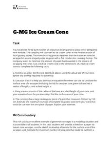
Ice Cream Cone
Every pupil with a sweet tooth will be clamoring for this lab and analysis, particularly when they're allowed to eat the results! Volume and surface area formulas for cones are developed from models, and then extended to the printing of...
Curated OER
Floodplain Modeling
Students simulate the impact of fluctuating river volumes on structures and landforms. They experiment with table top-sized riverbed models and water. Students consider how human design can help mitigate the effects of a flood.
Curated OER
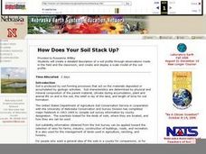
How Does Your Soil Stack Up?
Students examine the soil in their local area and create a soil profile. They record observations in the field and the classroom. They create their own display of the soil profile as well.
It's About Time
Plate Boundaries and Plate Interactions
How does the Earth continually repair itself? Explore the answer to this question, and others, with a unit on plate boundaries and interaction. Pupils classify the types of movement at plate boundaries and identify the...


