CK-12 Foundation
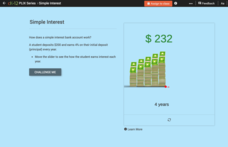
Simple Interest
Mathematicians manipulate a mountain of money to solve six questions about simple interest. Question types include several multiple-choice and one discussion.
Curated OER
A Poem for Nature
Students imagine what it would be like to enter a landscape painting and then write a poem on nature.
Curated OER
Big Blue Sky- Based on the Montana Quarter Reverse
Students use a Montana quarter to help describe geographical features such as landforms and bodies of water. Students read an article about Montana as a group and discuss examples of landforms and bodies of water. After reading,...
Curated OER
3-D Topographic Maps
Students create a 3-D topographic map. In this map building instructional activity, students use cardboard to create a topographic map of the Catskills mountain region.
Curated OER
Bhutan, the Last Shangri-La: Sandwich Squash: How the Himalayas Were Formed
Students create and record a model of mountain formation. They identify major mountain building formations. Students understand how the Himalaya Mountains were formed, why they are located near Bhutan, and why they are becoming larger.
Curated OER
Sculptured Landscapes
Students research glaciers, how they are formed and what kind of landforms they carve out of the rock they pass over. They organize their findings into a mock newscast in a presentation for the class.
Curated OER
The Earth's Landscape#156
Students define a word from the natural disaster list, find a location in the world where this type of disaster has occurred and discuss what they have identified. They design a crossword puzzle of natural disaster words or check a...
Curated OER
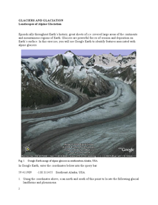
Landscapes of Alpine Glaciation
In this glaciers worksheet, students use Google Earth to look for examples of different glacial landforms and phenomena. Students complete 2 short answer questions.
Curated OER
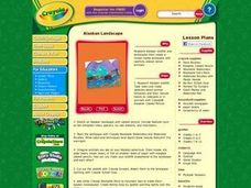
Alaskan Adventure
Students research Alaskan wildlife and landscapes. They create a mixed media landscape with carefully placed native animals and make sketches about animal behaviors and their natural habits on note cards or in journals. The include...
Curated OER
Landscape Picture Map: Natural Features
Students discover six landscapes. In this natural features lesson, students review the meaning and examples of natural features. Students use a landscape picture map to identify six natural features.
Curated OER
"Potato Mountain": Reading/Understanding Topographic Maps
Students investigate how to read topographic maps. For this map reading lesson students complete a topographic map activity.
Curated OER
Book: Germany
Students, after reading Chapter One in the book, "Germany," analyze and recreate the political boundaries as well as the physical features of the nation of Germany with the assistance of play-doh or salt dough. In groups, they create...
Curated OER
Boom and Bust in the Ozark Forests
Here is a hard-hitting, cross-curricular lesson plan on the effects that the deforestation of the Ozark forests in the 19th century had on the people, animals, and ecosystems of the area. The Dr. Seuss book The Lorax is used as a way of...
PBS
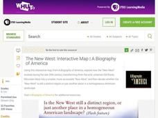
The New West: Interactive Map | A Biography of America
Using this interactive map activity, from A Biography of America, explore how the "New West" evolved during the late 20th century, transforming from the wild, untamed Old Rocky Mountain West into a smaller, more accessible "New West."...
Montana State University
Ice in Action
Make your own bite-size glacier! A resource teaches about the formation and melting of ice. Activities include videos, a hands-on activity where your pupils build glaciers, and a photographic analysis to teach individuals the chilling...
K-State Research and Extensions
The Crusty Earth
Geology rocks — literally! A geology chapter offers eleven activities at four different levels. Scholars enjoy completing hands-on experiments before applying critical thinking skills following a share, process, generalize, apply,...
Curated OER
Painting Without A Paintbrush
Students sketch a landscape scene and paint that scene using unconventional "paintbrushes" including forks, knives, squirt bottles, cotton swabs, toothpicks, water containers, and mat board.
Curated OER
Glaciers Worksheet #2
A map of the Hudson River Valley is exhibited here. Arrows representing glacial striations are spread across the map for learners to analyze. They answer five multiple choice questions in response. The worksheet is a compact review of...
Curated OER
The Landscape of Poland
Students recognize and re-create the political boundaries and physical features of the nation of Poland. They create three dimensional topographic maps of Poland. In addition, they compose two journal entries written in two different...
Rainforest Alliance
Knowing the Essential Elements of a Habitat
To gain insight into the many different types of habitats, individuals must first get to know their own. Here, scholars explore their school environment, draw a map, compare and contrast their surroundings to larger ones. They then...
K12 Reader
What Glaciers Leave Behind
Glaciers may seem distant and stationary, but they are huge deposits of moving ice that have made changes to the earth's surface. Your pupils can learn about the different types of impressions left by glaciers by reading the short...
Rainforest Alliance
How Do Jaguars and Howler Monkeys in Belize Depend on Us?
How does weather play a role in the lives of land and sea creatures? Find out with a lesson plan focused on habitats and the ways animals from different homes are connected. Here, learners explore how the life of a jaguar and...
Rainforest Alliance
Protecting the Critical Habitat of the Manatee and Loggerhead Turtle
Explore ocean habitats with a lesson that showcases the home of manatees and loggerhead turtles in Belize. Here, pupils compare and contrast the homes of ocean animals to those of humans, listen to an original short story about...
CK-12 Foundation
Topographic and Geologic Maps: Topographic Maps
Maps are great for helping you get where you're going, but what does that place actually look like? Geology scholars compare and contrast the features of topographical and geologic maps using an interactive lesson. The resource describes...


