Curated OER
Paul Gauguin Art: Opposite Colour Masterpieces
Learners discover new art techniques by examining the work of Paul Gauguin and his use of opposite colors. In this art analysis lesson, students investigate the different perspectives and colors used in classic post impressionist...
Curated OER
Mystery State #8
For this mystery state worksheet, students answer five clues to identify the state in question. They then locate that state on a map.
Curated OER
Don't Water....Shed A Tear#145
Learners examine the definition and attributes of tributaries and watersheds. They design a landscape which includes a mountain, a river, a lake and other appropriate items. They observe as the teacher pours water through the landscape...
Curated OER
Body and Mindscapes
Third graders view artwork by Robert Harris of landscapes and mountains. Using a map, they locate and identify the physical features of the Canadian province they live in. In groups, they use one of his paintings and add music to...
Curated OER
Cooperative Group Lesson Plan
Learners work together to develop a city landscape using various symbols. Using the various elements, they justify the placement of each symbol and discover the importance of location and accessibility. They present their landscape to...
Curated OER
Creative Writing and Analysis
Students read and analyze poems by Li Po and Wang Wei. They answer discussion questions, identify the elements of the poems, examine and discuss Chinese landscape paintings, write an original poem, and write a comparison/contrast essay.
Curated OER
The Profound Simplicity Of Scrolls
Students create art scrolls in the Chinese style using individual examples of landscape pictures and poetry in this lesson for the middle-level Language Arts, Social Studies, or Art classroom.
Curated OER
Getting to Know "Our Environment"
In this environment instructional activity, students access a website to describe the landscape, climate, forests, and animals in British Columbia. This instructional activity has 3 matching and 5 short answer questions.
Curated OER
Making a Region Map of a State
Fourth graders create salt maps of a state and indicate its regions. They include topographical elements including mountains, valleys, lowlands and major water bodies and a compass rose.
Curated OER
Musical Plates
Sixth graders engage in a study of the plates and how they are part of the formation of the ever changing landscape of planet earth. They access web sites that have applications for observation and conducting different activities. The...
Curated OER
Trade along the Silk Roads
Students explore the Silk Road. In this Asian history and culture lesson, students read a book about the silk Road, then create pictures of the products and landscapes found along the Silk Road.
Curated OER
Gilbert Munger Lesson Plan Ideas
Students read the biography of Gilbert Munger and analyze art that reflects the beauty of nature. In this art analysis instructional activity, students view a realistic image of Salt Lake City and lake over 100 years ago.
Curated OER
Field Trip to San Bruno
Students contrast a weedy annual grassland of introduced species with an undisturbed, ancient plant community of native bunchgrasses and wildflowers.
Curated OER
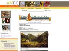
Taming the Frontier
Students examine paintings by Thomas Cole and Jasper Francis Cropsey as windows into American frontier life. They consider the pioneer's relationship with nature and the role of Native Americans in the pioneer's lives and settlements.
DiscoverE
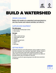
Build a Watershed
What's the best way to learn how watersheds work? Build one! Combining engineering, the water cycle, and ecology concerns, the activity is the perfect fit for an interdisciplinary unit. Teams construct a model watershed with simple...
Curated OER
Identifying and Using Parallelism and Balance in Literature
Analyze the use of balanced sentences and parallelism in a narrative. Included in this resource is a narrative about serving as a Peace Corps volunteer in Kazakhstan titled, "The Train Ride Home". Middle and high schoolers review...
Curated OER
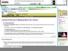
Lesson 2 Activity 2: Mapping Mount St. Helens
Students use topographic map skills to interpret impact of the May 18, 1980 eruption of Mount St. Helens on the volcano's topography, and draw profile views of Mount St. Helens before and after the May 18, 1980, eruption.
Curated OER
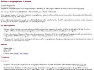
Mapping Mount St. Helens
Students study topographic maps and contour lines and construct a simple three-dimensional model of Mount St. Helens before the May 18, 1980, eruption. They use topographic map skills to interpret the impact of the May 18, 1980, eruption...
Curated OER
Sentence Fragments
As middle and high schoolers experiment with their writing styles, it's easy to slip in a few accidental sentence fragments. After reading a full-page of information regarding how to identify and avoid sentence fragments, learners...
Indian Land Tenure Foundation
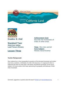
More Tribal Homelands
Here is a very fun idea that introduces young learners to how geographical location affects cultural development. They are introduced to four areas where Native Americans have lived in the past by reading stories and examining images....
Calvin Crest Outdoor School
Survival
Equip young campers with important survival knowledge with a set of engaging lessons. Teammates work together to complete three outdoor activities, which include building a shelter, starting a campfire, and finding directions in the...
National Geographic
Mapping the Shape of Everest
With Mount Everest as the motivator, your earth science class learns about topographic maps. Begin by showing a film clip from The Wildest Dream: Conquest of Everest, featuring fearsome virtual imagery of a path up world's tallest...
Channel Islands Film
Island Rotation: Lesson Plan 1
How do scientists provide evidence to support the theories they put forth? What clues do they put together to create these theories? After watching West of the West's documentary Island Rotation class members engage in a series of...
Stanford University
Ansel Adams at Manzanar
Analyzing photos from Ansel Adams of Manzanar—a camp where the American government imprisoned thousands of Japanese-Americans during World War II—individuals consider what images have to say about this period in American history....


