Curated OER
Central America Outline Map
In this Central American political map learning exercise, students make note of national boundaries and capitals in this region of the world. National capital city locations are noted with stars.
Curated OER
Central America Outline Map - Labelled
In this Central American political map worksheet, students make note of national boundaries and capitals in this region of the world. National capital city locations are noted with stars.
Curated OER
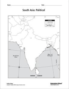
South Asia: Political Map
In this South Asia political map worksheet, students examine the national boundaries. The map also highlights each country's capital city.
Curated OER
Central America Map
In this Central American political map worksheet, students make note of national boundaries and capitals in this region of the world.
Curated OER
North America Map
In this North America political map activity, students examine the labeled countries and their respective national boundaries.
Curated OER
North America: Unlabelled Map
In this North America political map instructional activity, students examine the unlabelled countries and their respective national boundaries.
Curated OER
Afghanistan & Pakistan Map
In this Afghanistan and Pakistan political map worksheet, students examine the national boundaries as well as major cities in each of the countries.
Curated OER
European Country Map
In this Europe political map worksheet, students examine the national boundaries. The country names are labeled on the map.
Curated OER
Reshaping the Nation
Students learn why the census makes a difference. In this U.S. Census lesson plan, students learn how to read and use a cartogram while they explore new ways to represent data.
Alabama Learning Exchange
Action at Plate Boundaries
Students diagram the spreading of the ocean floor. In this earth science lesson plan, students read an article on plate boundaries of the ocean. Students are expected to diagram the oceanic convergent boundary, and...
Curated OER
Water Density Boundaries
Students create observable layers in water that represent a separation based upon density differences. They model density boundaries using differences in temperature and salinity. They, in groups, perform a meaningful experiment...
Curated OER
Asia and the South Pacific: Political Map
In this Asia and the South Pacific map worksheet, students examine national political boundaries and national capitals in this region of the world.
Curated OER
Europe Outline Map (Labled)
In this blank outline map instructional activity, learners study the political boundaries of the labeled European nations.
Curated OER
Drawing The Line
Pupils explore how arbitrary borders affect communities by participating in two hands-on activities and by reading about and discussing a community divided by national borders. They investigate the borders of their own neighborhoods.
DocsTeach
Nixon Visits China: The Week that Changed the World
Sometimes one trip shakes up the entire world. When President Richard Nixon traveled to China, he defied international and political boundaries. Nixon was the first American president to visit mainland China, which was a communist nation...
Curated OER
AFGHANISTAN IN RUINS
Students explore the meaning of the term global interdependence, why rich countries help poorer countries, and match types of international aid to their scenarios.
NOAA
Plate Tectonics I
Young geologists get a glimpse beneath the earth's surface in this plate tectonics investigation. After first learning about the different layers of the earth and the constant movement of its plates, young...
National Wildlife Federation
Quantifying Land Changes Over Time Using Landsat
"Humans have become a geologic agent comparable to erosion and [volcanic] eruptions ..." Paul J. Crutzen, a Nobel Prize-winning atmospheric chemist. Using Landsat imagery, scholars create a grid showing land use type, such as urban,...
The New York Times
Crossing the Line Online: Sexual Harassment and Violence in the Age of Social Media - NYTimes.com
Sexual harassment and sexual violence are by no means new issues. What has changed is the role of social media in these issues. This powerful and troubling lesson uses a specific rape case to launch research into a discussion of the...
Curated OER
Castolon Historic District
Students complete a variety of activities that go along with the study of and possible fieldtrip to the Castolon Historic District in Big Bend National Park, TX.
Curated OER
Book: Spain
Learners, after reading Chapter One in the book, "Spain," design and re-create the political boundaries as well as the physical features of nation of Spain. They utilize play-doh or salt dough to illustrate and create their three...
Curated OER
Analyzing Hurricanes Using Web and Desktop GIS
Students analyze hurricanes. In hurricanes lesson, students use the Internet and GIS to analyze hurricanes. Students view the National Atlas of Maps to discuss the direction hurricanes move. Students study the wind and pressure fields to...
Curated OER
American Indians of the Local Region
Students describe the American Indian nations in their local region long ago and in recent past. They research religious beliefs, customs, and various folklore traditions.
Curated OER
No Magic Borders: Haleakala Style
Young scholars discuss borders and boundaries. They discuss pollution and the fact that boundaries cannot stop pollution and that pollution affects even protected wildlife and plants. They participate in an activity in which they must...


