Curated OER
Educational Technology Clearinghouse: Maps Etc: North America, 1903
A map from 1903 of North America. The focus of this map is the Dominions of Canada, showing the transportation network in from Montreal east to Quebec and Nova Scotia, and west to Vancouver, British Columbia. The map shows the...
Curated OER
Educational Technology Clearinghouse: Maps Etc: North America, 1858
A map from 1858 of North America showing the boundaries at the time for Russian America (Alaska), Greenland, British America or New Britain, Canada East and Canada West, the United States, Mexico, Central America, and the West Indies...
Curated OER
Educational Technology Clearinghouse: Maps Etc: North America, 1800
A map of North America and Central America showing territorial claims and possessions in 1800. The map is color-coded to show the territories of the United States, British, Spanish, French, and Russians, and indicates areas of disputed...
Curated OER
Educational Technology Clearinghouse: Maps Etc: Drawing North America, 1872
A map exercise from 1872 for drawing North America. The map shows the general outline of the coasts, major waters and rivers, and a vertical profile cross-section of the continent from the San Francisco Bay area to Cape Hatteras....
Curated OER
Educational Technology Clearinghouse: Maps Etc: North American Colonies, 1783
A map of eastern North America in 1783 at the end of the American Revolutionary War, showing the territory of the newly formed United States as proposed by the Treaty of Paris, the Canadian border extending to the Ohio River proposed by...
Curated OER
Etc: Maps Etc: Orographical Map of North America, 1911
A map from 1911 of North America, Central America, Greenland, and the Caribbean showing mountain systems (orographical), highlands, plains, and major rivers of the region. The map uses colot-contouring to show general land elevations...
Curated OER
Etc: N America Illustrating the Conquest of Canada and War of Indep, 1757 1783
A map of eastern North America illustrating the Conquest of Canada and the War of Independence (1757-1783). The map shows major cities of the time, major river ways, topography and political boundaries. The map is color-coded to show the...
Curated OER
Unesco: Canada: Gros Morne National Park
Situated on the west coast of the island of Newfoundland, the park provides a rare example of the process of continental drift, where deep ocean crust and the rocks of the earth's mantle lie exposed. More recent glacial action has...
Curated OER
Unesco: Canada: L'anse Aux Meadows National Historic Site
At the tip of the Great Northern Peninsula of the island of Newfoundland, the remains of an 11th-century Viking settlement are evidence of the first European presence in North America. The excavated remains of wood-framed peat-turf...
Curated OER
Educational Technology Clearinghouse: Clip Art Etc: Captain James Cook
A British explorer who made detailed maps of Newfoundland before he achieved the first European contact with the eastern coastline of Australia and the Hawaiian Islands.
Curated OER
Educational Technology Clearinghouse: Clip Art Etc: Giovanni Da Verrazzano
Giovanni da Verrazzano (c. 1485 - c. 1528) was an Italian explorer of North America, in the service of the French crown. He is renowned as the first European to explore the Atlantic coast of North America between South Carolina and...
Curated OER
Educational Technology Clearinghouse: Clip Art Etc: Jacques Cartier
Jacques Cartier, voyager of St. Malo, coasted along the north of Newfoundland in 1534 and passed through the Straits of Belle Ilse into the water now known as St. Lawrence Gulf, and into the mouth of the St. Lawrence River. Erecting a...
Curated OER
Educational Technology Clearinghouse: Clip Art Etc: Sebastian Cabot
An explorer born in Venice. He traveled to Newfoundland and America.
Library of Congress
Loc: Portuguese Exploration Along the Northeast Coast of North America
This site, which is provided for by the Library of Congress, gives a history of the Portuguese explorations of North America. The information is fairly brief, but factual, and worth checking out on the subject.
Open Door Team
Open Door Web Site: The Struggle Between France and Britain for North America
Although France and England were fighting in Europe, wars spilled over into North America too before the French and Indian Wars.
Other
The Norse Settlers in the New World
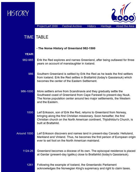
Features a time line of the events of the Viking voyages to Canada. Identifies different events that occurred during this time period of early Viking exploration.
Canis Major Publications
Dog Owner's Guide: Breed Profiles
Articles about many different dog breeds. Each gives an in-depth look at its characteristics, temperament and such. Great resource!
New Advent
Catholic Encyclopedia: George Calvert
This article describes George Calvert's life and attempt to find land where Catholics could settle. Please note that ?The Catholic Encyclopedia? is a historic reference source and should be viewed in the context of resource material...
Other
Titanic
An archive of articles about the Titanic including pictures and a timeline showing events leading up to the creation of the Titanic.
Curated OER
Photograph: Prime Minister St. Laurent, Speaking at Welcoming Ceremonies.
The National Library and Archives of Canada has a website dedicated to each province's road to Confederation in Canada. This section on New Foundland begins years before their eventual inclusion in 1949, but does include a section on...
Other popular searches
- Newfoundland Regiment
- Geography Newfoundland
- Exploration and Newfoundland
- Newfoundland and Labrador
- Newfoundland Fish
- History Culture Newfoundland
- Newfoundland Resettlement
- Newfoundland Dogs
- Newfoundland Smallwood
- Newfoundland Small Wood
- Newfoundland Exploits River


