Curated OER
"Egypt, Gift of Nile"
Sixth graders are introduced to the basics of ancient Egypt focusing on the Nile River and the necessity of the river. The students work in small groups and
become "experts" on the given topic and then present the information that
was...
Curated OER
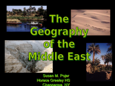
The Geography of the Middle East
Topographic, political, and satellite maps establish the world of the Middle East for your class- a land about which they have heard quite a lot, but might not really understand. This presentation would be a good introduction into a unit...
Curated OER
Africa: Its People And Places
Students plan a pretend trip to the African continent choosing from several prominent places such as the Nile Delta, Mount Kilimanjaro or the Sahara Desert . In small groups, they form transportation, accommodation, packing, itinerary...
Tutankhamun
Pharaohs, Pyramids and the World of the Gods
Your young historians will learn all about the pharaohs, pyramids, and gods of ancient Egypt with these informational text worksheets, each of which are accompanied by hands-on, follow-up activities.
K12 Reader
The Mississippi River
After examining a short passage about the Mississippi River system, readers use the provided graphic organizer to identify the main idea and supporting ideas in the article.
Curated OER
Map of Egypt
In this map of Egypt activity, students label the cities, bodies of water, surrounding countries and color the map according to the directions.
Curated OER
Archaeology: Quiz 46
In this archeology worksheet, students complete multiple choice questions about King Tut, Howard Carter, and more. Students complete 4 questions total.
Curated OER
Rivers Quiz 3
In this rivers worksheet, students answer short answer questions about famous rivers around the world. Students complete 10 short answer questions.
Curated OER
Ancient Egypt
In this ancient Egypt worksheet, 6th graders use maps in chapter 5 of a Houghton Mifflin text to label items on an outline map and answer a set of 10 related questions.
Curated OER
Ancient Civilizations
In this social studies worksheet, 3rd graders find the words that are related to different civilizations and the answers are found at the bottom of the page.
Curated OER
Let's Go on a Hunt
Students search for specific color food items. In this color review lesson, students search for hidden food items of a specific color inside the classroom.
Andre Dollinger
Reshafim: The Nile
Along with a map of the Nile, read about settlements in the area and the importance of the Nile and its flooding to the ancient Egyptians. Follow hyperlinks to additional information.
Mocomi & Anibrain Digital Technologies
Mocomi: Nile River Facts and History
Learn the history, location, and other interesting facts about the Nile River.
Curated OER
Educational Technology Clearinghouse: Maps Etc: Delta of the Nile, 1916
A map from 1916 of the Nile Delta, showing the water courses of the delta, the Pyramids, Cairo, Alexandria, Rosetta, Damietta, and Port Said and Suez at the openings of the Suez Canal.
Curated OER
Educational Technology Clearinghouse: Maps Etc: Egypt and the Nile Valley, 1920
A map of Egypt and the Nile Valley from the delta south to the confluence of the Sobat River and the Upper Nile. This map shows Egypt Proper, Nubia, Kordofan, Sudan, Eritrea, and portions of Abyssinia and British Somalia. The map also...
Curated OER
Science Kids: Science Images: Nile River Delta
This is an amazing satellite image of the Nile River Delta as seen from orbit. Located in North East Africa, the Nile River is largely agreed to be the longest river in the world, reaching 6650 kilometres (4132 miles) in length. For more...
The British Museum
British Museum: Ancient Egypt
A comprehensive site on Ancient Egypt, including sections on the lifestyle, geography, religion, and politics of the country.
Travel Document Systems
Tds: Egypt: Economy
Find out what the Egyptian government is doing to jump-start its economy. Although based on agriculture, see how the economy is branching out into other sectors to provide jobs for millions of Egyptians. Information is from the U.S....
Curated OER
Educational Technology Clearinghouse: Maps Etc: Egypt and Syria, 1912
A map of Egypt showing the major cities of the Nile Delta and the Nile River south to Assouan at the First Cataract in Upper Egypt.
Curated OER
Educational Technology Clearinghouse: Maps Etc: Africa, 1919
A map from 1919 of Africa showing the territorial changes made after World War I. The map shows the areas ceded by Germany, including Togo and Kamerun to be decided by British and French mandate, German East Africa under British mandate,...
Curated OER
Educational Technology Clearinghouse: Maps Etc: Colonial Africa, 1902
A map of Africa in 1902 showing the European colonial possessions established at the Berlin Conference in 1885, and the Turkish or Ottoman possession of Tripoli. This map shows major cities, rivers, and mountain systems, canals and head...
Curated OER
Educational Technology Clearinghouse: Maps Etc: Colonial Africa, 1899
Map of Africa in 1899 showing the colonial possessions of European powers on the continent established at the Berlin Conference of 1885. This map shows major cities and trade centers, railroad routes and canals, major river systems, and...
Curated OER
Educational Technology Clearinghouse: Maps Etc: Pre Colonial Africa, 1858
Map of Africa in 1858, prior to the extensive European colonization of the continent established at the Berlin Conference of 1885. This map shows the European possessions of the Cape Colony, Natal, and Orange River Free State, and the...
Curated OER
Etc: Maps Etc: Political and Physical Africa, 1901
A map from 1901 of the political and physical features of Africa. The map uses color-contouring to show highlands above 2000 feet in buff tints, lowlands in greens, and the submerged part of the continental plateau in light blue. The map...


