Curated OER
Three Young Pilgrims
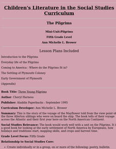
Fifth graders study the story of the voyage of the Mayflower told from the view point of the three Allerton siblings who were on board the ship. The book tells of their voyage across the Atlantic and their first year here on the North...
Curated OER
Why Not Come to North Amercia?
Students examine the motives for French expansion into the New World, they evaluate primary source documents to determine who, what, when, where and why.
Curated OER
Seed Selection for Genetic Variation
Students will research the origin of corn, analyze factors that contribute to shorter and longer growing seasons, and use the scientific method to answer the question: Did seed selection contribute to the successful movement of corn from...
Curated OER
Pennsylvania Watersheds
Students identify the major watersheds of Pennsylvania. In this forestry lesson plan, students learn what a watershed is and are assigned one of the major watersheds of Pennsylvania. Groups then need to determine the boundaries of...
Curated OER
Using Venn Diagrams to Compare Two Ecosystems
Students explore the distribution of two ecosystems on a global scale; and map the distribution of tropical and temperate rain forests throughout the world. They use a Venn Diagram to describe these ecosystems and the differences between...
Curated OER
Book: Latinos Today: Facts and Figures
Students, after reading Chapter 1 in the book, "Latinos Today: Facts and Figures," identify and characterize the four main ethnic/racial groups in America. They calculate and design a bar graph showing their populations by their...
Curated OER
Continents Lesson
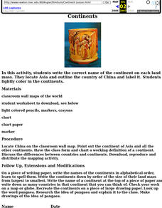
Fourth graders write the correct name of the continent on each land mass. They locate Asia and outline the country of China and label it. They lightly color in the continents.
Curated OER
A Brief History of Vietnam (1858-2004) and Its Evolving Communist System
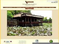
High schoolers examine the French colonization of Vietnam, the Vietnam War, and the current evolving Communist system. They develop political maps, outline the major events of the Vietnam War, write an essay, and compare/contrast...
Curated OER
Jack-O-Latern Lesson
Have a Happy Halloween and build strong oral language skills. Special needs Pupils functioning at a moderate level can practice sequencing, writing lists, and using oral language by explaining how they carve a pumpkin.
Curated OER
Indian Women in Texas History
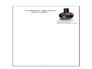
Fourth graders study Indian women in Texas. In this US history instructional activity, 4th graders discuss what each Indian woman's contribution was by completing a timeline and table. Students examine the Caddo Women's...
Curated OER
Drake’s West Indian Voyage 1588-1589
Learners examine the exploration routes of Sir Francis Drake. In this American exploration lesson, students investigate primary sources to trace the routes and contact with the natives that Sir Francis Drake experienced on his voyages in...
Curated OER
Canada's Geographic Position
Ninth graders investigate the characteristics of the geographic position of Quebec and Canada in the World. They study Canada's land and water boundaries, surface area and time zones.
Curated OER
Aboriginal Societies of Canada
Fourth graders study Aboriginal Societies in Canada and do an oral presentation to the class.
Curated OER
Native Indian Culture: Plains Indians in Montana
Students examine the culture of the Plains Indians. In this Montana history lesson plan, students view a PowerPoint presentation regarding the social, religious, and traditional life of the Plains Indians.
Curated OER
The Age of Exploration
Young scholars apply computer skills to gain further insight into early exploration. They analyze the role of each explorer and evaluate their importance. Students comprehend the Chronology of Discovery and Trade of early explorers. ...
Curated OER
Trading Faces
Students use addition to determine values of coin combinations. They play a game where they come up with possible trades: two nickels for a dime and complete a tally worksheet. There are other lessons in this unit.
Curated OER
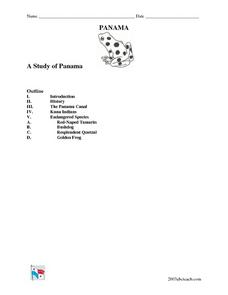
A Study of Panama
In this learning exercise on Panama, students read an introduction about Panama, then read about its history, The Panama Canal, the Kuna Indians and the Endangered Species of Panama. After each selection, students answer a set of related...
Curated OER
Mural Mania
Students create a mural that displays symbols for their home state. They complete worksheets and read a book about their state. They collect images of the state flower, tree and bird for the mural. There are 5 other lesson plans included...
Curated OER
Educational Technology Clearinghouse: Maps Etc: Drawing North America, 1872
A map exercise from 1872 for drawing North America. The map shows the general outline of the coasts, major waters and rivers, and a vertical profile cross-section of the continent from the San Francisco Bay area to Cape Hatteras....
Curated OER
Etc: Maps Etc: Production of Coal in North America, 1913
"Production of coal in North America in 1913 and approximate outlines [in red] of coal fields other than lignite.
Science Education Resource Center at Carleton College
Serc: Mapping the Glaciers
In this activity, students will use Minnesota Geological Survey 3-D maps of the upper Midwest to trace the outlines of where they believe glaciers may have affected North America. They will identify landforms that resulted from glacial...
Curated OER
Educational Technology Clearinghouse: Maps Etc: North America, 1901
A map from 1901 of North America, Central America, the Caribbean, and Greenland (Danish America) showing the political boundaries at the time. The map shows capitals and major cities, mountain systems, lakes, rivers, coastal features,...
Curated OER
Educational Technology Clearinghouse: Maps Etc: North America, 1899
A map from 1899 of North America, Central America, and the Caribbean showing national boundaries, capitals and major cities, terrain, lakes, rivers, and coastal features. The map shows longitude from Greenwich at the top of the map, and...
Curated OER
Educational Technology Clearinghouse: Maps Etc: North America, 1901
A map from 1901 of North America, Central America, the Caribbean, and Greenland showing general land elevations, mountain systems, rivers, coastal features, and ocean currents. The map is color-coded to show land elevations ranging from...


