Library of Congress
Loc: Southern Mosaic
This site, from the Library of Congress, provides a recording project by the WPA during the Depression Era of folk music collected throughout the southern states of the U.S. Supplemented by photos and other material to document life...
Other
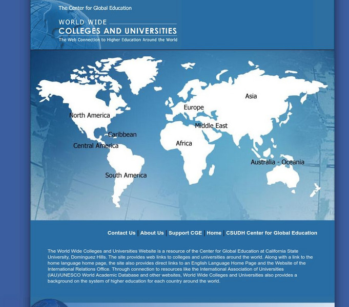
Usc Center for Global Education: World Wide Colleges
This comprehensive site provides links to universities around the world and explanation of the educational systems and standards of some of the countries. Links to many of the web sites are in the native language.
Library of Congress
Loc: 1492: An Ongoing Voyage
An exhibit by the Library of Congress supplies diverse facts on the famous 1492 voyage. The exhibition first examines the encounter between the European explorers and the native people. They explore five geographical areas: The Caribbean...
PBS
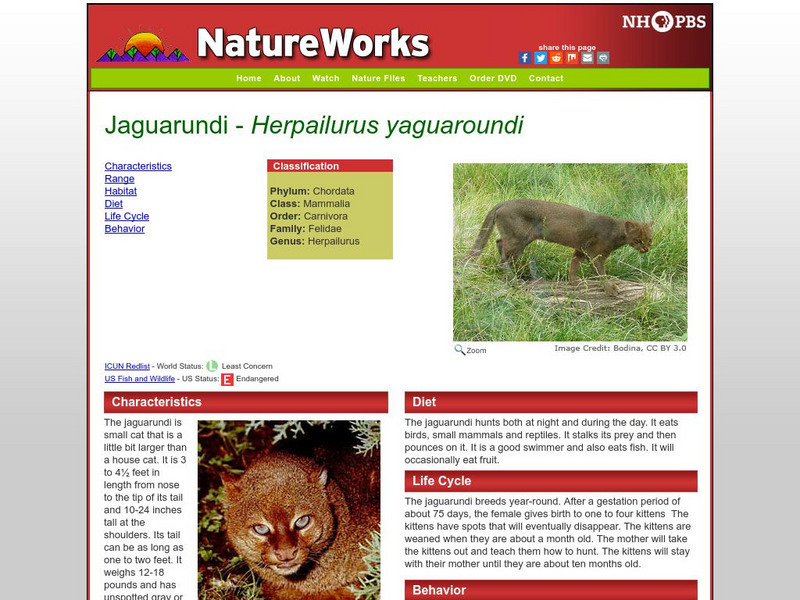
Nh Pbs: Nature Works: Jaguarundi
Learn more about the Jaguarundi through the exploration of this resource. The content of this site includes information on behavior, characteristics, life cycle, diet, range and habitat.
The Washington Post
The Washington Post: World
The Washington Post, an internationally renowned newspaper published in Washington D.C., provides the latest news from around the globe. Content includes international headline news, in-depth reports, various editorials, as well as...
Other
National Underground Railroad Freedom Center
The National Underground Railroad Freedom Center features the history of slavery in the United States, from the gallant actions of those who organized the Underground Railroad to stories of those who escaped to freedom. Strategically...
The History Cat
The History Cat: Us History: Election of 1860: Lincoln Elected
Looks at the election of Abraham Lincoln in 1860, and the divisions between North and South that resulted. Shortly after the election, a group of Southern states seceded and formed the Confederate States of America. The animosity between...
Art Institute of Chicago
Art Institute of Chicago: Art Access: Walter Ellison: Train Station
Information and analysis about a painting by Walter Ellison, Train Station, held in the collections of the Art Institute of Chicago. It is a visual document of the Great Migration, a period in U.S. history when large numbers of African...
Siteseen
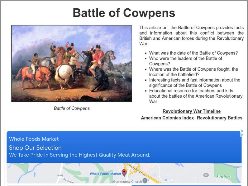
Siteseen: Land of the Brave: Battle of Cowpens
Learn about this Revolutionary War battle that took place January 17, 1781, between Great Britain and its thirteen colonies in North America that ended in a long-term victory for the American colonists.
Other
University of Delaware: Plate Tectonics
This site is a very simple overview of plate tectonics. It includes a map of all the major plates and a diagram of the layers of the earth.
Other
Flags of the World: Index to Flags of the World
Contains a link to the flag of every country in the world. Each contains a picture of the flag and helpful supplemental information. Use for easy research on the flags of the world.
Curated OER
Educational Technology Clearinghouse: Maps Etc: New Hampshire, 1903
A map from 1903 of New Hampshire showing the capital of Concord, counties and county seats, principal cities and towns, railroads, rivers, and mountain ranges. "New Hampshire, one of the New England States of the American Union, lies...
Curated OER
Educational Technology Clearinghouse: Maps Etc: Civil War, 1861 1865
A series of maps showing important campaigns and regions of the American Civil War (1861-1865). The maps show important cities and towns, railroads and campaign routes, terrain and coastal features, and rivers. The maps include (1)...
Curated OER
Unesco: Canada: Rideau Canal
The Rideau Canal, a monumental early 19th-century construction covering 202 km of the Rideau and Cataraqui rivers from Ottawa south to Kingston Harbour on Lake Ontario, was built primarily for strategic military purposes at a time when...
Curated OER
Unesco: Canada: Head Smashed in Buffalo Jump
In south-west Alberta, the remains of marked trails and an aboriginal camp, and a tumulus where vast quantities of buffalo (American Bison) skeletons can still be found, are evidence of a custom practised by aboriginal peoples of the...
Curated OER
Etc: Development of Early Carolina, 1663 1732
A map showing the development of the Carolinas from the land grant of Charles II in 1663 to the establishment of the Province of Georgia by charter in 1732. The map shows the area of Carolina as established by the Patent of 1665...
Curated OER
Etc: Seat of War in the Southern States, 1775 1781
A map of parts of Virginia, North Carolina, South Carolina, and Georgia showing the seat of war in the southern states during the American Revolution. The map shows the routes of Cornwallis from Savannah to Augusta, Charleston, Guilford...
Curated OER
Etc: The Revolution in Southern States, 1774 1783
A map of America's southern states during the time of the American Revolution, including North Carolina, South Carolina, and Georgia. The map shows major cities, towns, forts, battle sites, mountain systems, rivers, and coastal features...
Curated OER
Educational Technology Clearinghouse: Maps Etc: Nebraska, 1903
A map from 1903 of Nebraska showing county borders, cities and towns, rivers, and railroads. This map also shows the rock types in the state. "Nebraska, a central State of the American Union, lies between 40 degrees and 43 degrees N....
Curated OER
Etc: Maps Etc: The Theatre of Georgia and Carolinas Campaigns, 1861 1865
A map of the parts of Virginia, Tennessee, North Carolina, South Carolina and Georgia involved in the Georgia and the Carolinas campaigns of the American Civil War. The map shows major cities, towns, and ports, railroads, mountain...
Curated OER
Etc: Maps Etc: Mexico, Central America, and the West Indies, 1898
A map from 1898 of Mexico, Central America and the West Indies. The map includes an inset map of Cuba and the Isthmus of Nicaragua. "The surface of the Rocky Mountain highland in Mexico is quite similar to that of the great plateau...
Curated OER
Etc: The Alaskan Boundary Dispute, 1825 1903
A map of the northern Pacific coastland of North America showing the territorial dispute of the Alaska boundary from the Anglo-Russian Treaty of St. Petersburg in 1825 that established the British claims, the purchase of the area by the...
Curated OER
Educational Technology Clearinghouse: Maps Etc: Hay Herbert Treaty, 1903
A map of the southern border of Alaska and Canada showing the area of boundary dispute and the boundary established by the Hay-Herbert Treaty between Britain and the United States in 1903. The map shows the coastline and fjords of the...
Curated OER
Educational Technology Clearinghouse: Maps Etc: Oregon Controversy, 1792 1846
A map of the Oregon Territory between the time of exploration by George Vancouver (1792) and the Oregon Treaty of 1846. The map is color-coded to show the disputed claims of the British and United States, the Russian American line of...


