Curated OER
Three Regions of North Carolina
Fourth graders investigate the three regions of North Carolina using works of art.
Curated OER
Craft Revival: Shaping Western North Carolina Past and Present
Learners gain an understanding of a resident's lifestyle of North Carolina. They analyze five objects the are representation of the culture of North Carolina. Critical thinking skills are used to describe the geography through using the...
Curated OER
North Carolina Salt Dough Map Social Studies Project
In this lesson, North Carolina Salt Dough Map, 4th graders create a salt dough map of North Carolina, Students use dough to form the shape of the state of North Carolina. Students label the three regions of North Carolina and all of...
Curated OER
North Carolina Test Chapter 1
In this social studies worksheet, students match the North Carolina term with the definition in the right-side of the page for the eight questions. The answers are found by clicking the bottom of the page.
Curated OER
North Carolina
In this North Carolina activity, students read about the early history of North Carolina and answer true and false questions about it. Students answer 10 true and false questions.
Curated OER
A Different Point of View
Fourth graders imagine what North Carolina looks like from the air. Looking at a map, they list the different kinds of views we might find, (i.e., beach, mountains, cities, farms, etc.) then attempt to draw their own version of a map.
Curated OER
South Carolina Jeopardy
One of the better PowerPoints I've come across is a "Jeopardy"-style game whose focus is South Carolina. Some excellent photographs and maps make the slides especially good. The "Final Jeopardy" clue is especially challenging. An...
Curated OER
Ozark Folk Culture and Geography in the Mountain View, Arkansas Area
Upper grade through early high schoolers develop an understanding of Ozark culture, and the geography of the Ozark Plateau. They study place, location, human environmental impacts, and movement. This interesting plan incorporates muic,...
Curated OER
North Carolina Textured Landscape
Fourth graders explore the artistic ideas of landscape, foreground, middle ground, and background through a creative painting project. While this is written for North Carolina, teacher may adapt for any state/region.
Curated OER
South Carolina Responds
Learners examine and explain the events that lead up to the Revolutionary War. For this Revolutionary War lesson, students summarize and evaluate several of the major battles that defined the Revolutionary War.and major battles involving...
Curated OER
Day 1: IDP Introduction
Fourth graders locate the three regions of North Carolina (Coastal
Plains, Piedmont, and Mountain Region) and differentiate between the regions on a physical and cultural level. They identify a region based on characteristics through a...
Curated OER
IDP Introduction
Fourth graders examine the three regions of North Carolina through class discussion of favorite places in the state and a review game based on the game of twister. The different colors on the twister sheet represent the different...
K5 Learning
Moving On
Read about Daniel Boone and his early years in a new land in Yadkin County, North Carolina. After reading, pupils respond to four comprehension questions that address the how and the why.
Curated OER
North Carolina Place Names
Fourth graders examine a map of North Carolina to discover the heritage left behind in the names of various places. They compare/contrast those derived from Native American culture to those derived from European settlers.
Curated OER
Acid Rain Research
Students collect samples of rainfall, cloud condensation, and water that trickles through the soil. These samples are tested for pH, conductivity, and the presence of sulfates, nitrates, calcium, and magnesium.
Curated OER
The Debate Over North Shore Road
Students examine the impact of the North Shore Road Project in North Carolina. In this environmental science activity, students share their views regarding this environmental issue. They compare and contrast the map of the Great Smoky...
Carolina K-12
Affrilachia
What makes a culture unique? Learners research life in the Appalachia region of the United States. Poetry, music, and oral history create Affrilachia, the term used to describe the lifestyle of the area. African-American mountain culture...
Curated OER
Social Studies: Underground Railroad
Students role-play as escaped slaves making their way from North Carolina to Canada, stopping in Indiana. They track their journeys on maps and include a stop at Harriet Tubman's. Students write three paragraphs about how Tubman aids...
Curated OER
A Look At Rocks
Students write letters to organizations, such as United States Geological Society, to find out more about rocks. Students write about a pretend time they found a magic pebble. Students calculate distances to travel to see various...
Curated OER
Candy Bar Subsurface Geology
Students are introduced to drawing and interpreting topographical maps. They each cut through there Jell-o mountain at regular height intervals, and trace around the shape of the Jell-o cut off at the height, overlaying the different...
Curated OER
Communications: To the Rescue!
Students role-play as soldiers rescuing lost mountain climbers. Working in teams, they interpret maps to locate the climbers and use flashlights to send and receive coded messages about the rescue. Their goal is to complete the task in...
Curated OER
Dialect Awareness in Literature and Life
Eighth graders realize the impact of dialect in literature as well as their own speaking and writing by reading selections from Frances O'Roark Dowell's novel, Dovey Cove.
Book Units Teacher
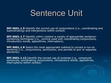
Sentence Unit
Imagine using history to teach grammar. This 178-slide PowerPoint presents an amazing collection of images and historical information about the settlement of Tennessee and about famous residents like Daniel Boone. Viewers...
Jamestown-Yorktown Foundation
How Did Relations between Britain and the Colonies Change after the French and Indian War?
What does the French and Indian War have to do with the American Revolution? Following the war, Britain issued the Proclamation of 1763 in an attempt to limit the colonists' western expansion. To understand how the proclamation, the...


