Curated OER
The Age of Exploration
Students apply computer skills to gain further insight into early exploration. They analyze the role of each explorer and evaluate their importance. Students comprehend the Chronology of Discovery and Trade of early explorers. They...
Curated OER
Drake’s West Indian Voyage 1588-1589
Young scholars examine the exploration routes of Sir Francis Drake. In this American exploration lesson, students investigate primary sources to trace the routes and contact with the natives that Sir Francis Drake experienced on his...
Curated OER
The July Crisis: Can You Stop the Great War?
Students role-play as diplomats from countries involved in World War I who have received telegrams stating they must prepare presentations on their country's position about the war. They have 45 minutes to reach a peace accord, or they...
Curated OER
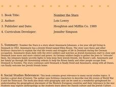
Number The Stars
Students read a book about prejudices that occur in our daily lives. They describe characters in the book. Students discuss real life events of World War II and the Holocaust. Students simulate hiding Jews from the German soldiers. ...
Curated OER
I'm Dreaming of a Sustainable Christmas
Learners examine global trade. In this global economics lesson, students visit websites to learn about trade with China and the environmental damage of global trade.
Curated OER
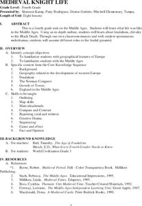
Medieval Knight Life
Students research the Middle Ages. In this Middle Ages lesson, students complete lessons about feudalism, life on a manor, chivalry and knighthood, an activity about the Battle of Hastings, the growth of Middle Age towns, the trial by...
Curated OER
The Mausoleum at Halicarnassus
Students explore an ancient wonder of the world. In this Mausoleum at Halicarnassus lesson, students read about the history of the Mausoleum, create Mausoleum timelines, and research the sculptors whose work is featured in the Mausoleum.
Curated OER
The Art of the Byzantine Empire
Eighth graders describe, analyze, and evaluate the history of the Byzantine Empire and Russia from about 300 to 1000 A.D. They emphasis the preservation of Greek and Roman traditions. Students analyze the Byzantine art and architecture.
Curated OER
Letters from Rifka
Students read Karen Hesse's book "Letters from Rifka" and explore how it presents the experiences of a Russian immigrant to America. They research and write reports on the experiences of various immigrants from different cultures, keep...
Curated OER
The New Californians
Students identify the groups of immigrants who came to California. They trace the route they possibly took to American on a world map. They discuss the reasons why they left their homeland and what challenges they faced once they arrived.
Cool Math
Coolmath: Coolmath Games: Map Snap: Europe
You are presented with an outline map of Europe and you must place each country in its correct position. It clicks into place if you're in the right spot. You may want to start with the practice mode which has the shape outlines of the...
Curated OER
Educational Technology Clearinghouse: Maps Etc: Outline Map of Europe, 5,000 Bce
An outline map of Europe at a time when sea levels were lower than present, with Iceland, the British Isles and Scandinavian Peninsula a part of the mainland, and the Mediterranean, not connected to the Atlantic Ocean, split into two...
Curated OER
Educational Technology Clearinghouse: Maps Etc: Europe, 1810
A colored outline map of Europe in 1810, when Napoleon was at the height of his power. The map shows the European countries that were controlled by France, allied with France, or independent of France. Territories are numbered and...
Curated OER
Educational Technology Clearinghouse: Maps Etc: Europe, 1815
A colored outline map of Europe in 1815, after the Congress of Vienna. Territories are numbered and referenced on the map.
Curated OER
Educational Technology Clearinghouse: Maps Etc: Europe, 1796
A colored outline map of Europe in 1796 just after the French Revolution and the Division of Poland. Territories are numbered and referenced on the map.
Curated OER
Educational Technology Clearinghouse: Maps Etc: Europe, 1540
A colored outline map of Europe as it was in 1540, including the Holy Roman Empire, Lands of the Habsburgs, the Kingdom of the Two Sicilies, the Duchy of Milan, the Lands of the German Knights of Livonia, and several other powers of the...
Curated OER
Educational Technology Clearinghouse: Maps Etc: Europe, 1901
A map from 1901 of Europe, showing the political boundaries at the time, capitals and other major cities, mountain and terrain features, lakes, rivers ,islands, and coastal features of the region. The physical division between Europe and...
Curated OER
Etc: Maps Etc: Physical Features of Europe, 1901
A map from 1901 of Europe, showing the physical features of the region. This map is color-coded to show general elevations from sea level to over 6,500 feet, mountain systems, drainage divides, lakes, rivers, coastal features, and the...
Curated OER
Educational Technology Clearinghouse: Maps Etc: Coalfields of Europe, 1910
An outline map from 1910 of the principal coal fields of Europe.
Curated OER
Educational Technology Clearinghouse: Maps Etc: Pre Colonial Africa, 1872
A map of Africa showing the continent prior to the Berlin Conference of 1885, when the most powerful countries in Europe at the time convened to make their territorial claims on Africa and establish their colonial borders at the start of...
Curated OER
Educational Technology Clearinghouse: Maps Etc: Asia, 1899
A map of Asia from 1899 showing country boundaries at the time, foreign possessions, capitals and major cities, rivers, canals, lakes, deserts, terrain, and coastal features. This map shows the principal railways and caravan routes of...
Curated OER
Educational Technology Clearinghouse: Maps Etc: British Isles, 1906
A map of the British Isles from 1906, showing the terrain, rivers, and coastal features of Ireland, Scotland, England, and Wales. Major cities are shown, and the map includes an inset map of the Shetland and Orkney Islands, a locator map...
Curated OER
Etc: Maps Etc: Russia in Europe and Caucasia, 1920
A map of European Russia and the Caucasia at the end of World War I, showing province boundaries at the time, and the conjectural boundaries of the new states at the time the map was made given in red outline. These new states include...
Other popular searches
- Medieval Europe Outline Map
- Europe Outline Maps
- Western Europe Outline Map
- Blank Outline Maps Europe
- Medievil Europe Outline Map
- Wwi Outline Map Europe
- Europe Outline Map Activity
- Europeon Outline Map


