National Park Service
Weather Patterns of the Pacific Ocean
How do oceans affect weather patterns? Learners define vocabulary associated with dew point, topographical lifting, condensation, and formation of clouds and precipitation as they explore the weather in the Pacific Northwest. They also...
Curated OER
Ocean Exploration Time Lines
Learners investigate ocean explorations. They conduct Internet research, and create a chronological timeline of various ocean explorations.
PBS
Regional Patterns of Climate: Pacific Northwest
Climate systems involve sunlight, ocean, atmosphere, ice, land forms, and many other factors. Scholars explore each of these variables related to the Pacific Northwest rain forest. They use an online interactive to investigate the polar...
Curated OER
The Open Ocean, What is it and How Does it Change?
Students investigate the ocean environment. In this ocean lesson, students discover the physical properties of the ocean. Over two days, students work in small groups investigating ocean maps and creating water currents.
Teach Engineering
The Great Pacific Garbage Patch
The Great Pacific Garbage Patch is one of several garbage patches around the world where garbage accumulates naturally. As part of a GIS unit that combines oceanography, environmental science, and life science, class members investigate...
Curated OER
Where Did They Come From?
Give science learners nine questions about the biogeography of hydrothermal vents and turn them loose to research this fascinating habitat. Working in cooperative groups, they prepare a report that addresses each of the questions. A...
NOAA
Into the Deep
Take young scientists into the depths of the world's ocean with the second lesson of this three-part earth science series. After first drawing pictures representing how they imagine the bottom of the ocean to appear, learners...
Curated OER
Rubber Duckies and Ocean Currents
Students explore marine life by conducting a rubber duck experiment. In this water currents lesson, students practice identifying latitude and longitude coordinates on a map and define the currents of major oceans. Students discuss the...
Curated OER
Maps and Globes: Where in the World are We?
Students explore maps and globes. In this introduction to map and globe concepts lesson, students identify features of physical maps, political maps, and globes. Students locate land and water, and recite a poem about the names of the...
Dawn N . Ericson
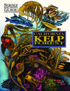
California Kelp Forest Restoration
This unit is so cool, you won't be able to "kelp" yourself! Intended for all grades, this science and activity guide for teachers offers a unique opportunity to understand kelp's role as a valuable ecological resource. Teachers and...
Curated OER
Protecting Philippine Reefs
Learners watch a slide show about the Philippine Reefs to explore the topic of fish populations. In this reef and fish population instructional activity, students watch a slide show about fish populations and how the Peace...
Curated OER
Second Star To the Left and Straight On 'Till Morning" - Spreadsheet Driven Exploration of Pacific Asian Geography
Students explore the geography of Pacific Asia. The class is divided into two groups to participate in a role-play activity where they act as European explorers. Students utilize mathematics, spreadsheet and internet technology to make...
Wilderness Classroom
Ocean Life
Our oceans are composed of many complex relationships. Young oceanographers explore relationships between organisms, understand the world ocean's currents, and discover the effects of water pollution and how it behaves. There are...
American Museum of Natural History
What is Marine Biology?
A marine environment covers the majority of the earth but is arguably the least understood. Teach young scientists about the characteristics of oceans and ocean species using an interactive online lesson. The in-person or remote learning...
Curated OER
The Seven Continents Scavenger Hunt
Who doesn't enjoy an engaging scavenger hunt? Here, scholars listen to, and discuss, the informative text, Where is my Continent? by Robin Nelson. They then explore the seven continents and four major oceans using...
Curated OER
Christopher Columbus
Some very good graphics are included in this informative presentation on the life of Christopher Columbus and the voyages he took. Among other things, students discover that Columus missed the chance to be the first European to view the...
Curated OER
What Lives in the Open Ocean and Where Do They Live?
Students explore oceanography by participating in a flash card activity. In this ocean inhabitant lesson, students define a list of ocean related vocabulary terms and answer ocean geography study questions. Students utilize organism...
Curated OER
Fisheries in the Open Ocean
Students explore fisheries in the open ocean. In this ocean environment lesson, students study the impact fisheries have on the ocean habitat. Students complete a WebQuest and summary project regarding fisheries.
Curated OER
Ocean Observations
Students examine a coastal ocean. For this physical science/earth science lesson, students generate a list of questions about how researchers study the ocean. In addition, students investigate, through research on the computer, to answer...
Curated OER
Encountering Very Different Ways of Life
Students explore the concept of crossing cultures. They examine how Americans may be viewed by people in another culture and discover that that Peace Corps Volunteers are trained to cross cultures respectfully so that they are accepted...
Curated OER
Chapters 14 & 15 – Age of Exploration
In this U.S. history worksheet, students read assigned textbook pages regarding the Age of Exploration and respond to 49 short answer questions.
Curated OER
Life on the Ocean Floor
Why would water 2700 meters deep suddenly become warmer? Explore this and other ocean floor discoveries through this reading response worksheet. Scholars read information about the organisms discovered by Alvin, a deep-sea submersible....
Channel Islands Film
Island Rotation: Lesson Plan 3
How far have California's Channel islands moved? What was the rate of this movement? Class members first examine data that shows the age of the Hawaiian island chain and the average speed of the Pacific Plate. They then watch West...
Curated OER
Where in the World War? Mapping WWII in the Pacific
Students explore the Pacific Theatre of War. In this World War II lesson, students use reference material to access information about significant locations in the Pacific Theatre of War. Students identify the locations of the listed...


