Curated OER
Sustainable Southern Belize: Coral Health Lesson Plan
Fifth graders investigate coral reefs and the dangers they face by labeling and drawing. In this oceanography lesson plan, 5th graders view a PowerPoint presentation of photographs of coral reefs in Belize. Students investigate and...
Curated OER
Life of a Mission - From Beginning to Now
Students research the history of a Spanish mission. They create a timeline showing the major events of the mission. They complete a worksheet to end the lesson.
Curated OER
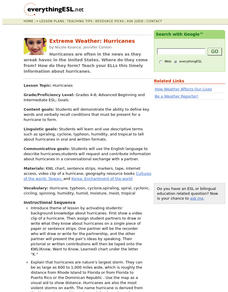
Extreme Weather: Hurricanes
Students demonstrate the ability to define key words and verbally recall conditions that must be present for a hurricane to form.
Curated OER
Slave Ship: Carrier of Destiny
Fifth graders research topics related to slavery. They visit area museums, and the Arkansas Arts Council presents cultural experiences. They discuss and internalize the plight of people sold into slavery.
Curated OER
Exploring our Community
Young scholars research Los Angeles and its surrounding communities. They create digital presentations of the information they have gathered by answering the question included in the lesson.
Curated OER
China
Second graders complete a variety of activities surrounding a unit on China and Chinese culture.
Curated OER
Earth Science: The Structure of the Earth
Students identify and complete activities about the structure of the Earth. For this Earth structure lesson, students view a Powerpoint about the Earth's layers and complete a diagram. students compare temperatures in the Earth's layers...
Curated OER
Where is Everybody?#135
Students examine the human uses of school spaces through a variety of activities. They draw the playground during recess and not during recess. They determine how many people use each room at different times before graphing the...
Curated OER
Legends Coming to Life
Students prepare an essay that reflect their knowledge of World War II, acquired through research.
Curated OER
Ancient Civilizations: Medieval and Early Modern Times
Seventh graders gain an understanding of the history of Mongolian culture through making inferences about Mongolian artwork
Curated OER
Exploring our Community
Students research the geography and history of Los Angeles and its surrounding communities.
Curated OER
Enhancing Social Skills and Vocabulary through Photography
Students in a special education classroom identify pictures of various living things. In groups, they role-play different roles to help them with their social and communication skills. To end the lesson, they take pictures of different...
Other
Tunisian National Tourist Office: Come to Tunisia: Interactive Map
An interactive pictorial map of Tunisia. Hovering over an image reveals its name and what it is known for.
Curated OER
Educational Technology Clearinghouse: Maps Etc: Virginia the Old Dominion, 1921
A pictorial map of Virginia from 1921, showing its capital, Richmond and other major cities and inland waters. It also gives the population for each city shown. It also contains pictorial representations of Houdon's Statue of Washington,...
Curated OER
Educational Technology Clearinghouse: Maps Etc: Plants of Asia, 1906
A pictorial map from 1906 illustrating the principle plants found in various regions of Asia. The map shows tea in the east and southeast of Asia and Ceylon (Sri Lanka), rice in the wet lands of the southeast, cotton, wheat, millet, and...
Curated OER
Educational Technology Clearinghouse: Maps Etc: Plants of Africa, 1906
A pictorial map of the African continent showing various plant types found in the regions of Africa, including wheat, sago palm, cotton, banana, cocoanut, oil palm, river grass, and fan palm.
Curated OER
Educational Technology Clearinghouse: Maps Etc: Animals of Africa, 1906
A pictorial map of the African continent showing animals found in the various regions of Africa.
Curated OER
Educational Technology Clearinghouse: Maps Etc: Animals of Asia, 1906
A pictorial map from 1906 illustrating the various animals that live in regions of Asia. "The white bear, the seal and many sea birds are found near the Arctic shore. In the cold parts of Siberia tribes of yellow people keep herds of...
Curated OER
Educational Technology Clearinghouse: Maps Etc: Animals of Australia, 1906
A pictorial map of Australia showing animals found in the various regions.
Curated OER
Educational Technology Clearinghouse: Maps Etc: Animals of Europe, 1906
A pictorial map of Europe showing typical animals found in the various regions.
National Archives (UK)
National Archives: Education: What Was Chertsey Like in the Middle Ages?
Lesson, drawing on maps from the collections of the National Archives, asks students what knowledge they can gain about life in the Middle Ages from studying a map of medieval Chertsey. They then compare the medieval map with another of...
Curated OER
Educational Technology Clearinghouse: Maps Etc: Landforms of Asia, 1904
An outline map from 1904 of Asia showing mountain systems, plateau, plains, major lakes, rivers, coastal features, and seas of the region. This map is used as a key map for locating landform features on a traditional relief map, where...
Curated OER
Etc: Maps Etc: Plan of the Movements at Concord, 1775
A plan of the Battle of Concord, Massachusetts, at the opening of the American Revolutionary War (April 19, 1775). Explanation of the Plan: (1) Lexington Road; (2) Hills and high land where the liberty pole stood; (3) center of the town,...
Other
A Short Pictorial History on Upper Ft. Garry
Unfortunately only a gate remains of a once historic landmark, Upper Fort Garry. Site provides a great picture, narrative, and a clickable map that leads to more pictures.


