Missouri University of science & Technology
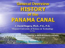
General Overview History of the Panama Canal
Called the Eight Wonder of the World by some and the Big Ditch by others, the Panama Canal is indeed an engineering marvel. The long, complicated, and sometimes controversial history of the canal is captured in a presentation loaded with...
Curated OER
Europe Before and after WWI
Eighth graders compare and contrast maps of Europe before and after World War I. In this World War I lesson, 8th graders color and label maps of Europe prior to the war and after it. The historical maps can be accessed online.
Curated OER
This Land is Your Land
Students consider the concept of borders and their development by looking at maps and documents. They create a presentation highlighting a current border dispute and propose solutions.
Curated OER
If the World Were a Village
Students examine the conditions of the global economy. As a class, they discuss the political, economic and cultural differences around the world. They review the concepts of distribution and scarcity and identify the costs and...
Curated OER
Grades 6-8 Lesson Plan - Cities as Transportation Centers
Students examine maps of the 1800's and 1900's. For this geography skills lesson, students collaborate to read core maps and identify transportation centers and travel networks.
Curated OER
Put Me in My Place: Using Alphanumeric Grids to Locate Places
Students practice locating points on a large wall grid and create and label a neighborhood map. In this geography lesson, students spell and discuss places as the teacher places them on the map. They discuss the concept of an...
Curated OER
European Agriculture
Students make inferences on how physical geography affected the development of early civilizations and come up with solutions to global issues. In this physical geography lesson plan, students compare maps of the past to maps of today to...
Curated OER
Ireland: the Emerald Isle
Third graders complete a unit of study that examines several perspectives of Ireland. They explore how climate shapes Irish culture, reference historical and political maps, compute exchange values for Irish money, complete worksheets,...
Curated OER
Treaty of Versailles
Students describe the purposes of the Treaty of Versailles. In groups, they analyze the causes and effects of the treaty and discuss why the Americans were so against it. They note ideas for and against its ratification and they make...
Curated OER
Brave New World
Students view a video about the effects of World War II on the map of Europe. They discuss the video and answer questions. They work together to identify accomplishments that best represent American culture.
Curated OER
Geography and World History
Students build off of their current knowledge of geography and world history, while being introduced to new concepts and ideas.
Curated OER
Deutschland und die Europäische Union (Germany and the European Union)
Introduce your language students in German class to the European Union, including the historic developments, the current structure, and some of the political and social principles behind it with this lesson plan. In small groups,...
Curated OER
Geography And The Gulf War
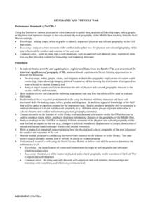
High schoolers develop maps, tables, graphs, charts, and diagrams to depict the geographic implications of current world events, and analyze major human conflicts to determine the role of physical and cultural geographic features in the...
Curated OER
Empire State-Building
Students explore how empires around the globe have impacted the world in which they have existed. They analyze whether or not the United States is an imperialist nation and create their own empires based on their understanding of empires...
Curated OER
The Roosevelt Presidency
Students explore the history of America from 1900-1912. Students explore how past events and philosophies have affected the management of modern-day conflicts. Through research, students write an essay on the handling of the Panama Canal...
Curated OER
Chart Making for Navigators
Students discuss the importance and function of nautical maps for sailors. They, in groups, take soundings of a simulated bay in a shoebox and develop a nautical chart that enable them to navigate the shoebox safely.
Curated OER
Papyrus to PDA
What a great project. Graphic arts students consider the social, political, and economic impact made by a chosen invention. They build an argument to substantiate their reasons for choosing said invention. They create an oral...
Curated OER
Never To Forget
Tenth graders discuss the events leading up to antisemitic behavior in Europe during World War II. Through various activities, 10th graders acquaint themselves with the political ideology of Nazism and assess responsibility for the...
Curated OER
My Secret War: Lesson 8
Fifth graders explore American history by viewing videos on the Internet. In this Japanese internment lesson, 5th graders discuss the politics that took place between America and Japan during WWII and why it was necessary to incarcerate...
Curated OER
Four Immigrant Groups: Their Lives and Music
Fourth graders examine the experiences of four immigrant groups. Class members brainstorm a list of misconceptions of those groups and discuss if these perceptions are still present today. Using maps, groups locate the countries of...
Curated OER
A Brief History of Vietnam (1858-2004) and Its Evolving Communist System
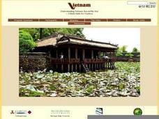
Students examine the French colonization of Vietnam, the Vietnam War, and the current evolving Communist system. They develop political maps, outline the major events of the Vietnam War, write an essay, and compare/contrast democracy...
Curated OER
Walking that Line
Students attempt to describe and use longitude and latitude. They will identify different countries, their neighbors, and borders around the world. Included in the lesson the students identify natural features that control the borders of...
Curated OER
Alexander the Great and Hellenistic Greece
Visual images, maps, and notes on the great philosophers and scientists of Hellenistic Greece await your class. While light in terms of text, the presentation provides images that should help you to describe the area and reign of...
Other popular searches
- World Political Map
- World Outline Political Map
- Blank World Political Map
- World Political Map Labeled


